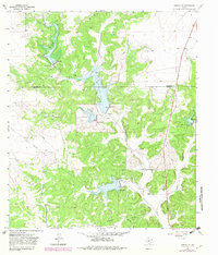
1964 Map of Sonora NW
USGS Topo · Published 1982About this map
Dry Devils River carves a deep path through the limestone plateau of the Edwards Plateau, crossing the boundary between Schleicher Co and Sutton Co. This 1964 topographic survey, updated in the early 1980s, reveals a landscape defined by large family holdings and early energy development. Significant ranching operations including Nixon Ranch, Jones Ranch, and the Meckel Ranch are situated among the winding draws and ridges.
Find a feature on this map
21 named features on this map. Tap any name to fly to it.
Don’t see what you’re looking for? This feature index may not catch every label — zoom into the map to look around manually.
Map Details
Editions of this 1964 Sonora NW Map
2 editions found
Other maps of this area

1954 · Sonora
USGS Topo · 1:250,000

1958 · Sonora
USGS Topo · 1:250,000

1964 · Sonora
USGS Topo · 1:24,000

1964 · Sonora SE
USGS Topo · 1:24,000

1964 · Sonora NE
USGS Topo · 1:24,000

1964 · Eldorado SW
USGS Topo · 1:24,000

1964 · Sonora NW
USGS Topo · 1:24,000

1964 · Coupe Ranch
USGS Topo · 1:24,000
1964 · Eldorado
USGS Topo · 1:24,000

1967 · Savell Ranch
USGS Topo · 1:24,000