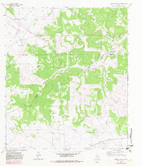
1963 Map of Buffalo Well NW
USGS Topo · Published 1982About this map
The high plateau and drainage basins of the Texas Hill Country define this landscape along the border of Schleicher Co Sutton Co. Settlement in the early 1960s was organized around significant family-held livestock operations, including the Copeland Ranch, Mc Intosh Ranch, and Schwiening Ranch. These holdings are scattered across the intricate topography carved by Middle Valley and the Middle Valley Prong.
Find a feature on this map
17 named features on this map. Tap any name to fly to it.
Don’t see what you’re looking for? This feature index may not catch every label — zoom into the map to look around manually.
Map Details
Editions of this 1963 Buffalo Well NW Map
2 editions found
Other maps of this area

1893 · Fort McKavett
USGS Topo · 1:125,000

1954 · Sonora
USGS Topo · 1:250,000

1958 · Sonora
USGS Topo · 1:250,000

1963 · Buffalo Well
USGS Topo · 1:24,000

1963 · Buffalo Well NW
USGS Topo · 1:24,000

1963 · Buffalo Well SE
USGS Topo · 1:24,000

1963 · Adams SE
USGS Topo · 1:24,000

1963 · Buffalo Well SW
USGS Topo · 1:24,000

1963 · Adams SW
USGS Topo · 1:24,000

1964 · Sonora SE
USGS Topo · 1:24,000