Old Maps of Las Palmas Number 2 Colonia, El Paso for Genealogy
Trace your family roots with 17 historic maps of Las Palmas Number 2 Colonia. These high-res maps reveal old neighborhoods, homesites, landmarks, and streets — helping you uncover where your ancestors lived and how the area evolved over time.
- Explore historic neighborhoods: Identify where your relatives may have lived in the 1800s or 1900s.
- Compare maps over time: Trace the changes in streets, buildings, and landmarks for multi-generational research.
- Perfect for genealogy & ancestry research: Used by family historians and researchers to map out lineage and migration.
These maps are an incredible resource for exploring your personal connection to Las Palmas Number 2 Colonia's past.
Las Palmas Number 2 Colonia, El Paso maps
(17)- 1896 Map of El Paso
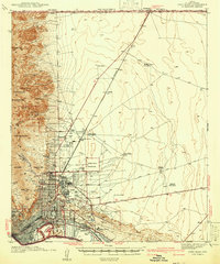
 1896 El Paso1896 Print · USGSThe El Paso borderlands were a nexus of rail and river commerce in the 1890s, where international boundaries met the western frontier. Researchers can trace the early layout of El Paso, the military presence at Fort Bliss, and historic valley settlements like Ysleta and San Elizario.2 unique versions available
 - 1908 Map of El Paso
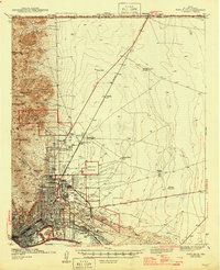
 1908 El Paso1908 Print · USGSEl Paso and the lower Rio Grande valley are seen here in the first decade of the century as the railroad and military presence transformed the borderlands. Genealogists can trace family footprints in historic river towns like San Elizario, Ysleta, and Socorro, or find early ranch sites like Newman's Ranch.2 unique versions available
 - 1942 Map of Fort Bliss
 1942 Fort Bliss1942 Print · USGSEl Paso and its military neighbors are captured here in the early 1940s as the desert landscape rapidly modernized. Researchers can trace family ranching sites like Tobin Ranch alongside the expansion of Fort Bliss and the Biggs Field.
 - 1945 Map of Fort Bliss
 1945 Fort Bliss1945 Print · USGSEl Paso and its military environs are captured here during the mid-1940s, showing the intersection of rapid defense growth and desert ranching. Genealogists and historians can trace family sites like Tobin Ranch, locate the CCC Camp, and study the early layout of Biggs Field.
 - 1948 Map of Fort Bliss SE
 1948 Fort Bliss SE1948 Print · USGSEl Paso County at the end of the 1940s reveals a desert landscape defined by military boundaries and small-scale ranching operations. Researchers can locate the early footprints of the Sherman Hog Ranch, Price Dairy, and Bakers Well Windmill.
 - 1953 Map of El Paso
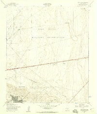
 1953 El Paso1953 Print · USGSEl Paso and the border region are shown here in the early fifties, documenting a landscape of shared river life and rising military presence. Genealogists and historians can trace rail-tied communities like Smeltertown, San Elizario, and the grounds of Fort Bliss.
 - 1955 Map of Fort Bliss SE, 1959 Print
 1955 Fort Bliss SE1959 Print · USGSEl Paso and the surrounding desert were undergoing rapid postwar expansion in the mid-fifties as military and civilian footprints grew. You can trace the development of Del Norte Heights, locate the old Drive-in Theater, and see the footprint of Biggs Air Force Base.3 unique versions available
 - 1959 Map of El Paso, 1968 Print
 1959 El Paso1968 Print · USGSEl Paso and the international borderlands come alive in this mid-century survey of the Chihuahuan Desert. Genealogists and historians can trace rail-side settlements like Columbus and Fabens, locate the sprawling Fort Bliss, and explore the geologically unique Kilbourne Hole.2 unique versions available
 - 1964 Map of El Paso
 1964 El Paso1964 Print · USGSThe El Paso and Juarez borderlands are shown in detail during the mid-sixties, from the urban center to the remote volcanic craters of the West Potrillo Mountains. Trace the rail-and-river network through Asarco Smeltertown, the Fort Bliss Military Reservation, and Columbus.
 - 1965 Map of El Paso
 1965 El Paso1965 Print · USGSEl Paso and the Mesilla Valley are shown in the mid-1960s as the region's military and transport infrastructure expanded. Researchers can trace the irrigation network along the Rio Grande, find old border stations like Columbus, and locate Hueco Tanks.
 - 1983 Map of El Paso
 1983 El Paso1983 Print · USGSThe Chihuahuan Desert borderlands come into sharp focus in the early eighties as the binational metro area of El Paso and Ciudad Juarez expands. Genealogists and historians can trace rail lines like the Santa Fe, military grounds at Fort Bliss, and rural valley settlements including Canutillo and Zaragoza.2 unique versions available
 - 1994 Map of Fort Bliss SE
 1994 Fort Bliss SE1994 Print · USGSEl Paso saw significant suburban expansion in the early nineties as residential neighborhoods pushed toward the military boundary. Genealogists and local historians can trace family locations near Evergreen Cemetery East, Hacienda Heights, and the St Raphael Sch.
 - 2010 Map of Fort Bliss SE, 2010 Print
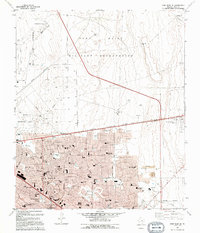
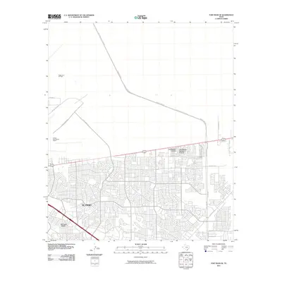 2010 Fort Bliss SE2010 Print · USGSCovers Las Palmas Number 2 Colonia, including El Paso, Las Palmas Colonia, and other nearby areas
 - 2012 Map of Fort Bliss SE, 2012 Print
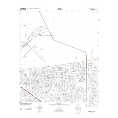 2012 Fort Bliss SE2012 Print · USGSCovers Las Palmas Number 2 Colonia, including El Paso, Las Palmas Colonia, and other nearby areas
 - 2016 Map of Fort Bliss SE, 2016 Print
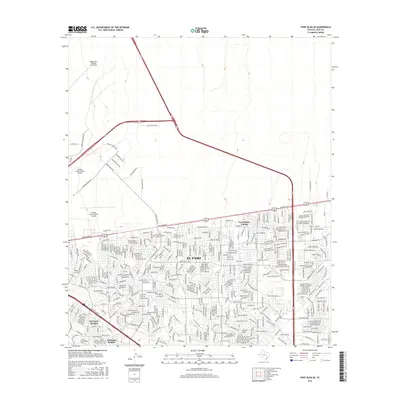 2016 Fort Bliss SE2016 Print · USGSCovers Las Palmas Number 2 Colonia, including El Paso, Las Palmas Colonia, and other nearby areas
 - 2019 Map of Fort Bliss SE, 2019 Print
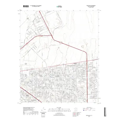 2019 Fort Bliss SE2019 Print · USGSCovers Las Palmas Number 2 Colonia, including El Paso, Las Palmas Colonia, and other nearby areas
 - 2022 Map of Fort Bliss SE, 2022 Print
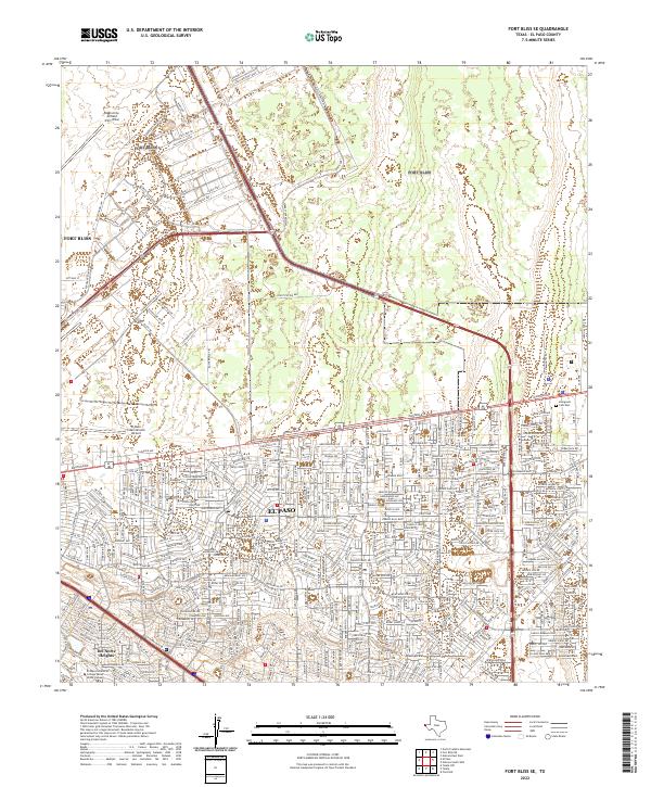 2022 Fort Bliss SE2022 Print · USGSEl Paso and the expansive grounds of the military reservation are shown here in the early twenty-first century. Researchers can trace the development of Fort Bliss and Biggs Army Airfield alongside local landmarks like Evergreen Cem East.
End of results
Showing maps 1-17 of 17
Top cities near Las Palmas Number 2 Colonia
- El Paso historical maps
- Socorro historical maps
- Chaparral historical maps
- Horizon City historical maps
- San Elizario historical maps
- Clint historical maps
Frequently asked questions
- What are the different types of historical maps available for Las Palmas Number 2 Colonia?
- What is the oldest map of Las Palmas Number 2 Colonia?
- Where can I purchase historical maps of Las Palmas Number 2 Colonia for my home or office?
- Where can I download high-res historical maps of Las Palmas Number 2 Colonia?
- Are there historical topographic maps available for Las Palmas Number 2 Colonia?
- Is there historical aerial imagery available for Las Palmas Number 2 Colonia?
- Where are historical maps of Las Palmas Number 2 Colonia sourced from?