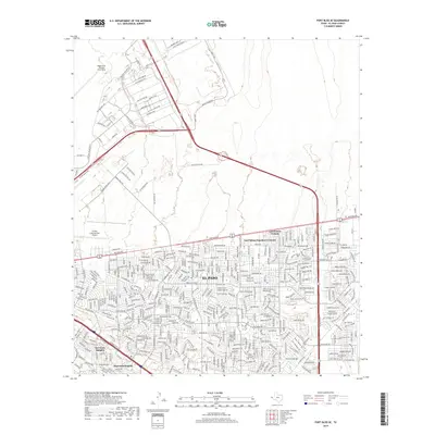
2019 Map of Fort Bliss SE
USGS Topo · Published 2019About this map
Biggs Army Airfield (Fort Bliss) and its surrounding military infrastructure dominate the northern portion of this El Paso landscape. The map reveals a high-density grid of residential developments and commercial corridors, including established neighborhoods like Del Norte Heights and Hacienda Heights. These communities are bounded by major transportation arteries such as Montana Ave and the Liberty Expy, which facilitate movement between the urban core and the sprawling aviation facilities at El Paso International Airport.
Find a feature on this map
42 named features on this map. Tap any name to fly to it.
Don’t see what you’re looking for? This feature index may not catch every label — zoom into the map to look around manually.
Map Details
Editions of this 2019 Fort Bliss SE Map
This is the sole edition of this map. No revisions or reprints were ever made.
Other maps of this area

1896 · El Paso
USGS Topo · 1:125,000

1908 · El Paso
USGS Topo · 1:125,000

1939 · Ysleta
USGS Topo · 1:62,500

1939 · Heuco Tanks
USGS Topo · 1:62,500

1940 · Heuco Tanks
USGS Topo · 1:62,500

1941 · El Paso
USGS Topo · 1:31,680

1941 · Clint
USGS Topo · 1:62,500

1941 · Ysleta
USGS Topo · 1:62,500

1942 · Fort Bliss
USGS Topo · 1:62,500

1943 · El Paso
USGS Topo · 1:31,680
Featured Places
- El Paso, TX
- Las Palmas Colonia, El Paso
- Turf Estates Number 1 Colonia, TX
- Del Norte Heights, El Paso
- Las Palmas Number 2 Colonia, El Paso