
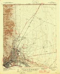
1941 Map of El Paso
USGS Topo · Published 1941About this map
The Franklin Mountains dominate the western skyline of this border landscape, where the growing urban grid of El Paso meets the sprawling Fort Bliss Military Reservation. This 1938-39 survey captures a critical era of regional development, showing the proximity of early neighborhoods like Austin Terrace and Morningside to military infrastructure and the international boundary. A remarkable feature is Cordova Island, a piece of Mexican territory then situated north of the Rio Grande due to river shifts, illustrating the complex geopolitical history of the Chamizal dispute.
Find a feature on this map
60 named features on this map. Tap any name to fly to it.
Don’t see what you’re looking for? This feature index may not catch every label — zoom into the map to look around manually.
Map Details
Editions of this 1941 El Paso Map
This is the sole edition of this map. No revisions or reprints were ever made.
Other maps of this area

1896 · El Paso
USGS Topo · 1:125,000

1908 · El Paso
USGS Topo · 1:125,000

1917 · Canutillo
USGS Topo · 1:62,500

1919 · Canutillo
USGS Topo · 1:62,500

1939 · Ysleta
USGS Topo · 1:62,500

1941 · Ysleta
USGS Topo · 1:62,500

1942 · Fort Bliss
USGS Topo · 1:62,500

1943 · El Paso
USGS Topo · 1:31,680

1945 · Ysleta
USGS Topo · 1:62,500
1945 · Fort Bliss
USGS Topo · 1:62,500