Old Maps of Ennis, Texas
Explore 16 old maps of Ennis, spanning from 1954 to today. These high-resolution historic maps reveal how streets, neighborhoods, landmarks, and natural features evolved over time — perfect for genealogy, metal detecting, research, and local history exploration.
What you can do with these maps:
- See how Ennis changed over time: Compare historical maps to modern-day views to trace roads, homesites, rail lines & more.
- View detailed metadata: Each map includes creators, publishers, year, scale, and archive source.
- Overlay maps with satellite & LiDAR: Visualize the past alongside modern tools to explore terrain & human change.
- Trusted historical sources: Maps sourced from the USGS, Library of Congress, and other archives.
- Access maps your way: View online, download high-res files, or order prints for personal or research use.
Start exploring old maps of Ennis to uncover forgotten places, hidden landmarks, and the deep history beneath your feet.
Ennis, TX maps
(16)- 1954 Map of Dallas, 1963 Print
 1954 Dallas1963 Print · USGSNorth Texas in the mid-fifties and early sixties reveals a landscape of rapid urban growth and water management. Genealogists and historians can trace the evolution of the metroplex through landmarks like Hensley Field, Boles Orphan Home, and the Texas & Pacific RR.4 unique versions available
 - 1956 Map of Ennis
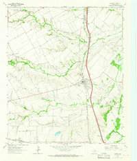
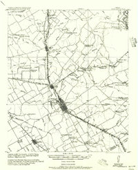 1956 Ennis1956 Print · USGSEllis County agricultural life is captured here in the years following the first World War, centered on the rail crossroads at Ennis P.O. Genealogists can locate family landmarks like Ghost School, Antioch Church, and the settlement of Boyce (Cottonwood).
 - 1958 Map of Dallas
 1958 Dallas1958 Print · USGSNorth Texas in the late fifties shows the dramatic expansion of the Metroplex as it absorbs surrounding farm towns. Genealogists and historians can trace old rail lines like the Missouri-Kansas-Texas and locate early lakefront developments at Eagle Mountain Lake and Lake Worth Village.
 - 1961 Map of Forreston, 1963 Print
 1961 Forreston1963 Print · USGSEllis County in the early sixties showcases a rural landscape shaped by the new Lake Waxahachie and established rail lines. Genealogists and local historians can trace family locations near Reagor Springs, Glenwood Cem, and the old station at Forreston.2 unique versions available
 - 1962 Map of Ennis West, 1965 Print
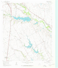
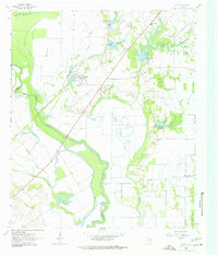
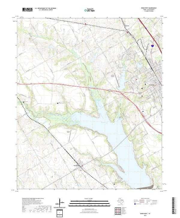
 1962 Ennis West1965 Print · USGSEllis County in the early sixties showcases the transformation of the landscape as the new reservoir reaches its pool elevation. Genealogists and local historians can trace family plots at Myrtle Cemetery or Bethel Cem and locate rail features like the Southern Pacific tracks.3 unique versions available
 - 1962 Map of Ennis East, 1965 Print
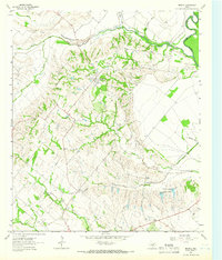
 1962 Ennis East1965 Print · USGSEastern Ellis County in the early 1960s shows a landscape of rail-linked prairie towns and country schools. Genealogists can trace family footprints at Redwine Cem, Alma, and the St Johns Ch.3 unique versions available
 - 1962 Map of Bristol, 1966 Print
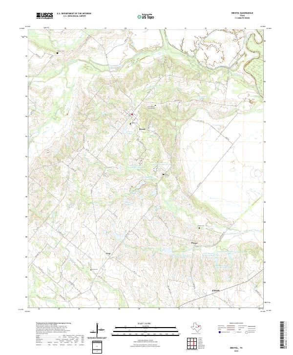
 1962 Bristol1966 Print · USGSThe rural landscape of eastern Ellis County in the early 1960s is defined by its relationship to the Trinity River and the transition from rail to road. Genealogists can trace family footprints at Crisp Cemetery, Weavers Chapel, and the settlement of Bristol.3 unique versions available
 - 1963 Map of Rosser
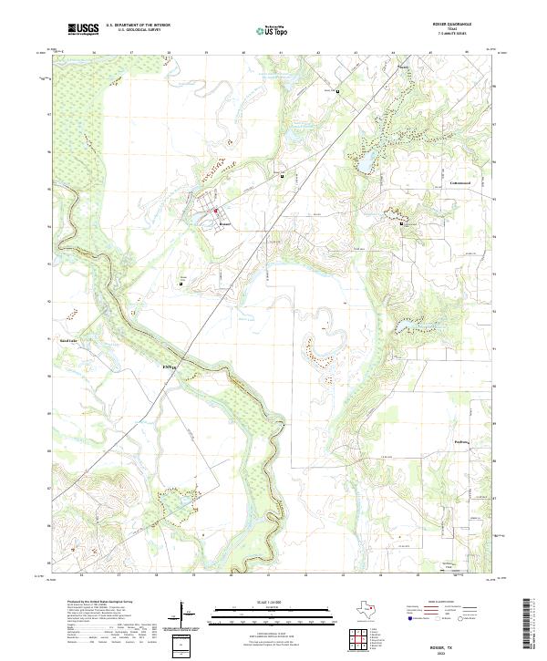
 1963 Rosser1963 Print · USGSThe Trinity River bottomlands near the Kaufman and Ellis County line come to life in the early 1960s. Genealogists and local historians can trace family connections at Rosser Cemetery and Cottonwood Church or locate the site of the Scurry-Rosser School.2 unique versions available
 - 1963 Map of Palmer, 1966 Print
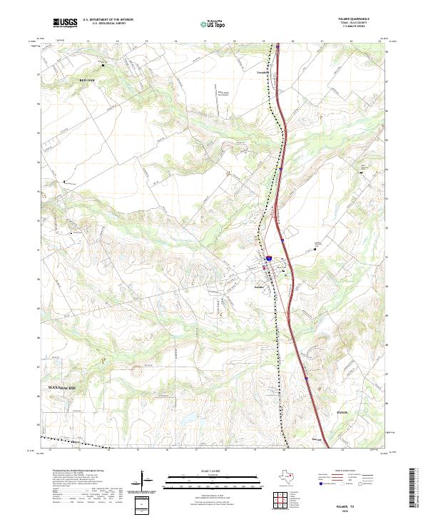
 1963 Palmer1966 Print · USGSEllis County's blackland prairie landscape is captured here in the early 1960s, centered on the railroad town of Palmer. Researchers can trace old family burial sites like Smith Cem and Lucille Cem or locate the rural Cedar Grove Ch near the banks of Brushy Creek.3 unique versions available
 - 1985 Map of Corsicana, 1986 Print
 1985 Corsicana1986 Print · USGSNorth Central Texas was defined by its expanding water reservoirs and deep-rooted rail corridors in the mid-eighties. Researchers can trace the heritage of local communities through landmarks like Southwestern Bible Institute, Navarro College, and rural markers such as Derrs Chapel.2 unique versions available
 - 2022 Map of Ennis East, 2022 Print
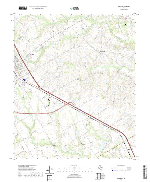 2022 Ennis East2022 Print · USGSThe Blackland Prairie landscape of Ellis County is captured here in the early twenty-first century as modern transit corridors follow historical paths. Genealogists and local researchers can trace family landmarks like Telico Cem, Alma Cem, and the rural community of Ensign.
 - 2022 Map of Rosser, 2022 Print
 2022 Rosser2022 Print · USGSKaufman and Ellis Counties appear here during a period of modern rural transition along the river bottomlands. Family historians can locate family burial plots at Green Cem and Rosser Cem while tracing the winding path of the Trinity River.
 - 2022 Map of Palmer, 2022 Print
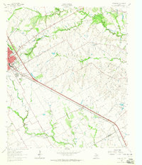
 2022 Palmer2022 Print · USGSEllis County is documented here during a period of sustained growth along the Interstate 45 corridor south of Dallas. Local researchers can trace family lands near Palmer Cemetery or locate smaller rural junctions like Trumbull, Boyce, and Garrett.
 - 2022 Map of Ennis West, 2022 Print
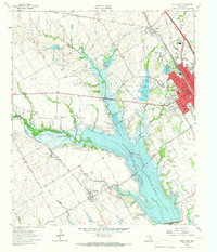
 2022 Ennis West2022 Print · USGSModern-day Ellis County is defined here by the waters of Bardwell Lake and the growing city of Ennis. Genealogists can trace several local burial grounds including Saint Joseph Cem, Sanderson Cem, and Boren Cem.
 - 2022 Map of Bristol, 2022 Print
 2022 Bristol2022 Print · USGSThe community of Bristol and the banks of the Trinity River are captured here in the early twenty-first century. Researchers can trace family history at the Hefley Pioneer Cem and Park or locate the small settlements of Crisp and Alsdorf.
 - 2022 Map of Forreston, 2022 Print
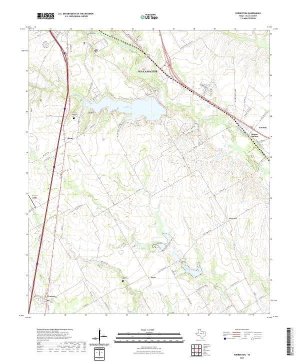 2022 Forreston2022 Print · USGSEllis County in the early 2020s shows the enduring character of its rural communities alongside the waters of Lake Waxahachie. Researchers can trace the legacy of family lands at Apperson Family Cemetery or the crossroads at Nash and Forreston.
End of results
Showing maps 1-16 of 16
Top cities near Ennis
- DeSoto historical maps
- Lancaster historical maps
- Waxahachie historical maps
- Corsicana historical maps
- Kaufman historical maps
- Combine historical maps
See more
Top neighborhoods of Ennis
Frequently asked questions
- What are the different types of historical maps available for Ennis?
- What is the oldest map of Ennis?
- Where can I purchase historical maps of Ennis for my home or office?
- Where can I download high-res historical maps of Ennis?
- Are there historical topographic maps available for Ennis?
- Is there historical aerial imagery available for Ennis?
- Where are historical maps of Ennis sourced from?