Old Maps of Italy, Texas
Explore 15 old maps of Italy, spanning from 1954 to today. These high-resolution historic maps reveal how streets, neighborhoods, landmarks, and natural features evolved over time — perfect for genealogy, metal detecting, research, and local history exploration.
What you can do with these maps:
- See how Italy changed over time: Compare historical maps to modern-day views to trace roads, homesites, rail lines & more.
- View detailed metadata: Each map includes creators, publishers, year, scale, and archive source.
- Overlay maps with satellite & LiDAR: Visualize the past alongside modern tools to explore terrain & human change.
- Trusted historical sources: Maps sourced from the USGS, Library of Congress, and other archives.
- Access maps your way: View online, download high-res files, or order prints for personal or research use.
Start exploring old maps of Italy to uncover forgotten places, hidden landmarks, and the deep history beneath your feet.
Italy, TX maps
(15)- 1954 Map of Dallas, 1963 Print
 1954 Dallas1963 Print · USGSNorth Texas in the mid-fifties and early sixties reveals a landscape of rapid urban growth and water management. Genealogists and historians can trace the evolution of the metroplex through landmarks like Hensley Field, Boles Orphan Home, and the Texas & Pacific RR.4 unique versions available
 - 1958 Map of Dallas
 1958 Dallas1958 Print · USGSNorth Texas in the late fifties shows the dramatic expansion of the Metroplex as it absorbs surrounding farm towns. Genealogists and historians can trace old rail lines like the Missouri-Kansas-Texas and locate early lakefront developments at Eagle Mountain Lake and Lake Worth Village.
 - 1965 Map of Avalon, 1967 Print
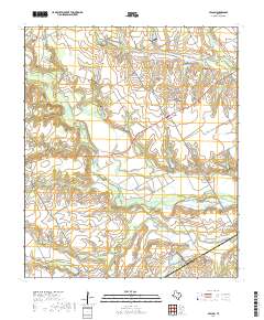
 1965 Avalon1967 Print · USGSSouthern Ellis County is captured here in the mid-sixties, a landscape of family farms and extensive creek-side water management. Researchers can locate the Missouri-Kansas-Texas rail line, local landmarks like Forreston Cem, and the rural community of Avalon.2 unique versions available
 - 1965 Map of Italy, 1967 Print
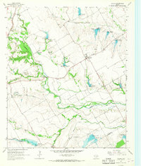
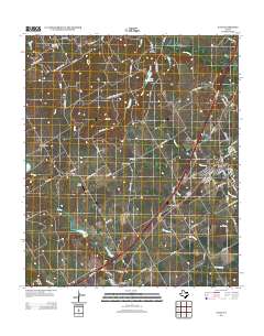
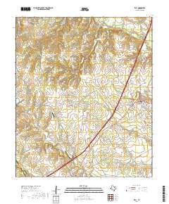
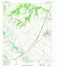 1965 Italy1967 Print · USGSIn the mid-1960s, this portion of Ellis County was a busy intersection of the Missouri Pacific and M-K-T railroads. Genealogists can trace family footprints at Bee Creek Cem, Stafford Sch, and the community of Center Point.3 unique versions available
 - 1985 Map of Corsicana, 1986 Print
 1985 Corsicana1986 Print · USGSNorth Central Texas was defined by its expanding water reservoirs and deep-rooted rail corridors in the mid-eighties. Researchers can trace the heritage of local communities through landmarks like Southwestern Bible Institute, Navarro College, and rural markers such as Derrs Chapel.2 unique versions available
 - 2010 Map of Avalon, 2010 Print
 2010 Avalon2010 Print · USGSCovers Italy, including Lumkins, Lone Cedar, and other nearby areas
 - 2010 Map of Italy, 2010 Print
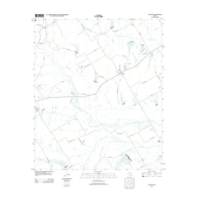
 2010 Italy2010 Print · USGSCovers Italy, including Milford, Bell Branch, and other nearby areas
 - 2012 Map of Italy, 2012 Print
 2012 Italy2012 Print · USGSCovers Italy, including Milford, Bell Branch, and other nearby areas
 - 2012 Map of Avalon, 2012 Print
 2012 Avalon2012 Print · USGSCovers Italy, including Lumkins, Lone Cedar, and other nearby areas
 - 2016 Map of Avalon, 2016 Print
 2016 Avalon2016 Print · USGSCovers Italy, including Lumkins, Lone Cedar, and other nearby areas
 - 2016 Map of Italy, 2016 Print
 2016 Italy2016 Print · USGSCovers Italy, including Milford, Bell Branch, and other nearby areas
 - 2019 Map of Italy, 2019 Print
 2019 Italy2019 Print · USGSCovers Italy, including Milford, Bell Branch, and other nearby areas
 - 2019 Map of Avalon, 2019 Print
 2019 Avalon2019 Print · USGSCovers Italy, including Lumkins, Lone Cedar, and other nearby areas
 - 2022 Map of Italy, 2022 Print
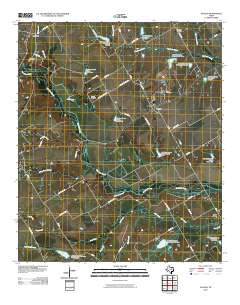
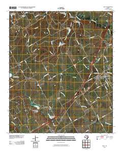
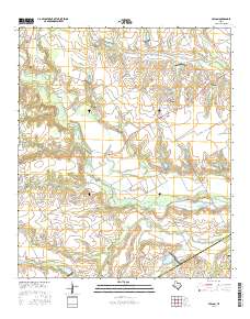
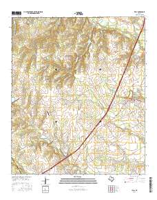
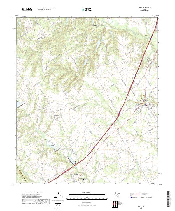 2022 Italy2022 Print · USGSSouthern Ellis County at the start of the 2020s shows the continued importance of historic centers like Italy and Milford along the transit corridor. Genealogists can locate family landmarks such as Italy Cem, Milford Cem, and the old Bee Creek School House Rd.
 - 2022 Map of Avalon, 2022 Print
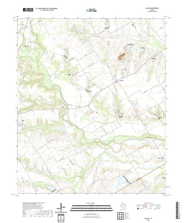 2022 Avalon2022 Print · USGSAgricultural lands and family cemeteries characterize this corner of Ellis and Navarro counties in the 2020s. Genealogists can trace local roots at Dean Cem, Forreston Cem, and Hughes Cem near the settlement of Avalon.
End of results
Showing maps 1-15 of 15
Top cities near Italy
- Waxahachie historical maps
- Ennis historical maps
- Midlothian historical maps
- Hillsboro historical maps
- Venus historical maps
- Palmer historical maps
See more
Frequently asked questions
- What are the different types of historical maps available for Italy?
- What is the oldest map of Italy?
- Where can I purchase historical maps of Italy for my home or office?
- Where can I download high-res historical maps of Italy?
- Are there historical topographic maps available for Italy?
- Is there historical aerial imagery available for Italy?
- Where are historical maps of Italy sourced from?