2020s Maps of Midlothian, Texas
Explore 4 historic maps of Midlothian from the 2020s. These maps offer a rare glimpse into what life looked like during the 2020s — showing old roads, neighborhoods, homes, and landmarks that have changed or disappeared over time.
Whether you're researching your family's past, planning a metal detecting trip, or studying how Midlothian's landscape evolved across the 2020s, these high-resolution maps are a powerful tool for exploring the history of this region.
- Focus on a specific era: All maps on this page are from the 2020s, giving you a focused view of this time period.
- See what’s changed: Compare century-old streets, trails, and buildings to today's modern landscape using overlays and satellite layers.
- Research with precision: Use these maps for genealogy, historical research, land use analysis, or educational projects.
- View, download, or print: Maps are fully viewable online in high resolution, and can be downloaded or printed for your own records.
Start exploring Midlothian's history through authentic maps from the 2020s. This is your window into the past.
Midlothian, TX maps
(4)- 2022 Map of Midlothian, 2022 Print
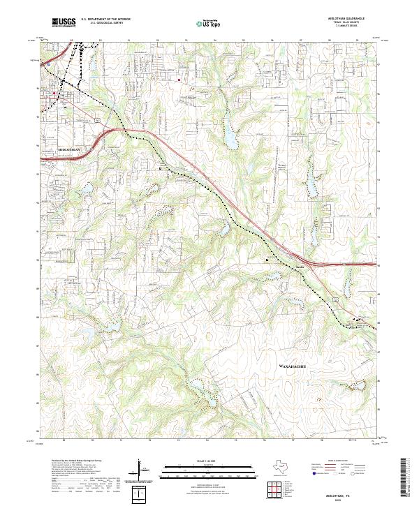 2022 Midlothian2022 Print · USGSMidlothian and Waxahachie are shown in the early twenty-first century as the Ellis County landscape transitions from rural roots to modern growth. Genealogists can trace family heritage at Rosemont Cem or Hillcrest Burial Park Cem and follow the path of Waxahachie Cr.
 - 2022 Map of Cedar Hill, 2022 Print
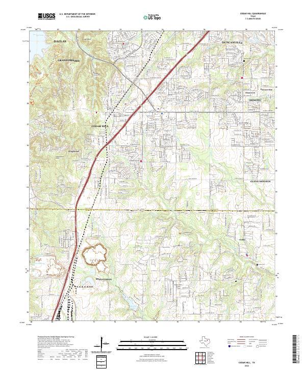 2022 Cedar Hill2022 Print · USGSThe suburbs south of Dallas were undergoing rapid growth in the early 2020s as residential tracts filled in the spaces between established towns. Genealogists and local historians can trace modern landmarks alongside historic sites like Shiloh Cem, Ovilla Cem, and Inspiration Point.
 - 2022 Map of Britton, 2022 Print
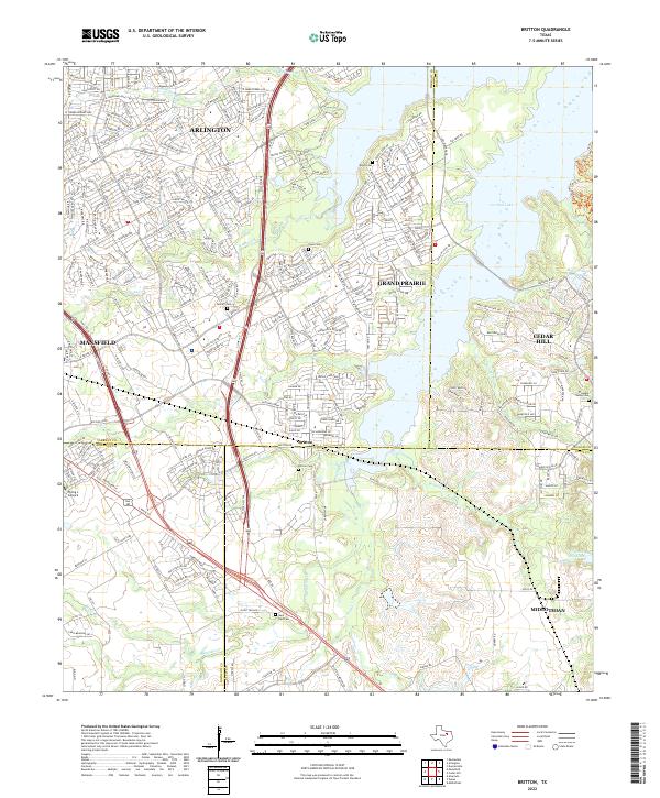 2022 Britton2022 Print · USGSFour North Texas counties meet at the crossroads of Britton in this recent survey of the suburbanizing landscape south of Arlington. Researchers can trace the sprawling shores of Joe Pool Lake and locate several community landmarks like Britton Cem and Saint Paul Cem.
 - 2022 Map of Venus, 2022 Print
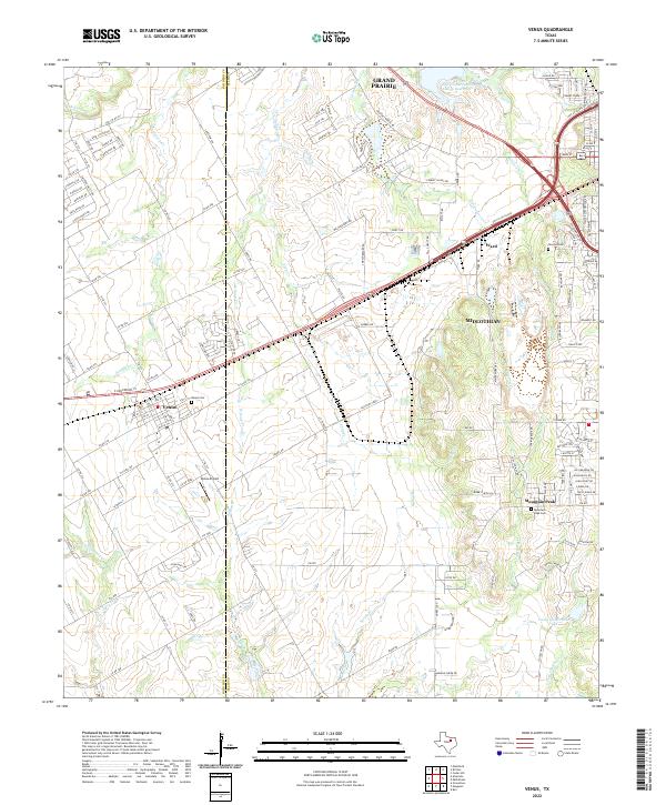 2022 Venus2022 Print · USGSThe Johnson and Ellis County border comes alive in the early 2020s as towns like Venus and Mountain Peak transition from rural roots. Genealogists can locate family landmarks such as Venus Cemetery and Mountain Peak Cemetery along the area's creek-fed landscape.
End of results
Showing maps 1-4 of 4
Top cities near Midlothian
- Dallas historical maps
- Fort Worth historical maps
- Arlington historical maps
- Grand Prairie historical maps
- Mansfield historical maps
- DeSoto historical maps
See more
Top neighborhoods of Midlothian
- Ward historical maps
- Mockingbird Estates historical maps
- Park Place historical maps
- Windermere Estates historical maps
- Kensington Park historical maps
Frequently asked questions
- What are the different types of historical maps available for Midlothian?
- What is the oldest map of Midlothian?
- Where can I purchase historical maps of Midlothian for my home or office?
- Where can I download high-res historical maps of Midlothian?
- Are there historical topographic maps available for Midlothian?
- Is there historical aerial imagery available for Midlothian?
- Where are historical maps of Midlothian sourced from?