Old Maps of Margaret, Texas for Hiking & Exploration
Hike through history with 10 historic maps of Margaret. Explore old trails, ghost towns, and forgotten backroads — perfect for outdoor adventurers and local explorers.
- Rediscover forgotten places: Map out old mining camps, roads, and footpaths that no longer exist on modern maps.
- Layer with modern tools: Combine with LiDAR or satellite views to plan hikes through historical terrain.
- Made for exploration: Popular among hikers, overlanders, and local history lovers.
Use these maps to find adventure and explore the hidden past of Margaret.
Margaret, TX maps
(10)- 1955 Map of Lawton, 1958 Print
 1955 Lawton1958 Print · USGSSouthwestern Oklahoma and North Texas are shown here in the mid-fifties, dominated by the Wichita Mountains and the vital Red River watershed. Genealogists and historians can trace the foundations of Lawton alongside rural landmarks like Rainy Mountain Church and Pleasant Hill School.5 unique versions available
 - 1958 Map of Medicine Mound, 1959 Print
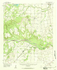 1958 Medicine Mound1959 Print · USGSHardeman and Foard Counties are shown here in the late fifties, defined by the winding Pease River and the iconic Medicine Mounds. Researchers can locate the Pease River Battlefield, the town of Margaret, and the Panhandle and Santa Fe rail line.
 - 1983 Map of Margaret, 1984 Print
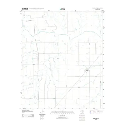
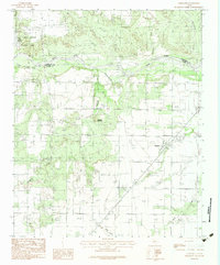 1983 Margaret1984 Print · USGSFoard County at the start of the eighties shows a landscape of ranching and river management. Trace the settlement at Margaret, the red-clay canyons of Copper Breaks State Park, and the winding course of the Pease River.2 unique versions available
 - 1986 Map of Vernon
 1986 Vernon1986 Print · USGSNorth Texas and Southern Oklahoma meet along the river in the mid-1980s, revealing a landscape defined by ranching, oil production, and rail transport. Researchers can locate distinct landmarks such as Medicine Mound, the Conley Oil Field, and the community of Punkin Center.
 - 1990 Map of Margaret, 1995 Print
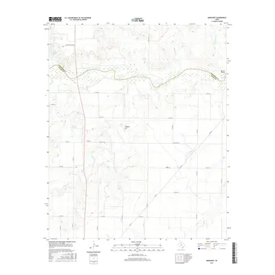
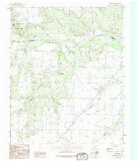 1990 Margaret1995 Print · USGSThe rural landscape of Foard County in the 1990s is captured here, centered on the settlement of Margaret. Researchers can trace the watercourses and landmarks of this ranching country, from Raggedy Mountain to the canyons of Copper Breaks State Park.
 - 2010 Map of Margaret, 2010 Print
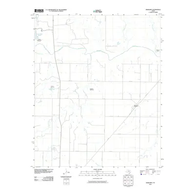 2010 Margaret2010 Print · USGSCovers Margaret, including Hardeman County, Foard County, and other nearby areas
 - 2012 Map of Margaret, 2012 Print
 2012 Margaret2012 Print · USGSCovers Margaret, including Hardeman County, Foard County, and other nearby areas
 - 2016 Map of Margaret, 2016 Print
 2016 Margaret2016 Print · USGSCovers Margaret, including Hardeman County, Foard County, and other nearby areas
 - 2019 Map of Margaret, 2019 Print
 2019 Margaret2019 Print · USGSCovers Margaret, including Hardeman County, Foard County, and other nearby areas
 - 2022 Map of Margaret, 2022 Print
 2022 Margaret2022 Print · USGSThe Foard County ranchlands meet the winding Pease River in this modern topographical survey of North Texas. Researchers can trace land divisions and local watercourses like Raggedy Mtn, Carroll Lake, and the remote Mule Cr.
End of results
Showing maps 1-10 of 10
Top cities near Margaret
Frequently asked questions
- What are the different types of historical maps available for Margaret?
- What is the oldest map of Margaret?
- Where can I purchase historical maps of Margaret for my home or office?
- Where can I download high-res historical maps of Margaret?
- Are there historical topographic maps available for Margaret?
- Is there historical aerial imagery available for Margaret?
- Where are historical maps of Margaret sourced from?