Old Maps of Vivian, Texas for Hiking & Exploration
Hike through history with 11 historic maps of Vivian. Explore old trails, ghost towns, and forgotten backroads — perfect for outdoor adventurers and local explorers.
- Rediscover forgotten places: Map out old mining camps, roads, and footpaths that no longer exist on modern maps.
- Layer with modern tools: Combine with LiDAR or satellite views to plan hikes through historical terrain.
- Made for exploration: Popular among hikers, overlanders, and local history lovers.
Use these maps to find adventure and explore the hidden past of Vivian.
Vivian, TX maps
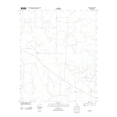
(11)- 1932 Map of Vivian
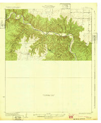 1932 Vivian1932 Print · USGSThe winding valley of the Pease River dominates this north Texas landscape as it appeared in the early thirties. Local history researchers can trace early county lines and rural landmarks like the Forestburg Sch and Teacup Mountain.2 unique versions available
 - 1955 Map of Lawton, 1958 Print
 1955 Lawton1958 Print · USGSSouthwestern Oklahoma and North Texas are shown here in the mid-fifties, dominated by the Wichita Mountains and the vital Red River watershed. Genealogists and historians can trace the foundations of Lawton alongside rural landmarks like Rainy Mountain Church and Pleasant Hill School.5 unique versions available
 - 1960 Map of Teacup Mountain, 1962 Print
 1960 Teacup Mountain1962 Print · USGSFoard and Hardeman counties are captured in the early sixties as they were shaped by the winding Pease River. Local historians can trace family landmarks and geographic features like Teacup Mountain, Sugarloaf Mountain, and the remote Oil Well site.
 - 1984 Map of Vivian, 1985 Print
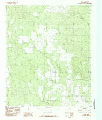 1984 Vivian1985 Print · USGSFoard County ranching country is captured here in the late seventies, showing a landscape of scattered settlements and seasonal waterways. Genealogists and local researchers can trace the area around Vivian or locate landmarks like Half Circle Spring and Blue Hole Creek.
 - 1986 Map of Vernon
 1986 Vernon1986 Print · USGSNorth Texas and Southern Oklahoma meet along the river in the mid-1980s, revealing a landscape defined by ranching, oil production, and rail transport. Researchers can locate distinct landmarks such as Medicine Mound, the Conley Oil Field, and the community of Punkin Center.
 - 1990 Map of Vivian, 1995 Print
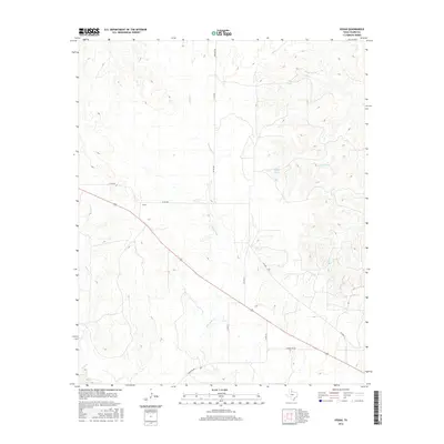
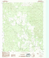 1990 Vivian1995 Print · USGSThe ranching country of Foard County, Texas, is captured here in the late twentieth century as it remained centered on the small community of Vivian. Researchers can locate the V Ranch, a local Cem, and natural landmarks like Half Circle Spring.
 - 2010 Map of Vivian, 2010 Print
 2010 Vivian2010 Print · USGSCovers Vivian, including Foard County, United States, and other nearby areas
 - 2012 Map of Vivian, 2012 Print
 2012 Vivian2012 Print · USGSCovers Vivian, including Foard County, United States, and other nearby areas
 - 2016 Map of Vivian, 2016 Print
 2016 Vivian2016 Print · USGSCovers Vivian, including Foard County, United States, and other nearby areas
 - 2019 Map of Vivian, 2019 Print
 2019 Vivian2019 Print · USGSCovers Vivian, including Foard County, United States, and other nearby areas
 - 2022 Map of Vivian, 2022 Print
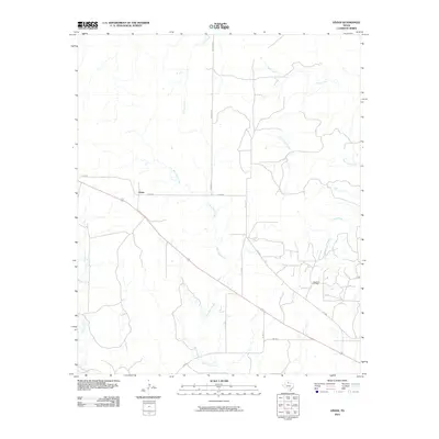
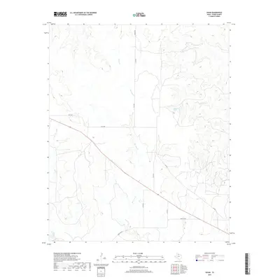
 2022 Vivian2022 Print · USGSFoard County ranching country is mapped here in the modern era, showing the enduring landscape of the Texas Rolling Plains. Genealogists and local historians can locate Vivian Cem and trace the winding paths of Blue Hole Cr and Half Circle Cr.
End of results
Showing maps 1-11 of 11
Top cities near Vivian
Frequently asked questions
- What are the different types of historical maps available for Vivian?
- What is the oldest map of Vivian?
- Where can I purchase historical maps of Vivian for my home or office?
- Where can I download high-res historical maps of Vivian?
- Are there historical topographic maps available for Vivian?
- Is there historical aerial imagery available for Vivian?
- Where are historical maps of Vivian sourced from?