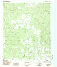
1984 Map of Vivian
USGS Topo · Published 1985About this map
The small settlement of Vivian sits within a landscape defined by an intricate network of intermittent waterways and cattle-ranching features in the Texas Panhandle region. Surveyed in the late 1970s, this area of Foard County reflects a reliance on local water sources, most notably at Half Circle Spring and the persistent drainage of Blue Hole Creek. The terrain is characterized by winding creek beds such as Cactus Creek and Cedar Creek, which feed into larger systems like Good Creek. A notable man-made feature is the Canal in the eastern portion of the quadrangle, illustrating the historical efforts to manage water in this semi-arid ranching country. For those tracing the local geography of the era, the presence of a Roadside Park along the primary roadway suggests the modest transit infrastructure serving this corner of North-Central Texas during the late twentieth century.
Find a feature on this map
9 named features on this map. Tap any name to fly to it.
Don’t see what you’re looking for? This feature index may not catch every label — zoom into the map to look around manually.
Map Details
Editions of this 1984 Vivian Map
This is the sole edition of this map. No revisions or reprints were ever made.
Other maps of this area

1927 · Quanah 3-a
USGS Topo · 1:48,000

1927 · Quanah 3-b
USGS Topo · 1:48,000

1932 · Vivian
USGS Topo · 1:62,500

1954 · Lubbock
USGS Topo · 1:250,000

1954 · Plainview
USGS Topo · 1:250,000

1954 · Wichita Falls
USGS Topo · 1:250,000

1955 · Lawton
USGS Topo · 1:250,000

1958 · Wichita Falls
USGS Topo · 1:250,000

1958 · Plainview
USGS Topo · 1:250,000

1960 · Teacup Mountain
USGS Topo · 1:62,500