Old Maps of Seminole, Texas for Hiking & Exploration
Hike through history with 16 historic maps of Seminole. Explore old trails, ghost towns, and forgotten backroads — perfect for outdoor adventurers and local explorers.
- Rediscover forgotten places: Map out old mining camps, roads, and footpaths that no longer exist on modern maps.
- Layer with modern tools: Combine with LiDAR or satellite views to plan hikes through historical terrain.
- Made for exploration: Popular among hikers, overlanders, and local history lovers.
Use these maps to find adventure and explore the hidden past of Seminole.
Seminole, TX maps
(16)- 1954 Map of Hobbs, 1963 Print
 1954 Hobbs1963 Print · USGSThe High Plains and Permian Basin transition is captured here at the height of the mid-century energy boom. Genealogists and industrial historians can trace the foundations of Humble City, locate the Potash Mine and Plant, and follow the Texas-New Mexico RR.2 unique versions available
 - 1958 Map of Hobbs
 1958 Hobbs1958 Print · USGSThe High Plains of the Texas-New Mexico border are shown here during the height of the mid-century oil boom. Genealogists and historians can trace the development of Hobbs, Lovington, and Jal, alongside ranching landmarks like James Ranch and the early Texas-New Mexico Railway.
 - 1970 Map of Seminole NE, 1973 Print
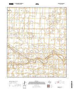
 1970 Seminole NE1973 Print · USGSGaines County oil production was in full swing by the early seventies. Genealogists and historians can trace the development of Seminole East Oil Field and Wescott Oil Field, or locate the Fairview settlement.
 - 1970 Map of Seminole, 1974 Print
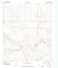
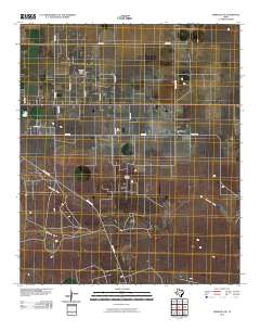
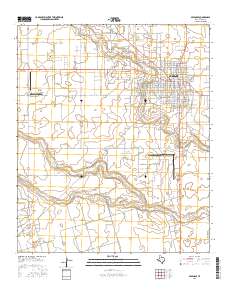
 1970 Seminole1974 Print · USGSGaines County enters the seventies as a bustling hub of oil production and local commerce. Trace the mid-century layout of Seminole, from the Courthouse square to the Doss-Robertson Field and the local Drive-in Theater.
 - 1985 Map of Seminole, 1986 Print
 1985 Seminole1986 Print · USGSGaines County and its neighbors are captured in the mid-eighties during a period of sustained energy production and agricultural persistence. Researchers can trace the sprawling oil fields and rail stops along the Atchison Topeka and Santa Fe near Denver City and Mungerville.
 - 1992 Map of Seminole
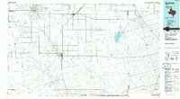
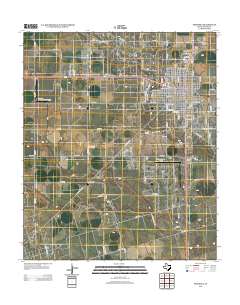
 1992 Seminole1992 Print · USGSThe Texas high plains in the early nineties show a landscape of heavy oil production and rural crossroads. Trace old family connections near Seminole, Denver City, or Seagraves, and explore the natural geography of Cedar (Salt) Lake.
 - 2010 Map of Seminole NE, 2010 Print
 2010 Seminole NE2010 Print · USGSCovers Seminole, including Gaines County, United States, and other nearby areas
 - 2010 Map of Seminole, 2010 Print
 2010 Seminole2010 Print · USGSCovers Seminole, including Gaines County, United States, and other nearby areas
 - 2012 Map of Seminole NE, 2012 Print
 2012 Seminole NE2012 Print · USGSCovers Seminole, including Gaines County, United States, and other nearby areas
 - 2012 Map of Seminole, 2012 Print
 2012 Seminole2012 Print · USGSCovers Seminole, including Gaines County, United States, and other nearby areas
 - 2016 Map of Seminole, 2016 Print
 2016 Seminole2016 Print · USGSCovers Seminole, including Gaines County, United States, and other nearby areas
 - 2016 Map of Seminole NE, 2016 Print
 2016 Seminole NE2016 Print · USGSCovers Seminole, including Gaines County, United States, and other nearby areas
 - 2019 Map of Seminole NE, 2019 Print
 2019 Seminole NE2019 Print · USGSCovers Seminole, including Gaines County, United States, and other nearby areas
 - 2019 Map of Seminole, 2019 Print
 2019 Seminole2019 Print · USGSCovers Seminole, including Gaines County, United States, and other nearby areas
 - 2022 Map of Seminole NE, 2022 Print
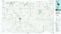
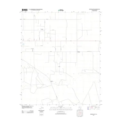
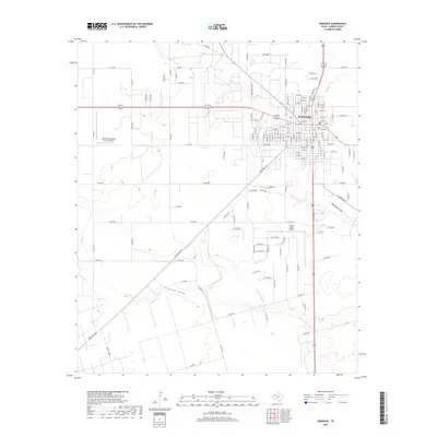
 2022 Seminole NE2022 Print · USGSSeminole and the surrounding Gaines County ranchlands are captured in the early 2020s, showing the interaction between urban growth and rural infrastructure. Researchers can trace the paths of Seminole Draw and Wardswell Draw across a landscape gridded by CO RD 104 and Fairview Rd.
 - 2022 Map of Seminole, 2022 Print
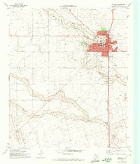
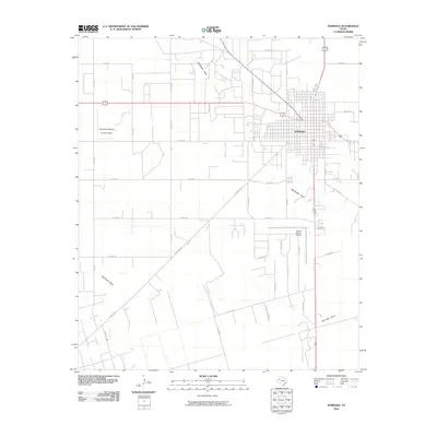
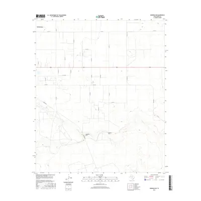
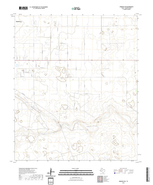
 2022 Seminole2022 Print · USGSThe West Texas town of Seminole is captured in this modern survey, showing a landscape defined by industrial agriculture and administrative history. Researchers can locate the Gaines County Courthouse, the Gaines County Cem, and the path of Seminole Draw.
End of results
Showing maps 1-16 of 16
Top cities near Seminole
Top neighborhoods of Seminole
- Finley Moore historical maps
- Elm Grove Addition historical maps
- Russell Addition historical maps
- Seminole North Addition historical maps
- 23rd Place historical maps
- Seminole Park historical maps
See more
Frequently asked questions
- What are the different types of historical maps available for Seminole?
- What is the oldest map of Seminole?
- Where can I purchase historical maps of Seminole for my home or office?
- Where can I download high-res historical maps of Seminole?
- Are there historical topographic maps available for Seminole?
- Is there historical aerial imagery available for Seminole?
- Where are historical maps of Seminole sourced from?