Old Maps of Grimes County, Texas for Hiking & Exploration
Hike through history with 94 historic maps of Grimes County. Explore old trails, ghost towns, and forgotten backroads — perfect for outdoor adventurers and local explorers.
- Rediscover forgotten places: Map out old mining camps, roads, and footpaths that no longer exist on modern maps.
- Layer with modern tools: Combine with LiDAR or satellite views to plan hikes through historical terrain.
- Made for exploration: Popular among hikers, overlanders, and local history lovers.
Use these maps to find adventure and explore the hidden past of Grimes County.
Grimes County, TX maps
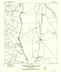
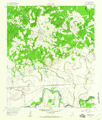
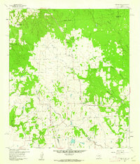
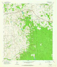
(94)- 1913 Map of Millican
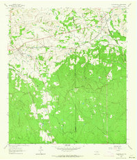
 1913 Millican1913 Print · USGSBrazos County at the beginning of the twentieth century was a critical rail junction defined by large-scale valley farming and the winding river border. Researchers can trace historic riverfront operations and rail stops including Millican, Hidalgo Falls, and the Steele Farm.3 unique versions available
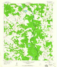
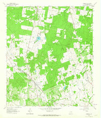
 - 1914 Map of Navasota
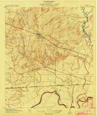
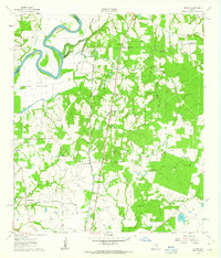
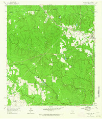
 1914 Navasota1914 Print · USGSBefore the modernization of the Brazos valley, this 1910s era survey captures the thriving rail-and-river economy of Grimes and Washington counties. Genealogists can trace early homesteads and community hubs like Wilsons Gin, Prairie Church, and Grange Hall School.2 unique versions available
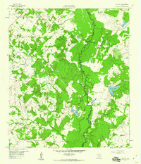
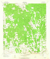
 - 1931 Map of Iola
 1931 Iola1931 Print · USGSThe Navasota River basin in the mid-1920s shows a landscape of river-bottom lakes and rural outposts. Genealogists can locate family landmarks like Keefer Cem and Nash Cem or the local hub at Burns Store.2 unique versions available
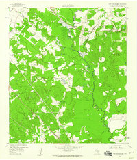
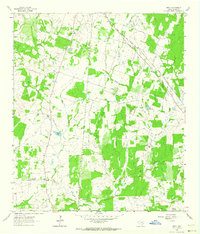
 - 1954 Map of Beaumont, 1964 Print
 1954 Beaumont1964 Print · USGSSoutheast Texas in the mid-fifties reveals a landscape of massive national forests, emerging reservoirs, and a booming oil economy. Genealogists and researchers can trace rural settlements like Dallardsville and Village Mills or locate early drilling sites at Sour Lake Oil Field.3 unique versions available
 - 1954 Map of Austin, 1964 Print
 1954 Austin1964 Print · USGSCentral Texas is captured during a period of steady growth as the capital city and its neighboring farm towns began to modernize. Researchers can trace historic rail corridors like the Southern Pacific RR or locate landmarks such as Bergstrom Air Force Base and Pilot Knob.4 unique versions available
 - 1956 Map of Hempstead
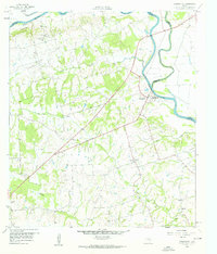
 1956 Hempstead1956 Print · USGSSoutheast Texas river country comes alive in this survey of the Brazos valley at the dawn of the motorized age. Genealogists and historians can trace the foundations of local society through schools like Pauls School, post offices at Howth P.O., and the path of the Houston and Texas Central Railroad.
 - 1956 Map of Carlos
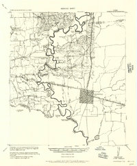
 1956 Carlos1956 Print · USGSGrimes and Brazos counties appear here in a transition from military to civil use, mapping the rural landscape along the Navasota River. Genealogists and historians can trace early schoolhouses like Independence S.H. and vanished rail sidings such as Grimes Switch.
 - 1957 Map of Beaumont
 1957 Beaumont1957 Print · USGSSoutheast Texas in the mid-fifties is defined by the timber-rich lands between the Trinity River and Beaumont. Trace the history of the Alabama and Coushatti Indian Reservation or locate early campus sites like Prairie View College.
 - 1958 Map of Washington, 1960 Print
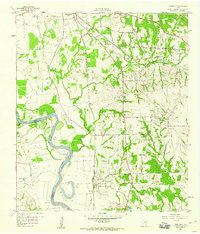
 1958 Washington1960 Print · USGSThe confluence of the Brazos and Navasota rivers defines this part of Texas in the late fifties. Genealogists and historians can locate old rural landmarks like Tennyson Cem, St Matthew Sch, and the riverside settlement of Washington.3 unique versions available
 - 1958 Map of Navasota, 1960 Print
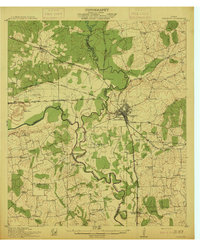
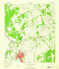 1958 Navasota1960 Print · USGSNavasota thrived as a vital rail junction and river town in the late fifties, serving as a crossroads for several major Texas railroad lines. Genealogists can trace family landmarks and burial sites including Oakland Cemetery, Erwin Cem, and the Salem Missionary Ch.3 unique versions available
 - 1958 Map of Courtney, 1960 Print
 1958 Courtney1960 Print · USGSThe Brazos River valley in the late fifties was a landscape of prairie farms and intersecting rail lines. Genealogists and historians can trace family-named sites like Sommerford Cem, congregations at Mercy Seat Ch, and the settlement at Courtney.3 unique versions available
 - 1959 Map of Millican, 1960 Print
 1959 Millican1960 Print · USGSThe Brazos Valley in the late fifties was a crossroads of major rail lines and river commerce. Genealogists and historians can trace the development of rail-side settlements like Millican and Allenfarm, or locate rural landmarks such as Brooks Chapel and Hidalgo Falls.4 unique versions available
 - 1959 Map of Clear Lake, 1960 Print
 1959 Clear Lake1960 Print · USGSThe Navasota River bottomlands are captured here in the late fifties at the meeting of Brazos, Madison, and Grimes Counties. Researchers can trace rural landmarks like Williamson Cem, find old river transits at Democrat Crossing, or locate Brushy Lake.3 unique versions available
 - 1959 Map of Reliance, 1960 Print
 1959 Reliance1960 Print · USGSBrazos and Grimes counties meet along the winding river bottomlands in the late fifties. Genealogists and local historians can trace the rural communities of Reliance and Harvey or locate the Stick Cem and Martin Prairie Ch.4 unique versions available
 - 1959 Map of Ferguson Crossing, 1960 Print
 1959 Ferguson Crossing1960 Print · USGSThe Brazos and Grimes county line along the Navasota River comes into focus in the late fifties, showcasing a rural Texas landscape of river bottoms and family landmarks. Genealogists and researchers can locate the Peach Creek Cem, the Rodeo Ground, and the historic namesake of Ferguson Crossing.3 unique versions available
 - 1960 Map of Waller NW, 1962 Print
 1960 Waller NW1962 Print · USGSThe rural borderlands of Waller and Harris counties are captured here in the early sixties, showing a landscape of family farms and creek bottoms. You can trace the community heart of the era through sites like Community Hall, Reida Prairie Ch, and Rosenau Cem.2 unique versions available
 - 1960 Map of Carlos, 1962 Print
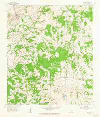
 1960 Carlos1962 Print · USGSIn the early sixties, this area of Grimes County was a mix of quiet ranch land and emerging industry. Genealogists and historians can trace the foundations of Carlos and Piedmont, or locate rural sites like Allen Cem and Blue Lake Ch.4 unique versions available
 - 1961 Map of Howth, 1963 Print
 1961 Howth1963 Print · USGSThe rural Brazos River valley comes to life in the early sixties, centered on the railroad town of Howth. Researchers can trace family history through sites like Salem Cem, St Luke Ch, and the small settlement of Rock Island.2 unique versions available
 - 1961 Map of Anderson, 1964 Print
 1961 Anderson1964 Print · USGSGrimes County at the start of the 1960s reveals a landscape of rural schools, historic churches, and winding creek bottoms. Genealogists can trace family footprints at Mason Cem, St Stanislaus Ch, and the site of the Grimes Prairie Sch.2 unique versions available
 - 1961 Map of Stoneham, 1964 Print
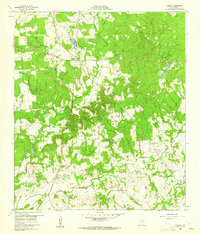
 1961 Stoneham1964 Print · USGSGrimes County's rural communities and rail junctions are documented here in the early 1960s. Genealogists and historians can locate family burial grounds like Salem Cem and trace settlements along the MISSOURI PACIFIC rail line such as Yarboro and Stoneham.
 - 1961 Map of Singleton, 1964 Print
 1961 Singleton1964 Print · USGSGrimes County at the start of the sixties reveals a rural landscape defined by heavy rail and creek systems. Genealogists and local historians can trace the junction of the Chicago Rock Island and Pacific Railroad and the Fort Worth and Denver Railroad near Singleton, alongside Zion Hill Ch.2 unique versions available
 - 1962 Map of Dacus, 1963 Print
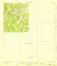
 1962 Dacus1963 Print · USGSSoutheast Texas at the start of the sixties reveals a transition from the Sam Houston National Forest into the rural creek-side communities of Grimes County. Genealogists can locate family sites near Bethel Cem, Mount Mariah Ch, and the settlement of Dacus.2 unique versions available
 - 1962 Map of Keith, 1964 Print
 1962 Keith1964 Print · USGSIn the early sixties, this portion of Grimes County was a landscape of winding cattle ranches and crossing rail lines. Genealogists can trace family footprints at Enon Cem, the old settlement of Keith, and the Kellum Springs area.2 unique versions available
 - 1962 Map of Plantersville, 1964 Print
 1962 Plantersville1964 Print · USGSPlantersville and its surrounding rail junctions are captured in the early sixties as they served the borderlands of Grimes and Montgomery Counties. Genealogists can trace family names through landmarks like Shannon Cem, Rose Hill Cem, and Center Point Ch.2 unique versions available
 - 1962 Map of Magnolia West, 1964 Print
 1962 Magnolia West1964 Print · USGSSoutheast Texas in the early sixties remains a landscape of timber and creek bottoms where county lines meet. Genealogists and historians can trace family locations near the Old Sanders Cem, the community of Fetzer, and the Lookout Tower Magnolia.3 unique versions available
Showing maps 1-25 of 94
Top cities of Grimes County
Frequently asked questions
- What are the different types of historical maps available for Grimes County?
- What is the oldest map of Grimes County?
- Where can I purchase historical maps of Grimes County for my home or office?
- Where can I download high-res historical maps of Grimes County?
- Are there historical topographic maps available for Grimes County?
- Is there historical aerial imagery available for Grimes County?
- Where are historical maps of Grimes County sourced from?