2020s Maps of Grimes County, Texas
Explore 23 historic maps of Grimes County from the 2020s. These maps offer a rare glimpse into what life looked like during the 2020s — showing old roads, neighborhoods, homes, and landmarks that have changed or disappeared over time.
Whether you're researching your family's past, planning a metal detecting trip, or studying how Grimes County's landscape evolved across the 2020s, these high-resolution maps are a powerful tool for exploring the history of this region.
- Focus on a specific era: All maps on this page are from the 2020s, giving you a focused view of this time period.
- See what’s changed: Compare century-old streets, trails, and buildings to today's modern landscape using overlays and satellite layers.
- Research with precision: Use these maps for genealogy, historical research, land use analysis, or educational projects.
- View, download, or print: Maps are fully viewable online in high resolution, and can be downloaded or printed for your own records.
Start exploring Grimes County's history through authentic maps from the 2020s. This is your window into the past.
Grimes County, TX maps
(23)- 2022 Map of Singleton, 2022 Print
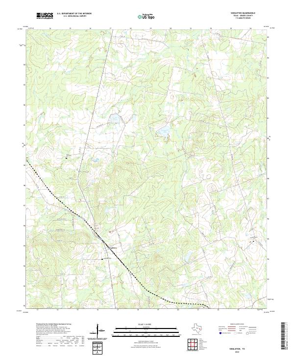 2022 Singleton2022 Print · USGSSingleton and the surrounding Grimes County countryside appear in this recent survey, showing a landscape defined by creeks and early burial grounds. Genealogists can locate Singleton Cem, Union Hill Cem, and Independence Cem tucked among waterways like S Bedias Cr.
 - 2022 Map of Plantersville, 2022 Print
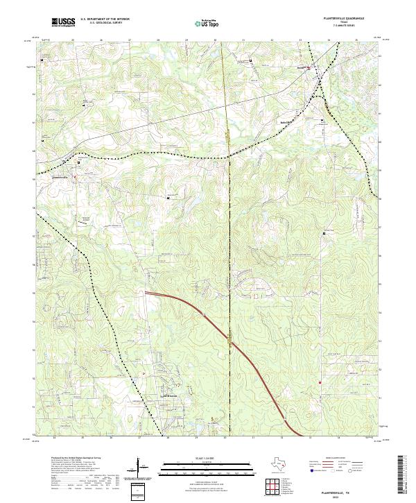 2022 Plantersville2022 Print · USGSThe Grimes and Montgomery county line comes into focus in this recent survey of the Texas piney woods. Genealogists and historians can trace numerous family and church burial sites, from Baker Family Cem to Porter Chapel Cem, alongside the community of Todd Mission.
 - 2022 Map of Loma, 2022 Print
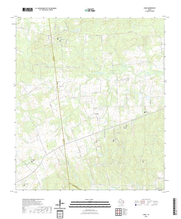 2022 Loma2022 Print · USGSThe rural crossroads around Loma and the Walker County line are documented in this recent survey. Genealogists and historians can trace numerous family and community sites including Foster Cem African American, Red Top Cem, and Midway Baptist Cem.
 - 2022 Map of Anderson, 2022 Print
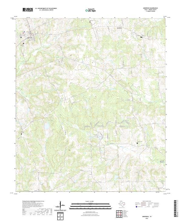 2022 Anderson2022 Print · USGSThe Grimes County seat and surrounding rural communities are captured here in the early twenty-first century. Genealogists can locate family landmarks like Mason Cem and Pleasant Grove Cem or trace the winding course of Holland Cr.
 - 2022 Map of Steep Branch, 2022 Print
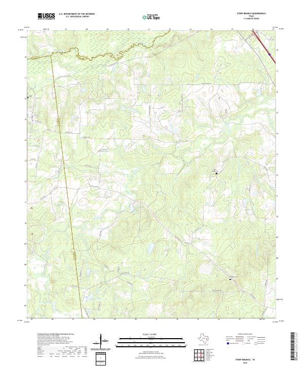 2022 Steep Branch2022 Print · USGSThe triple border of Madison, Grimes, and Walker counties comes alive in this 2022 survey of rural East Texas. Researchers can locate secluded family burial grounds like McAdams Cem and trace the winding paths of S Fork S Bedias Cr and Steep Br.
 - 2022 Map of Stoneham, 2022 Print
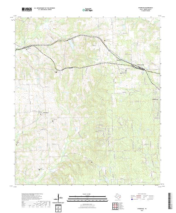 2022 Stoneham2022 Print · USGSGrimes County settlements like Stoneham and Plantersville are shown in this recent survey of rural East Texas. Genealogists can trace deep local roots through numerous burial grounds, including Stonehamville Cem, Yarboro Cem, and Childre Cem.
 - 2022 Map of Richards, 2022 Print
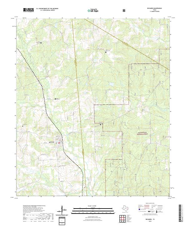 2022 Richards2022 Print · USGSRichards and the western edge of the Piney Woods are captured in this modern survey. Genealogists can trace family burial sites at Fairview Cem and David Chapel Cem while exploring the reach of the Sam Houston National Forest.
 - 2022 Map of Waller NW, 2022 Print
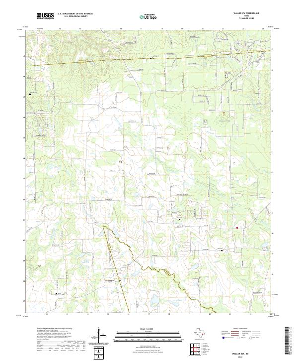 2022 Waller NW2022 Print · USGSThis rural portion of Waller and Grimes Counties shows a landscape of creek-fed prairies and historic family lands. Genealogists can locate long-standing burial sites like Fields Store Cem and Jones Cem alongside the waters of Spring Cr.
 - 2022 Map of Bedias, 2022 Print
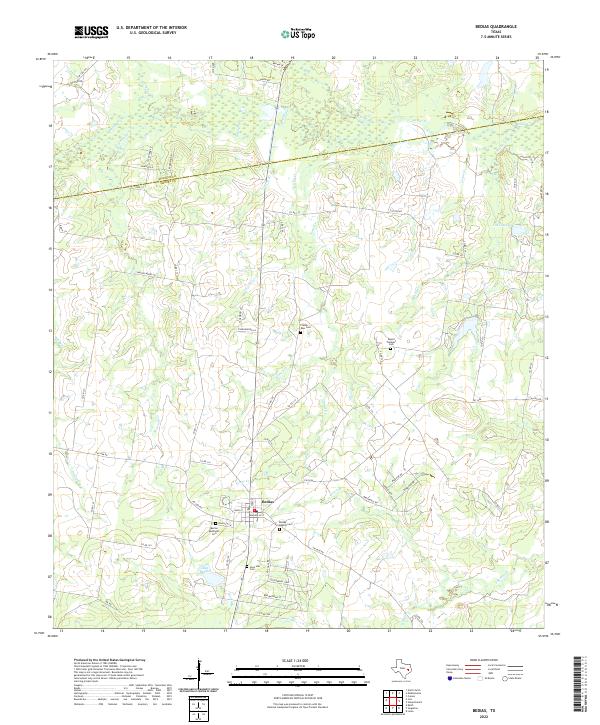 2022 Bedias2022 Print · USGSThe community of Bedias and its surrounding creek valleys are detailed in this recent survey of the Grimes and Madison County line. Family historians can locate several local burial sites, including the Bedias Baptist Cem and the Plaster - Ross Cem near Lake Bedias.
 - 2022 Map of Dacus, 2022 Print
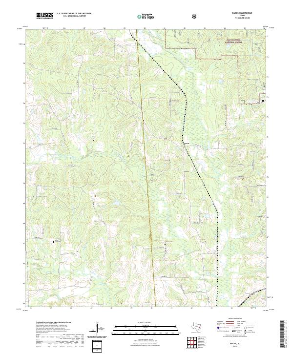 2022 Dacus2022 Print · USGSGrimes and Montgomery counties meet in this 2020s landscape characterized by the dense woodlands of the Sam Houston National Forest. Genealogists can locate family burial sites such as Smith - Floyd Cemetery and Waller Cemetery near the community of Dacus.
 - 2022 Map of Roans Prairie, 2022 Print
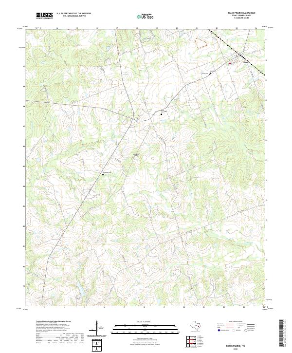 2022 Roans Prairie2022 Print · USGSThe rural landscape of Grimes County comes into focus here, showing the communities and family landmarks of the Roans Prairie area. Researchers can trace ancestral locations through several documented burial sites, including Bethlehem Cem, Old Oakland Cem, and the Spanish Cem.
 - 2022 Map of Howth, 2022 Print
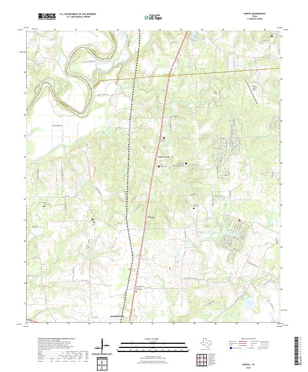 2022 Howth2022 Print · USGSThe Brazos River meanders through the Waller and Grimes county line in this contemporary look at the rural Texas prairie. Family historians can trace several burial grounds, including the Victoria David Memorial Farm Cem and the Old Salem Cem.
 - 2022 Map of Clear Lake, 2022 Print
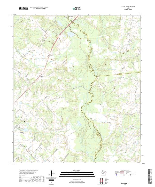 2022 Clear Lake2022 Print · USGSIn this contemporary Brazos County landscape, the meandering Navasota River marks the eastern county lines. Researchers can trace local history through the Williamson Cem, the settlement of Kurten, and prominent water bodies like Clear Lake.
 - 2022 Map of Washington, 2022 Print
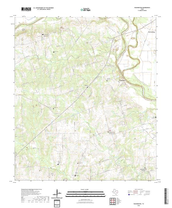 2022 Washington2022 Print · USGSNear the meeting point of the Brazos and Navasota rivers in the early 2020s, this landscape preserves a deep network of rural heritage. Genealogists can trace family and community history through numerous burial sites like Whiting Family Cem and Soul Chapel Cem.
 - 2022 Map of Courtney, 2022 Print
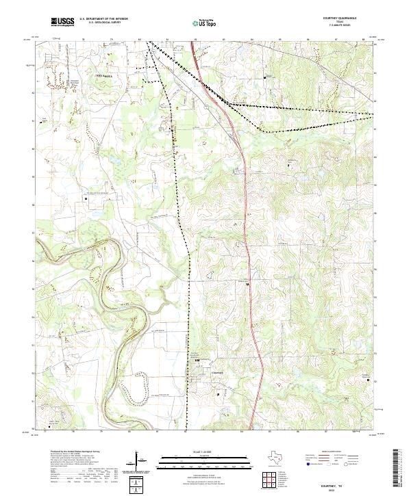 2022 Courtney2022 Print · USGSGrimes County at the edge of the Brazos River remains a landscape shaped by its waterways and family heritage. Genealogists can locate numerous burial sites like Sommerford Cem and Saint Holland Cem alongside the winding Beason Cr.
 - 2022 Map of Iola, 2022 Print
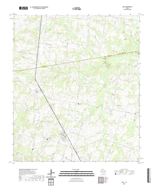 2022 Iola2022 Print · USGSIola and the surrounding Madison and Grimes County borderlands are shown here in the early 2020s. Family historians can locate several historic burial sites, including Concord Cemetery and Howard Cemetery, or trace the winding course of Bedias Creek.
 - 2022 Map of Reliance, 2022 Print
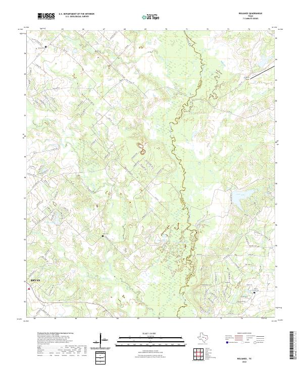 2022 Reliance2022 Print · USGSThe Brazos and Grimes County line comes alive in this contemporary view of the river bottomlands north of Bryan. Genealogists and historians can trace family burial sites at Reliance Cem and Stick Cem or locate the K Ranch Airport.
 - 2022 Map of Keith, 2022 Print
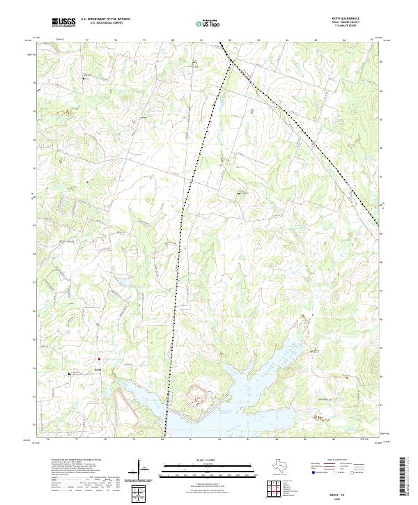 2022 Keith2022 Print · USGSGrimes County in the early 2020s remains a landscape of quiet creek bottoms and rural crossroads south of the Bedias Creek drainage. Genealogists can locate family burial sites at Evergreen Cem and Enon Cem or trace the shoreline of Gibbons Creek Reservoir.
 - 2022 Map of Carlos, 2022 Print
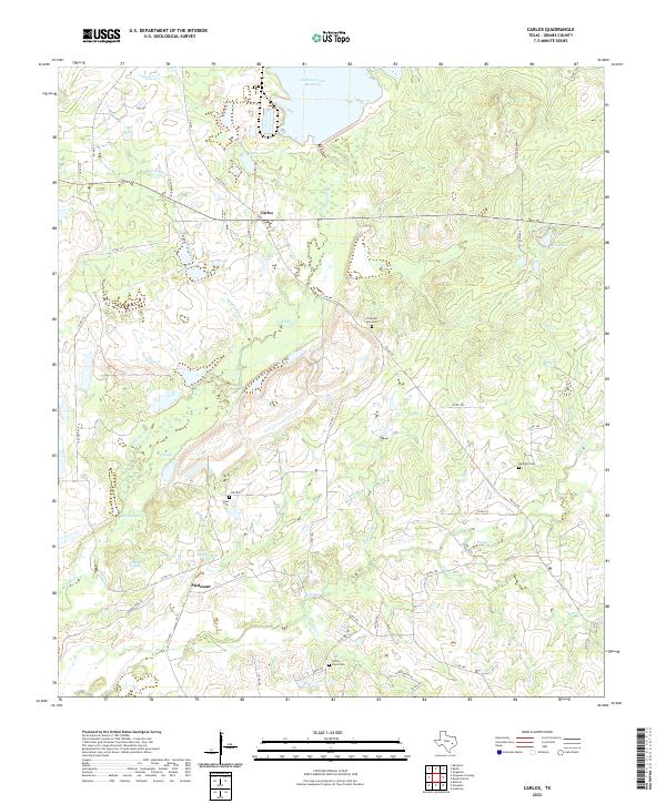 2022 Carlos2022 Print · USGSGrimes County near the modern reservoir shows a landscape of small settlements and historical springs in the early twenty-first century. Genealogists can trace family burial sites at Little Flock Cem and Kennard Cem or locate the site of Piedmont Springs.
 - 2022 Map of Millican, 2022 Print
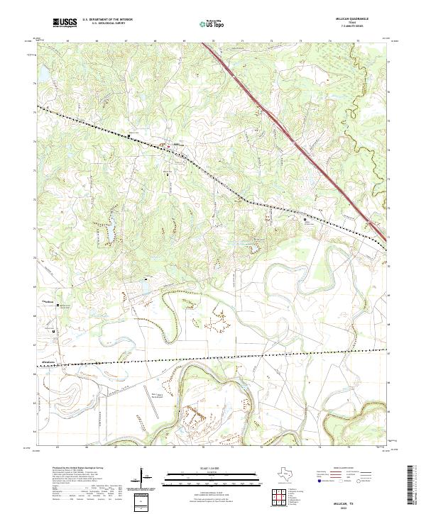 2022 Millican2022 Print · USGSIn the river bottoms of Brazos County, this modern survey shows the historic cotton-shipping hub of Millican and the rural community of Allenfarm. Genealogists and historians can trace family burial sites like Bethel Grove Church Cem and landmarks such as Hidalgo Falls along the river.
 - 2022 Map of Ferguson Crossing, 2022 Print
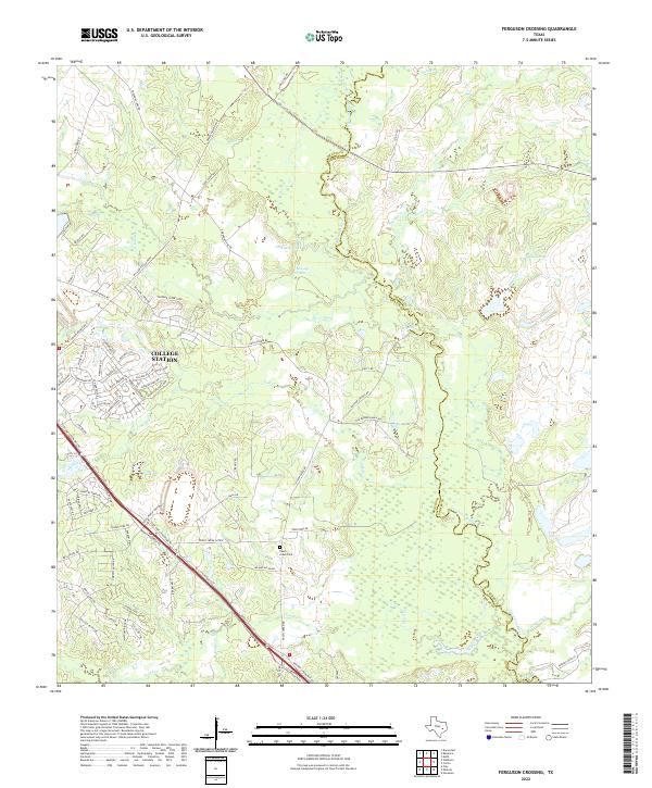 2022 Ferguson Crossing2022 Print · USGSBrazos and Grimes counties meet along the winding Navasota River as College Station expands into the surrounding countryside. Genealogists and local historians can trace family ties at Peach Creek Cem or locate old water sources like Lamb Spring and Sulphur Spring.
 - 2022 Map of Navasota, 2022 Print
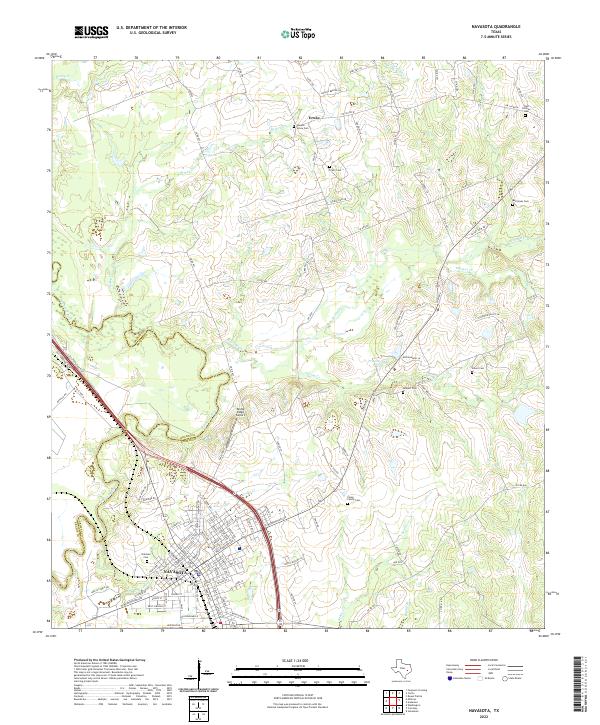 2022 Navasota2022 Print · USGSNavasota and the surrounding Grimes County countryside appear here as they were in the early 2020s, showing a mix of historic city streets and rural land. Researchers can locate many local burial grounds like Oakland Cem and Camp Family Cem while tracing the winding path of the Navasota River.
 - 2023 Map of Magnolia West, 2023 Print
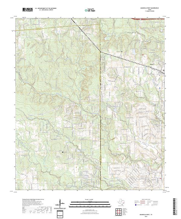 2023 Magnolia West2023 Print · USGSMagnolia and the surrounding tri-county area are shown in this modern survey as the region undergoes rapid suburban transformation. Genealogists can locate numerous small family burial grounds like Arnold Cem and Green Cem while tracing the winding paths of Walnut Creek.
End of results
Showing maps 1-23 of 23
Top cities of Grimes County
Frequently asked questions
- What are the different types of historical maps available for Grimes County?
- What is the oldest map of Grimes County?
- Where can I purchase historical maps of Grimes County for my home or office?
- Where can I download high-res historical maps of Grimes County?
- Are there historical topographic maps available for Grimes County?
- Is there historical aerial imagery available for Grimes County?
- Where are historical maps of Grimes County sourced from?