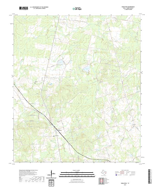
2022 Map of Singleton
USGS Topo · Published 2022About this map
Singleton serves as the focal point of this rural Grimes County landscape, where the intersection of FM 39 Rd and Co RD 154 marks a pocket of historical significance. This contemporary survey documents the enduring local legacy through sites like Singleton Cem and Union Hill Cem to the northwest. The terrain is defined by a dense network of tributaries including S Bedias Cr, Gibbons Cr, and Sulphur Cr, which feed numerous small bodies of water such as Lake Irene and Wilson Lake. Further east, Independence Cem sits near FM 2620 Rd, indicating early settlement patterns that follow the ridgelines and creek valleys. This map provides a clear view of the county's modern road infrastructure, tracing routes like Co RD 227 as they wind through the creek-divided countryside.
Find a feature on this map
46 named features on this map. Tap any name to fly to it.
Don’t see what you’re looking for? This feature index may not catch every label — zoom into the map to look around manually.
Map Details
Editions of this 2022 Singleton Map
This is the sole edition of this map. No revisions or reprints were ever made.
Other maps of this area

1931 · Iola
USGS Topo · 1:62,500

1954 · Beaumont
USGS Topo · 1:250,000

1954 · Austin
USGS Topo · 1:250,000

1956 · Carlos
USGS Topo · 1:62,500

1957 · Beaumont
USGS Topo · 1:250,000

1960 · Carlos
USGS Topo · 1:24,000

1961 · Singleton
USGS Topo · 1:24,000

1962 · Keith
USGS Topo · 1:24,000

1962 · Richards
USGS Topo · 1:24,000
1962 · Roans Prairie
USGS Topo · 1:24,000