
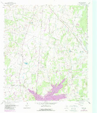
1962 Map of Keith
USGS Topo · Published 1964About this map
Keith anchors the southwestern portion of this Grimes County landscape, characterized by a network of small creeks and rural ranching operations in the early 1960s. The terrain is deeply carved by watercourses like Gibbons Creek, Bull Creek, and Panther Creek, which define the drainage patterns of the region. Local community life is evidenced by the concentration of spiritual and memorial sites, including Free Will Ch, Church of Christ, and the Evergreen Cem.
Find a feature on this map
28 named features on this map. Tap any name to fly to it.
Don’t see what you’re looking for? This feature index may not catch every label — zoom into the map to look around manually.
Map Details
Editions of this 1962 Keith Map
2 editions found
Other maps of this area

1931 · Iola
USGS Topo · 1:62,500

1954 · Beaumont
USGS Topo · 1:250,000

1954 · Austin
USGS Topo · 1:250,000

1956 · Carlos
USGS Topo · 1:62,500

1957 · Beaumont
USGS Topo · 1:250,000

1959 · Clear Lake
USGS Topo · 1:24,000

1959 · Reliance
USGS Topo · 1:24,000

1959 · Ferguson Crossing
USGS Topo · 1:24,000

1960 · Carlos
USGS Topo · 1:24,000

1961 · Singleton
USGS Topo · 1:24,000