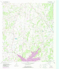
1962 Map of Keith
USGS Topo · Published 1989About this map
Keith serves as the focal point for this landscape in the early 1960s, a rural Texas community defined by its proximity to numerous small water bodies and seasonal drainages. The area is heavily marked by the Gibbons Creek Lake reservoir system, which includes Gibbons Creek and Sulphur Creek. A network of country churches and burial grounds, such as Evergreen Cem and the Free Will Ch, provides essential points of interest for those tracing family history and regional genealogy.
Find a feature on this map
33 named features on this map. Tap any name to fly to it.
Don’t see what you’re looking for? This feature index may not catch every label — zoom into the map to look around manually.
Map Details
Editions of this 1962 Keith Map
2 editions found

Other maps of this area

1931 · Iola
USGS Topo · 1:62,500

1954 · Beaumont
USGS Topo · 1:250,000

1954 · Austin
USGS Topo · 1:250,000

1956 · Carlos
USGS Topo · 1:62,500

1957 · Beaumont
USGS Topo · 1:250,000

1959 · Clear Lake
USGS Topo · 1:24,000

1959 · Reliance
USGS Topo · 1:24,000

1959 · Ferguson Crossing
USGS Topo · 1:24,000

1960 · Carlos
USGS Topo · 1:24,000

1961 · Singleton
USGS Topo · 1:24,000