Old Maps of Navasota, Texas for Genealogy
Trace your family roots with 15 historic maps of Navasota. These high-res maps reveal old neighborhoods, homesites, landmarks, and streets — helping you uncover where your ancestors lived and how the area evolved over time.
- Explore historic neighborhoods: Identify where your relatives may have lived in the 1800s or 1900s.
- Compare maps over time: Trace the changes in streets, buildings, and landmarks for multi-generational research.
- Perfect for genealogy & ancestry research: Used by family historians and researchers to map out lineage and migration.
These maps are an incredible resource for exploring your personal connection to Navasota's past.
Navasota, TX maps
(15)- 1914 Map of Navasota
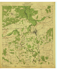 1914 Navasota1914 Print · USGSBefore the modernization of the Brazos valley, this 1910s era survey captures the thriving rail-and-river economy of Grimes and Washington counties. Genealogists can trace early homesteads and community hubs like Wilsons Gin, Prairie Church, and Grange Hall School.2 unique versions available
 - 1954 Map of Austin, 1964 Print
 1954 Austin1964 Print · USGSCentral Texas is captured during a period of steady growth as the capital city and its neighboring farm towns began to modernize. Researchers can trace historic rail corridors like the Southern Pacific RR or locate landmarks such as Bergstrom Air Force Base and Pilot Knob.4 unique versions available
 - 1958 Map of Navasota, 1960 Print
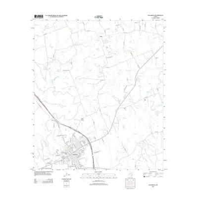
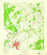 1958 Navasota1960 Print · USGSNavasota thrived as a vital rail junction and river town in the late fifties, serving as a crossroads for several major Texas railroad lines. Genealogists can trace family landmarks and burial sites including Oakland Cemetery, Erwin Cem, and the Salem Missionary Ch.3 unique versions available
 - 1958 Map of Courtney, 1960 Print
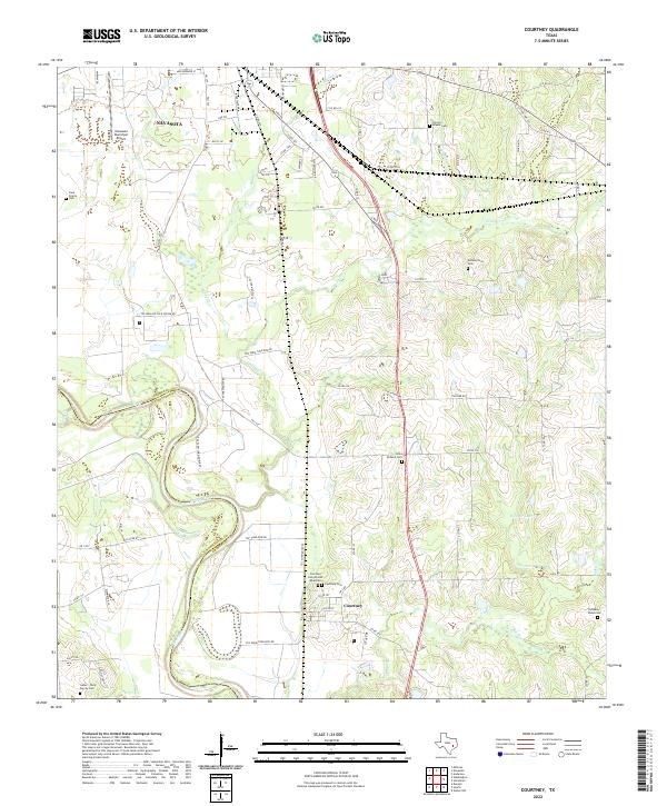
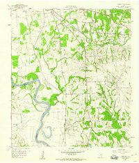 1958 Courtney1960 Print · USGSThe Brazos River valley in the late fifties was a landscape of prairie farms and intersecting rail lines. Genealogists and historians can trace family-named sites like Sommerford Cem, congregations at Mercy Seat Ch, and the settlement at Courtney.3 unique versions available
 - 1993 Map of Brenham
 1993 Brenham1993 Print · USGSTexas river country and the birthplace of the republic are showcased in the early nineties, centered on the confluence of the Brazos and Navasota. Researchers can trace the rail sidings of the Southern Pacific RR and locate historic community landmarks like St Paul Ch and Washington-on-the-Brazos State Park.
 - 2010 Map of Navasota, 2010 Print
 2010 Navasota2010 Print · USGSCovers Navasota, including Erwin, Brazos County, and other nearby areas
 - 2010 Map of Courtney, 2010 Print
 2010 Courtney2010 Print · USGSCovers Navasota, including Lynn Grove, Wood, and other nearby areas
 - 2013 Map of Courtney, 2013 Print
 2013 Courtney2013 Print · USGSCovers Navasota, including Lynn Grove, Wood, and other nearby areas
 - 2013 Map of Navasota, 2013 Print
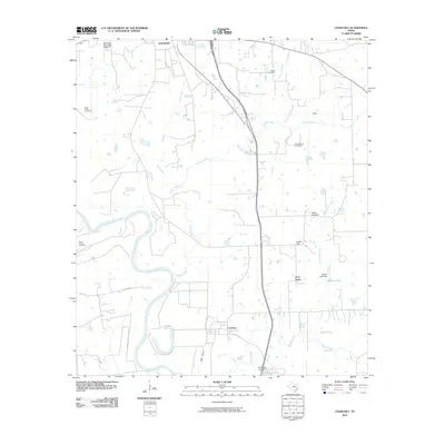
 2013 Navasota2013 Print · USGSCovers Navasota, including Erwin, Brazos County, and other nearby areas
 - 2016 Map of Courtney, 2016 Print
 2016 Courtney2016 Print · USGSCovers Navasota, including Lynn Grove, Wood, and other nearby areas
 - 2016 Map of Navasota, 2016 Print
 2016 Navasota2016 Print · USGSCovers Navasota, including Erwin, Brazos County, and other nearby areas
 - 2019 Map of Navasota, 2019 Print
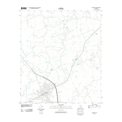
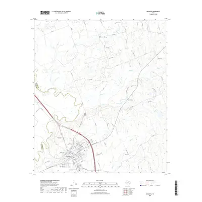 2019 Navasota2019 Print · USGSCovers Navasota, including Erwin, Brazos County, and other nearby areas
 - 2019 Map of Courtney, 2019 Print
 2019 Courtney2019 Print · USGSCovers Navasota, including Lynn Grove, Wood, and other nearby areas
 - 2022 Map of Courtney, 2022 Print
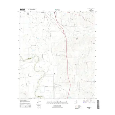
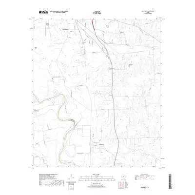
 2022 Courtney2022 Print · USGSGrimes County at the edge of the Brazos River remains a landscape shaped by its waterways and family heritage. Genealogists can locate numerous burial sites like Sommerford Cem and Saint Holland Cem alongside the winding Beason Cr.
 - 2022 Map of Navasota, 2022 Print
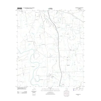
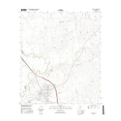
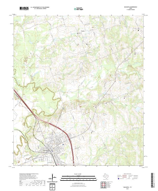 2022 Navasota2022 Print · USGSNavasota and the surrounding Grimes County countryside appear here as they were in the early 2020s, showing a mix of historic city streets and rural land. Researchers can locate many local burial grounds like Oakland Cem and Camp Family Cem while tracing the winding path of the Navasota River.
End of results
Showing maps 1-15 of 15
Top cities near Navasota
- College Station historical maps
- Bryan historical maps
- Millican historical maps
- Anderson historical maps
Frequently asked questions
- What are the different types of historical maps available for Navasota?
- What is the oldest map of Navasota?
- Where can I purchase historical maps of Navasota for my home or office?
- Where can I download high-res historical maps of Navasota?
- Are there historical topographic maps available for Navasota?
- Is there historical aerial imagery available for Navasota?
- Where are historical maps of Navasota sourced from?