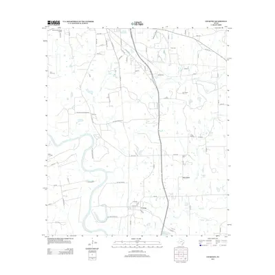
2013 Map of Courtney
USGS Topo · Published 2013About this map
The Brazos River carves a sweeping path through this portion of Grimes County, defining the western landscape as it meanders toward the south. Near its banks, the settlement of Courtney remains a focal point, served by FM 2 RD and FM 1227 RD. The rural character of the area is underscored by numerous small communities and family-named landmarks, including Sommerford, Wood, and Lynn Grove. Genealogists and local historians can find several burial grounds such as Sand Prairie Cem, Evans Prairie Cem, and Bryant Cem, which provide clues to the region's heritage. The northern reaches are more developed, featuring the Navasota Municipal Airport and a network of county roads like Co RD 422 and Co RD 407 that connect the scattered farmsteads and rural homesites across Grassy Cr and Sandy Cr.
Find a feature on this map
70 named features on this map. Tap any name to fly to it.
Don’t see what you’re looking for? This feature index may not catch every label — zoom into the map to look around manually.
Map Details
Editions of this 2013 Courtney Map
This is the sole edition of this map. No revisions or reprints were ever made.
Other maps of this area

1913 · Millican
USGS Topo · 1:31,680

1914 · Navasota
USGS Topo · 1:62,500

1954 · Beaumont
USGS Topo · 1:250,000

1954 · Austin
USGS Topo · 1:250,000

1956 · Hempstead
USGS Topo · 1:62,500

1957 · Beaumont
USGS Topo · 1:250,000

1958 · Washington
USGS Topo · 1:24,000

1958 · Navasota
USGS Topo · 1:24,000

1958 · Courtney
USGS Topo · 1:24,000

1959 · Millican
USGS Topo · 1:24,000