Old Maps of Wolf Flat, Texas for Academic Research
Study the evolution of Wolf Flat with 5 high-resolution historic maps. Whether you're teaching, researching, or modeling changes in land use, these maps provide essential visual documentation of urban, environmental, and geographic change.
- Analyze long-term change: Track patterns in development, transportation, and natural features.
- Ideal for environmental or urban studies: Support academic projects with primary historical map data.
- Use in the classroom or lab: Educators and researchers rely on these maps to bring historical context to life.
These maps are a powerful tool for teaching, research, and visualizing how Wolf Flat has changed over the decades.
Wolf Flat, TX maps
(5)- 1954 Map of Plainview, 1966 Print
 1954 Plainview1966 Print · USGSThe Texas Panhandle and the rugged Caprock Escarpment appear in detail as the region's agricultural and rail networks reached their mid-century peak. Trace family roots and old land patterns through the canyons and plains near Plainview, Palo Duro State Park, and Childress.3 unique versions available
 - 1958 Map of Plainview
 1958 Plainview1958 Print · USGSThe High Plains and Caprock Escarpment meet in the late fifties, showcasing the ranching and rail networks of the Texas Panhandle. Trace family roots and vanished stops along the Panhandle and Santa Fe railroad through Plainview, Silverton, and Matador.
 - 1967 Map of North Windmill, 1969 Print
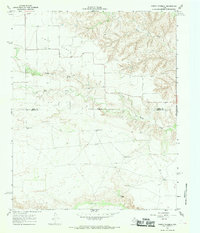 1967 North Windmill1969 Print · USGSThe rolling canyonlands of Motley and Hall County are captured in the late 1960s, a time when ranching life centered on the vital water of Turkey Creek. Genealogists can locate Dreamland Cem and remote landmarks like Dogtown Windmill or the settlement at Kent.2 unique versions available
 - 1986 Map of Childress
 1986 Childress1986 Print · USGSTexas ranching and conservation lands come to life in this mid-eighties survey of the Pease River country. Genealogists and historians can trace family roots through Matador, find the Matador Cem, or locate the Burlington Northern line through Childress.2 unique versions available
 - 2022 Map of North Windmill, 2022 Print
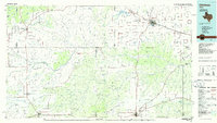
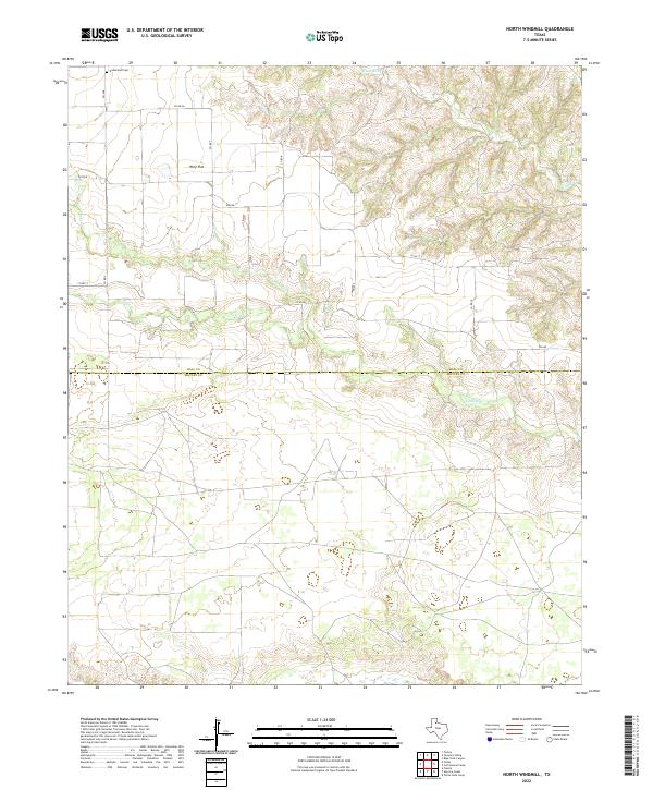 2022 North Windmill2022 Print · USGSThe West Texas ranchlands near the Motley and Hall county line are captured in this modern survey, showcasing a landscape of winding seasonal creeks. Genealogists and local historians can trace the roads around Wolf Flat or locate the Dreamland Cem and Turkey Cr.
End of results
Showing maps 1-5 of 5
Top cities near Wolf Flat
Frequently asked questions
- What are the different types of historical maps available for Wolf Flat?
- What is the oldest map of Wolf Flat?
- Where can I purchase historical maps of Wolf Flat for my home or office?
- Where can I download high-res historical maps of Wolf Flat?
- Are there historical topographic maps available for Wolf Flat?
- Is there historical aerial imagery available for Wolf Flat?
- Where are historical maps of Wolf Flat sourced from?