2020s Maps of Hansford County, Texas
Explore 20 historic maps of Hansford County from the 2020s. These maps offer a rare glimpse into what life looked like during the 2020s — showing old roads, neighborhoods, homes, and landmarks that have changed or disappeared over time.
Whether you're researching your family's past, planning a metal detecting trip, or studying how Hansford County's landscape evolved across the 2020s, these high-resolution maps are a powerful tool for exploring the history of this region.
- Focus on a specific era: All maps on this page are from the 2020s, giving you a focused view of this time period.
- See what’s changed: Compare century-old streets, trails, and buildings to today's modern landscape using overlays and satellite layers.
- Research with precision: Use these maps for genealogy, historical research, land use analysis, or educational projects.
- View, download, or print: Maps are fully viewable online in high resolution, and can be downloaded or printed for your own records.
Start exploring Hansford County's history through authentic maps from the 2020s. This is your window into the past.
Hansford County, TX maps
(20)- 2022 Map of Waka SW, 2022 Print
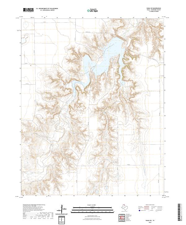 2022 Waka SW2022 Print · USGSHansford County in the early twenty-first century reveals a landscape shaped by the deep breaks of the Horse Creek drainage. Researchers can trace the intersection of local routes like FM 760 and FARM RD 3214 across this complex terrain.
 - 2022 Map of Gruver, 2022 Print
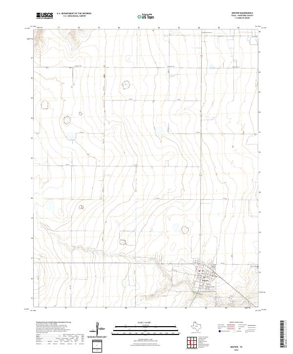 2022 Gruver2022 Print · USGSThe Texas Panhandle town of Gruver is captured here in the early twenty-first century, showing the community's established street grid and agricultural surroundings. Researchers can trace local land divisions and find landmarks like Gruver Cem and the natural path of Farwell Draw.
 - 2022 Map of Hansford, 2022 Print
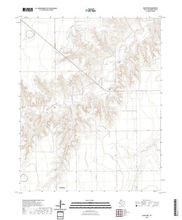 2022 Hansford2022 Print · USGSHansford County in the early 2020s remains a landscape defined by its deep creek breaks and high plains ranching. Researchers can trace the rural settlement at McKibben or locate ancestral sites at Hansford Cem and along the banks of Horse Cr.
 - 2022 Map of Spearman, 2022 Print
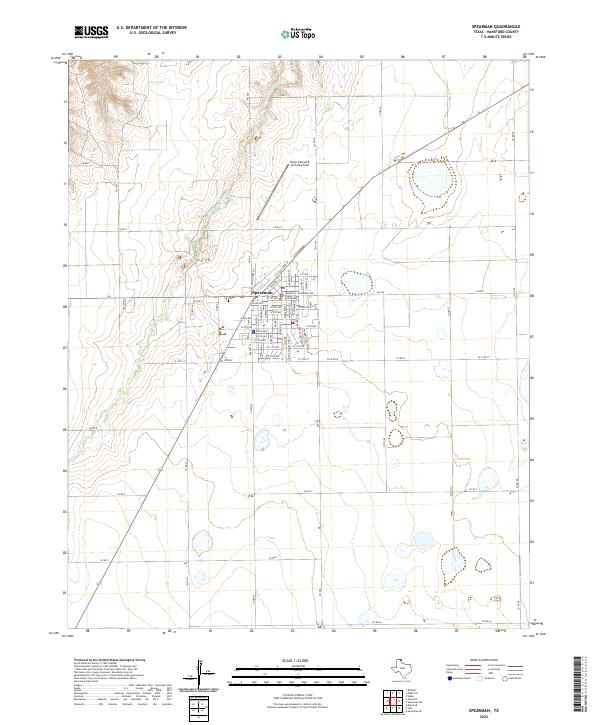 2022 Spearman2022 Print · USGSSpearman and the surrounding Hansford County plains are captured in this modern survey of the Texas Panhandle. Genealogists and local historians can locate the Hansford County Courthouse, the historic street grid of Spearman, and landmarks like Major Samuel B Cornelius Field.
 - 2022 Map of West of Gruver, 2022 Print
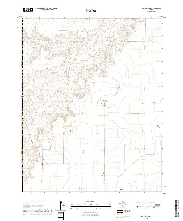 2022 West of Gruver2022 Print · USGSThe High Plains border of Hansford and Sherman counties is captured here in the early twenty-first century. Researchers can trace the intersection of ranching life and geography along Coldwater Cr, Martin Springs, and Ranch Rd 1573.
 - 2022 Map of Hannas Draw East, 2022 Print
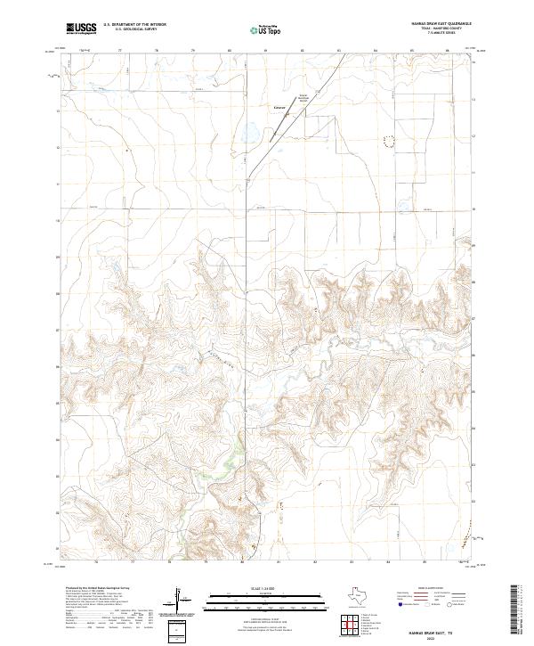 2022 Hannas Draw East2022 Print · USGSHansford County in the modern era shows the steady layout of the Texas Panhandle, where the town of Gruver meets the dissected plains. Researchers can trace the path of Hannas Draw or locate regional transit points like the Gruver Municipal Airport.
 - 2022 Map of Waka, 2022 Print
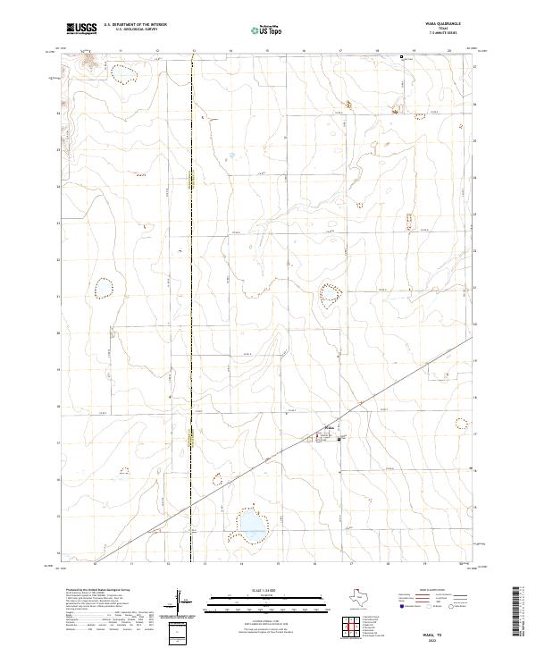 2022 Waka2022 Print · USGSTexas Panhandle ranching and farming lands are captured here in the early 2020s along the Hansford and Ochiltree county line. Researchers can locate the community of Waka, its central streets like Butler Ave, and rural burial sites including Bethel Cem.
 - 2022 Map of Phillips Camp, 2022 Print
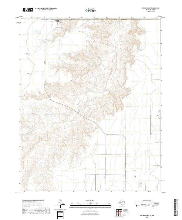 2022 Phillips Camp2022 Print · USGSHansford County in the modern era reveals the intersection of industrial agriculture and the carved breaks of Coldwater Creek. Trace the layout of the northern Panhandle landscape from Phillips Camp to the network of local routes like County Road 9.
 - 2022 Map of Kimball, 2022 Print
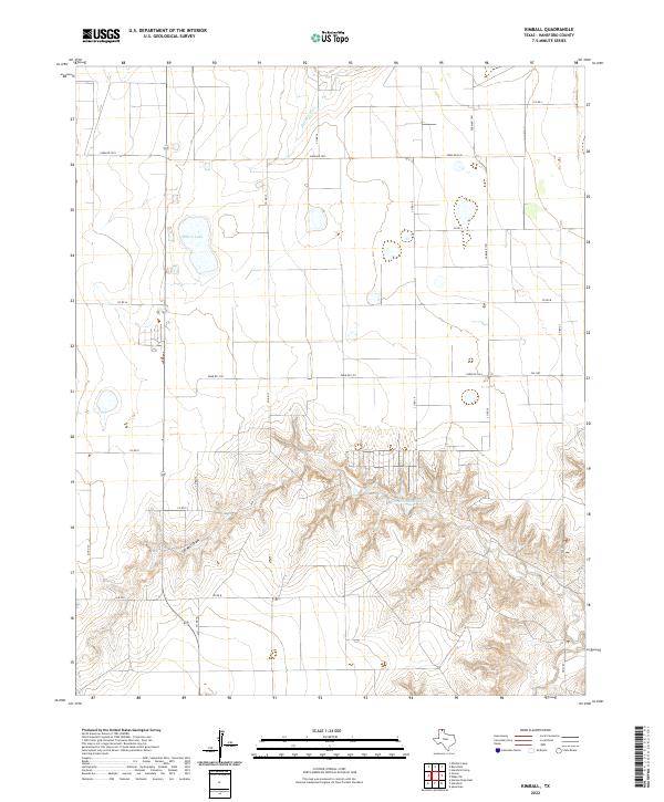 2022 Kimball2022 Print · USGSThe Texas Panhandle plateau transitions into the breaks of Farwell Draw in this modern Hansford County survey. Researchers can trace the grid of rural roads and water features like Millers Lake and Hackberry Cr.
 - 2022 Map of Spearman NE, 2022 Print
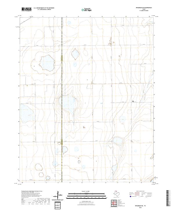 2022 Spearman NE2022 Print · USGSThe northern Panhandle plains come into focus in the early twenty-first century, showing the boundary between Hansford Co and Ochiltree Co. Researchers can locate the Black Cem and trace rural section lines along FM 759 or CO RD W.
 - 2022 Map of Morse SE, 2022 Print
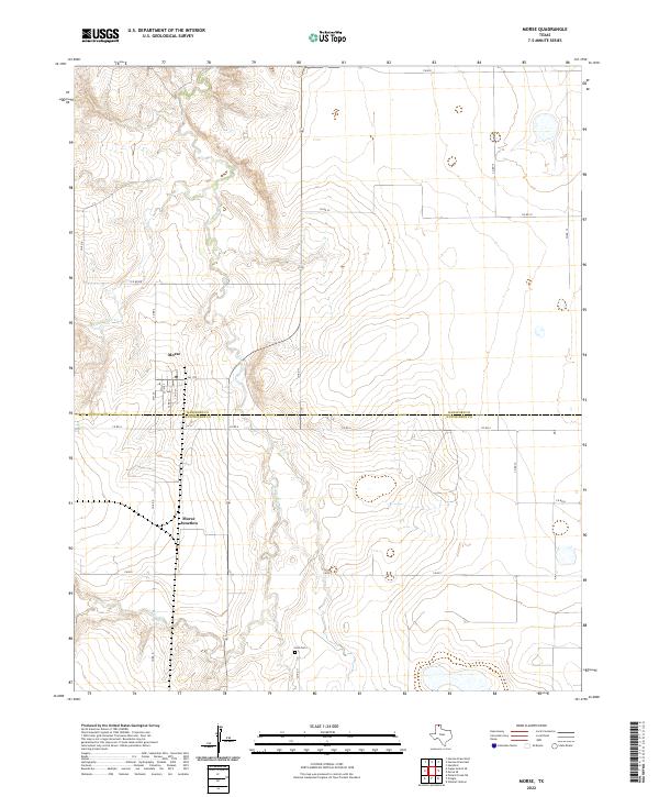
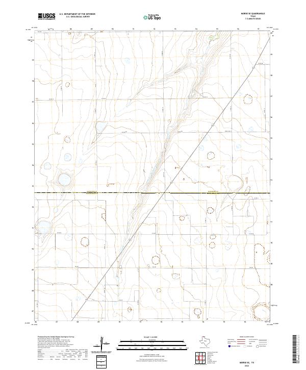 2022 Morse SE2022 Print · USGSHansford and Hutchinson counties meet in this Panhandle landscape during the early 2020s, showing the intersection of ranching life and modern infrastructure. You can trace the path of Horse Creek and locate family land along routes like CO RD 18 and FM 281.
 - 2022 Map of Holt, 2022 Print
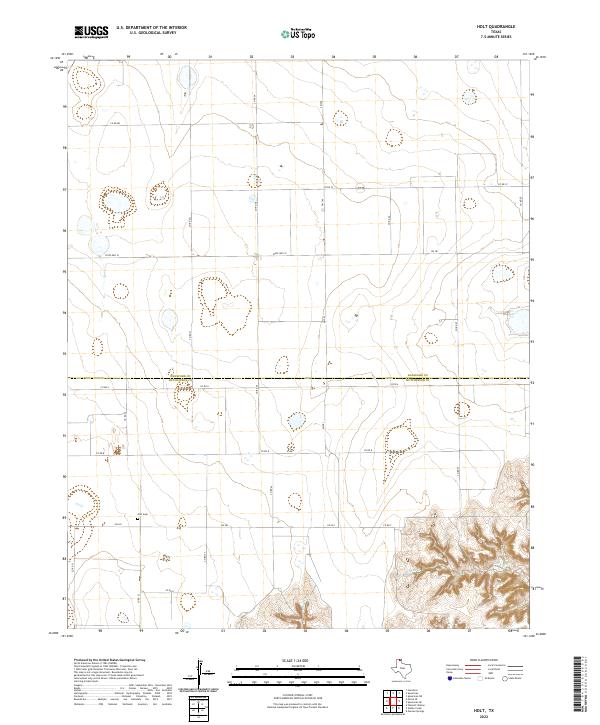 2022 Holt2022 Print · USGSThe Texas Panhandle at the Hansford and Hutchinson county line is shown here in the 2020s, a landscape of straight section roads and deep creek draws. Genealogists can locate Holt Cem near FM 281 or trace the rugged topography surrounding Johns Creek.
 - 2022 Map of Frisco Creek East, 2022 Print
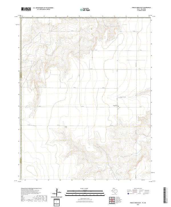 2022 Frisco Creek East2022 Print · USGSHansford County's high plains are documented here in the modern era, showing the enduring agricultural grid along the Sherman County line. Researchers can locate the Oslo Lutheran Church and Oslo Lutheran Church Cem situated between the drainages of Frisco Cr and Coldwater Cr.
 - 2022 Map of Hansford Camp, 2022 Print
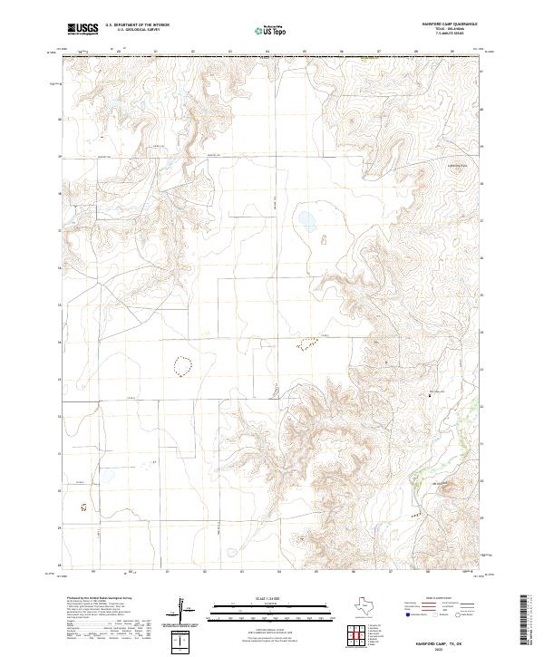 2022 Hansford Camp2022 Print · USGSHansford County, Texas, in the early twenty-first century shows a landscape of wide plains and deep draws. Genealogists and local historians can locate the New Hope Cem and trace the paths of Hackberry Cr and Mt Helland.
 - 2022 Map of Hannas Draw West, 2022 Print
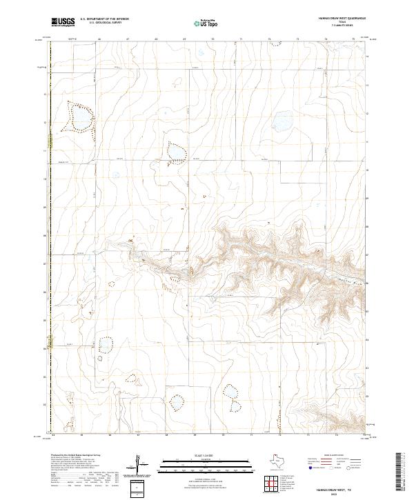 2022 Hannas Draw West2022 Print · USGSThe high plains of the Texas Panhandle meet the rugged drainages of the eastern border in the early 2020s. Genealogists and researchers can trace the boundary of Sherman Co and Hansford Co along rural routes like Fm 2018 and Hannas Draw.
 - 2022 Map of Morse, 2022 Print
 2022 Morse2022 Print · USGSThe high plains and rugged draws of the Texas Panhandle come into focus in this contemporary survey of the area surrounding Morse. Family researchers can locate the Lieb Cem and trace the paths of S Palo Duro Cr across the county line.
 - 2022 Map of Capps Switch SE, 2022 Print
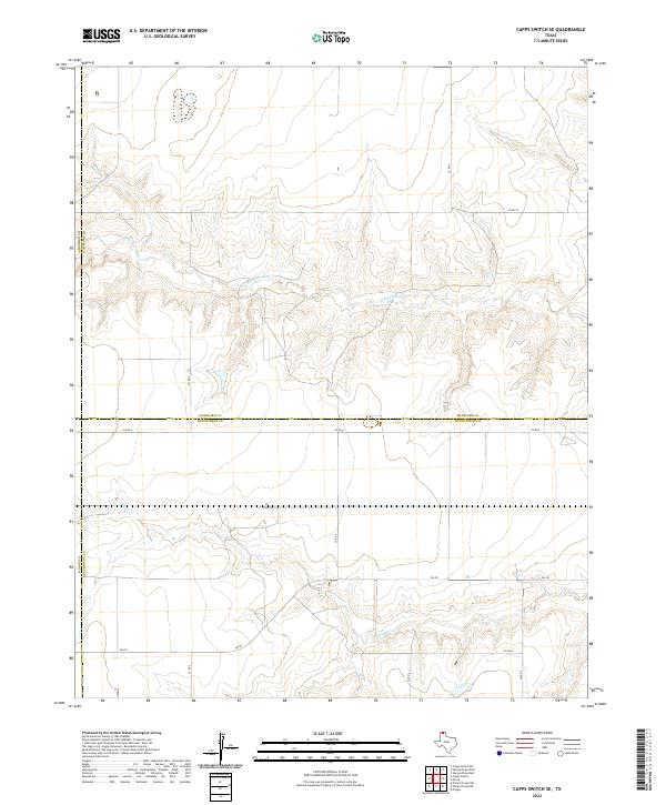 2022 Capps Switch SE2022 Print · USGSThe Texas Panhandle's wide-open ranch lands are documented here in the early twenty-first century as they span the meeting point of four counties. Researchers can trace the winding paths of N Palo Duro Cr and S Palo Duro Cr as they cut through the rural grid of Fm 281 and Co Rd A.
 - 2022 Map of Horseshoe Hill, 2022 Print
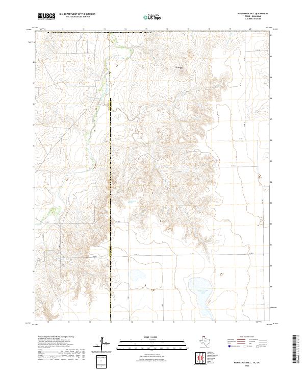 2022 Horseshoe Hill2022 Print · USGSThe northern Panhandle landscape along the Hansford Co Ochiltree Co line is documented in this modern survey. Researchers can trace the drainage of Palo Duro Cr and locate water sources like Wampus Cat Springs and Peckenpaugh Lake.
 - 2022 Map of Spearman SE, 2022 Print
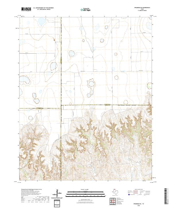 2022 Spearman SE2022 Print · USGSThe Texas Panhandle high plains meet the canyon breaks of the Canadian River watershed in this 2022 study. Genealogists and land researchers can trace property lines along Brainard Rd and the winding course of Pats Creek near the Ochiltree and Roberts county line.
 - 2022 Map of Bernstein, 2022 Print
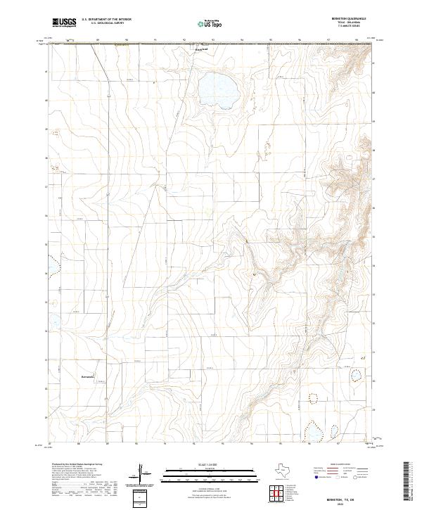 2022 Bernstein2022 Print · USGSHansford County, Texas, is captured in this recent survey, showing the agricultural grid and the natural drainage of Hackberry Cr. Genealogists and local historians can trace the road networks around Bernstein and Hitchland or locate Collie Lake.
End of results
Showing maps 1-20 of 20
Top cities of Hansford County
Frequently asked questions
- What are the different types of historical maps available for Hansford County?
- What is the oldest map of Hansford County?
- Where can I purchase historical maps of Hansford County for my home or office?
- Where can I download high-res historical maps of Hansford County?
- Are there historical topographic maps available for Hansford County?
- Is there historical aerial imagery available for Hansford County?
- Where are historical maps of Hansford County sourced from?