1900s (20th Century) Maps of Hansford County, Texas
Explore 23 historic maps of Hansford County from the 1900s (20th Century). These maps offer a rare glimpse into what life looked like during the 1900s — showing old roads, neighborhoods, homes, and landmarks that have changed or disappeared over time.
Whether you're researching your family's past, planning a metal detecting trip, or studying how Hansford County's landscape evolved across the 1900s, these high-resolution maps are a powerful tool for exploring the history of this region.
- Focus on a specific era: All maps on this page are from the 1900s, giving you a focused view of this time period.
- See what’s changed: Compare century-old streets, trails, and buildings to today's modern landscape using overlays and satellite layers.
- Research with precision: Use these maps for genealogy, historical research, land use analysis, or educational projects.
- View, download, or print: Maps are fully viewable online in high resolution, and can be downloaded or printed for your own records.
Start exploring Hansford County's history through authentic maps from the 1900s. This is your window into the past.
Hansford County, TX maps
(23)- 1954 Map of Perryton, 1966 Print
 1954 Perryton1966 Print · USGSThe High Plains of the Texas and Oklahoma panhandles are shown during a period of steady growth in the mid-1950s. Genealogists and researchers can trace rail history and local landmarks like Panhandle A & M College, Spurlock Chapel, and the isolated Lord Station.3 unique versions available
 - 1958 Map of Perryton
 1958 Perryton1958 Print · USGSThe Oklahoma Panhandle and Texas borderlands come alive in this mid-century survey, showing the vital rail-and-ranch economy of the High Plains. Researchers can trace historic stops along the Chicago Rock Island and Pacific and locate rural landmarks like Bethel Church and Spurlock Chapel.
 - 1962 Map of Kimball, 1965 Print
 1962 Kimball1965 Print · USGSThe northern Texas Panhandle appears here in the early sixties as a productive landscape of oil fields and cattle country. Researchers can trace the Chicago Rock Island and Pacific rail line and locate rural sites like Kimball and the Gruver Cem.2 unique versions available
 - 1962 Map of Hansford Camp, 1965 Print
 1962 Hansford Camp1965 Print · USGSThe High Plains of the Texas-Oklahoma border are captured in the early sixties as energy production reshaped the landscape. Genealogists and historians can trace the New Hope Cem and New Hope Sch near the wells of Hansford Camp.2 unique versions available
 - 1962 Map of Hansford, 1965 Print
 1962 Hansford1965 Print · USGSThe High Plains of the Texas Panhandle come into focus during the early sixties, showing the intersection of ranching lands and energy development. Researchers can trace the Panhandle and Santa Fe railroad near Mc Kibben or locate family sites at the Hansford Cem.
 - 1962 Map of Waka SW, 1965 Print
 1962 Waka SW1965 Print · USGSHansford County in the early sixties shows a landscape where industrial expansion met the break of the plains. Trace the early footprint of the Hansford North Gas and Oil Field and follow the intricate drainages of Palo Duro Creek.2 unique versions available
 - 1962 Map of Spearman, 1965 Print
 1962 Spearman1965 Print · USGSSpearman emerges as a bustling energy and agricultural center during the early 1960s. Researchers can trace the town's expansion through the Court House and County Hosp, or locate industrial sites within the Spearman Gas and Oil Field.2 unique versions available
 - 1973 Map of Horseshoe Hill, 1975 Print
 1973 Horseshoe Hill1975 Print · USGSThe Texas Panhandle meets the Oklahoma border in the early 1970s as energy extraction shapes the landscape. Trace the local impact of Gas Wells and Oil Wells near Peckenpaugh Lake and the rural settlement of Hogland.
 - 1973 Map of Waka, 1976 Print
 1973 Waka1976 Print · USGSWaka and the surrounding High Plains are captured here in the early 1970s, during a period of intensive energy development. Researchers can trace the Atchison Topeka and Santa Fe rail line, find the Bethel Cem, and locate numerous Oil Well sites.
 - 1973 Map of Spearman NE, 1976 Print
 1973 Spearman NE1976 Print · USGSThe Texas Panhandle in the early seventies shows an energy landscape shaped by gas extraction across the Hansford Co border. Local historians and genealogists can trace the rural landscape near Black Cem and the busy network of Gas Wells and pipelines.
 - 1973 Map of Spearman SE, 1976 Print
 1973 Spearman SE1976 Print · USGSThe Texas Panhandle at the meeting of four counties shows a landscape transformed by the mid-century energy boom. Trace the industrial footprint of the Gasoline Plant and Gravel Pits or follow the deep draws of Pats Creek and Willow Creek.
 - 1973 Map of Gruver, 1977 Print
 1973 Gruver1977 Print · USGSHansford County in the early seventies reveals a landscape defined by the Texas Panhandle’s energy and grain economies. Trace the rail-and-well network from the Chicago Rock Island and Pacific tracks to the Gruver Cem and local Grain Elevator.
 - 1974 Map of Morse, 1977 Print
 1974 Morse1977 Print · USGSThe High Plains of the Texas Panhandle are captured here in the mid-1970s, focused on the rail-connected community of Morse. Genealogists and historians can trace the Lieb Cem, the busy Morse Junction, and the winding path of Palo Duro Creek.
 - 1974 Map of Hannas Draw East, 1977 Print
 1974 Hannas Draw East1977 Print · USGSHansford County in the mid-1970s shows a landscape balancing high-plains energy production with deep creek drainages. Trace the diagonal route of the Chicago Rock Island and Pacific railroad past Gandy and the Rodeo Ground.
 - 1974 Map of Capps Switch SE, 1977 Print
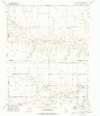 1974 Capps Switch SE1977 Print · USGSThe Texas Panhandle comes into sharp focus during the 1970s as energy production and rail transit define the landscape. Researchers can trace the Chicago Rock Island and Pacific rail line through Hutch and locate numerous Gas Wells near Morse.
 - 1974 Map of Sunray 1 SE, 1977 Print
 1974 Sunray 1 SE1977 Print · USGSHansford and Sherman Counties in the mid-1970s reveal a landscape dominated by the Texas energy boom. Researchers can trace the network of Pipelines and industrial sites like the Pumping Sta and various Gas Wells along Coldwater Creek.2 unique versions available
 - 1974 Map of Bernstein, 1977 Print
 1974 Bernstein1977 Print · USGSThe High Plains along the Texas-Oklahoma border come into focus in the mid-seventies, showing a landscape shaped by energy and rail. Trace the Chicago Rock Island and Pacific line near Hitchland or find the Hitchland Landing Strip.
 - 1974 Map of Holt, 1977 Print
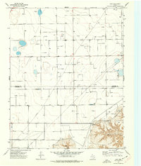 1974 Holt1977 Print · USGSThe Texas Panhandle comes into focus during the mid-seventies as energy production reshapes the high plains of Hansford and Hutchinson counties. Researchers can trace the layout of Holt, follow the winding path of Johns Creek, and locate numerous Gas Wells and local pipelines.
 - 1974 Map of Hannas Draw West, 1977 Print
 1974 Hannas Draw West1977 Print · USGSThe Texas Panhandle energy landscape comes into focus during the mid-seventies along the Sherman Co and Hansford Co border. Local historians can trace the industrial infrastructure of the era through a private Landing Strip, various Gravel Pits, and a dense network of Gas Wells.
 - 1974 Map of Morse SE, 1977 Print
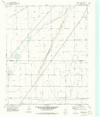 1974 Morse SE1977 Print · USGSThe High Plains of the Texas Panhandle are captured in the mid-1970s as a landscape defined by energy production and rail transport. Researchers can trace the industrial grid of Oil Wells and Gas Wells alongside the Atchison Topeka and Santa Fe railroad.
 - 1974 Map of Sunray 1 NE, 1977 Print
 1974 Sunray 1 NE1977 Print · USGSThe High Plains of the Texas Panhandle meet the Oklahoma border in the mid-1970s, showing a landscape defined by ranching and energy. Researchers can locate the Olso Church, explore the drainages of Frisco Creek, and trace old family sites near Graham.2 unique versions available
 - 1974 Map of Phillips Camp, 1977 Print
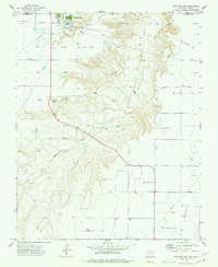 1974 Phillips Camp1977 Print · USGSHansford County, Texas, is captured in the mid-1970s as a bustling hub of energy extraction and transport near the Oklahoma border. Researchers can trace the extensive pipeline network serving Phillips Camp or locate a Gravel Pit along the banks of Coldwater Creek.
 - 1986 Map of Spearman, 1988 Print
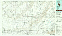 1986 Spearman1988 Print · USGSThe northern Texas Panhandle and Oklahoma border are seen here in the mid-1980s as a landscape of energy production and ranching. Trace local genealogy and land use across the oil and gas field or through settlements like Spearman, Texhoma, and Gruver.
End of results
Showing maps 1-23 of 23
Top cities of Hansford County
Frequently asked questions
- What are the different types of historical maps available for Hansford County?
- What is the oldest map of Hansford County?
- Where can I purchase historical maps of Hansford County for my home or office?
- Where can I download high-res historical maps of Hansford County?
- Are there historical topographic maps available for Hansford County?
- Is there historical aerial imagery available for Hansford County?
- Where are historical maps of Hansford County sourced from?