2020s Maps of Sour Lake, Texas
Explore 2 historic maps of Sour Lake from the 2020s. These maps offer a rare glimpse into what life looked like during the 2020s — showing old roads, neighborhoods, homes, and landmarks that have changed or disappeared over time.
Whether you're researching your family's past, planning a metal detecting trip, or studying how Sour Lake's landscape evolved across the 2020s, these high-resolution maps are a powerful tool for exploring the history of this region.
- Focus on a specific era: All maps on this page are from the 2020s, giving you a focused view of this time period.
- See what’s changed: Compare century-old streets, trails, and buildings to today's modern landscape using overlays and satellite layers.
- Research with precision: Use these maps for genealogy, historical research, land use analysis, or educational projects.
- View, download, or print: Maps are fully viewable online in high resolution, and can be downloaded or printed for your own records.
Start exploring Sour Lake's history through authentic maps from the 2020s. This is your window into the past.
Sour Lake, TX maps
(2)- 2022 Map of Sour Lake, 2022 Print
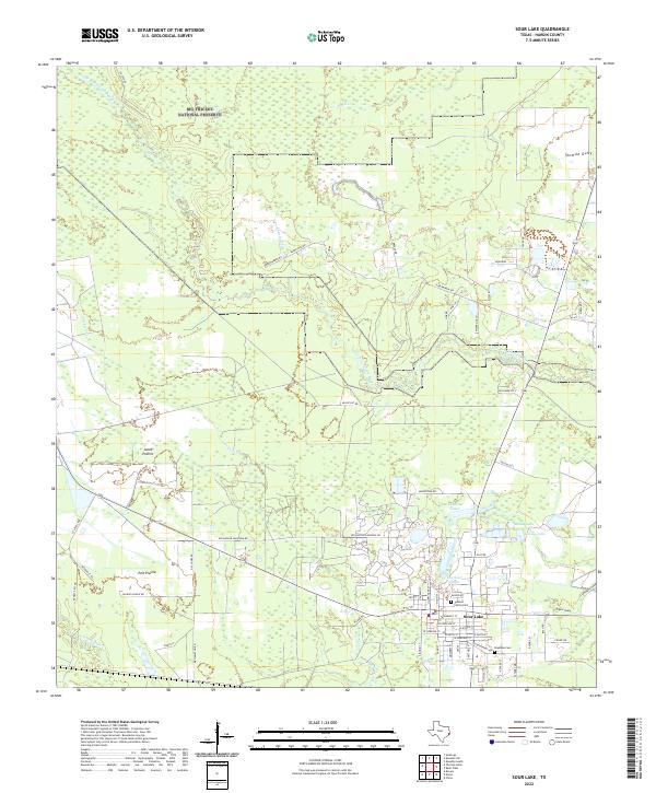 2022 Sour Lake2022 Print · USGSSour Lake and the surrounding Hardin County timberlands are shown here in the early twenty-first century. Genealogists and local historians can trace property lines near Pelt Prairie, locate the Jackson Family Cem, and follow the winding path of Pine Island Bayou.
 - 2022 Map of Nome, 2022 Print
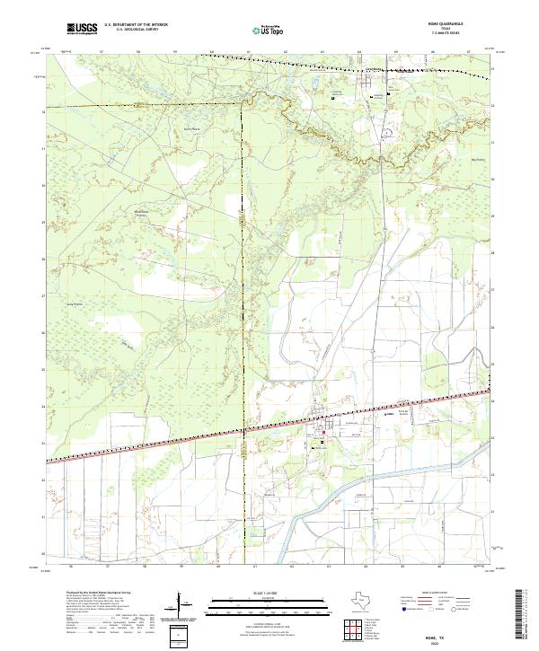 2022 Nome2022 Print · USGSCoastal Texas prairies and bayous define this landscape at the intersection of Hardin and Jefferson counties. Researchers can trace family history through several burial grounds, including Grayburg Black Cem and Pivoto Cem, or locate landmarks like the Farm Air Service.
End of results
Showing maps 1-2 of 2
Top cities near Sour Lake
- Beaumont historical maps
- Lumberton historical maps
- Silsbee historical maps
- Kountze historical maps
- Bevil Oaks historical maps
- Daisetta historical maps
See more
Frequently asked questions
- What are the different types of historical maps available for Sour Lake?
- What is the oldest map of Sour Lake?
- Where can I purchase historical maps of Sour Lake for my home or office?
- Where can I download high-res historical maps of Sour Lake?
- Are there historical topographic maps available for Sour Lake?
- Is there historical aerial imagery available for Sour Lake?
- Where are historical maps of Sour Lake sourced from?