1910s Maps of Airline, Harris County
Explore 4 historic maps of Airline from the 1910s. These maps offer a rare glimpse into what life looked like during the 1910s — showing old roads, neighborhoods, homes, and landmarks that have changed or disappeared over time.
Whether you're researching your family's past, planning a metal detecting trip, or studying how Airline's landscape evolved across the 1910s, these high-resolution maps are a powerful tool for exploring the history of this region.
- Focus on a specific era: All maps on this page are from the 1910s, giving you a focused view of this time period.
- See what’s changed: Compare century-old streets, trails, and buildings to today's modern landscape using overlays and satellite layers.
- Research with precision: Use these maps for genealogy, historical research, land use analysis, or educational projects.
- View, download, or print: Maps are fully viewable online in high resolution, and can be downloaded or printed for your own records.
Start exploring Airline's history through authentic maps from the 1910s. This is your window into the past.
Airline, Harris County maps
(4)- 1916 Map of Aldine
 1916 Aldine1916 Print · USGSCoastal prairie life in Harris County comes into focus as the railway network expanded north of Houston. Genealogists and researchers can trace the early footprint of Aldine and find the location of the Hargrove School near Greens Bayou.2 unique versions available
 - 1916 Map of Humble
 1916 Humble1916 Print · USGSHarris County is captured here in the early twentieth century as small rail-side settlements began to dot the coastal prairie. Local historians can trace the foundations of Humble and Mt Houston or locate the rural Higgs School and a small Cem near the winding Greens Bayou.2 unique versions available
 - 1919 Map of Aldine
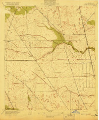 1919 Aldine1919 Print · USGSCoastal prairie and early rail infrastructure define this Harris County landscape during the late nineteen-teens. Researchers can trace ancestral property near Aldine, locate the rural Hargrove School, and follow the original routes of Kuyendahl Road.3 unique versions available
 - 1919 Map of Humble
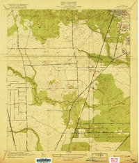 1919 Humble1919 Print · USGSHarris County at the height of the early oil era is defined by the convergence of major rail lines and bayou-side settlements. Genealogists and industrial historians can trace the early footprints of Humble, the location of Higgs School, and the dense rail network of the International and Great Northern.3 unique versions available
End of results
Showing maps 1-4 of 4
Frequently asked questions
- What are the different types of historical maps available for Airline?
- What is the oldest map of Airline?
- Where can I purchase historical maps of Airline for my home or office?
- Where can I download high-res historical maps of Airline?
- Are there historical topographic maps available for Airline?
- Is there historical aerial imagery available for Airline?
- Where are historical maps of Airline sourced from?