Old Maps of Airline, Harris County for Hiking & Exploration
Hike through history with 27 historic maps of Airline. Explore old trails, ghost towns, and forgotten backroads — perfect for outdoor adventurers and local explorers.
- Rediscover forgotten places: Map out old mining camps, roads, and footpaths that no longer exist on modern maps.
- Layer with modern tools: Combine with LiDAR or satellite views to plan hikes through historical terrain.
- Made for exploration: Popular among hikers, overlanders, and local history lovers.
Use these maps to find adventure and explore the hidden past of Airline.
Airline, Harris County maps
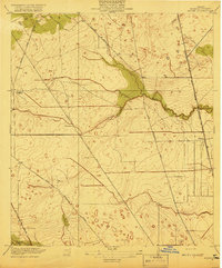
(27)- 1916 Map of Aldine
 1916 Aldine1916 Print · USGSCoastal prairie life in Harris County comes into focus as the railway network expanded north of Houston. Genealogists and researchers can trace the early footprint of Aldine and find the location of the Hargrove School near Greens Bayou.2 unique versions available
 - 1916 Map of Humble
 1916 Humble1916 Print · USGSHarris County is captured here in the early twentieth century as small rail-side settlements began to dot the coastal prairie. Local historians can trace the foundations of Humble and Mt Houston or locate the rural Higgs School and a small Cem near the winding Greens Bayou.2 unique versions available
 - 1919 Map of Aldine
 1919 Aldine1919 Print · USGSCoastal prairie and early rail infrastructure define this Harris County landscape during the late nineteen-teens. Researchers can trace ancestral property near Aldine, locate the rural Hargrove School, and follow the original routes of Kuyendahl Road.3 unique versions available
 - 1919 Map of Humble
 1919 Humble1919 Print · USGSHarris County at the height of the early oil era is defined by the convergence of major rail lines and bayou-side settlements. Genealogists and industrial historians can trace the early footprints of Humble, the location of Higgs School, and the dense rail network of the International and Great Northern.3 unique versions available
 - 1946 Map of Humble
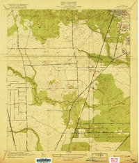
 1946 Humble1946 Print · USGSNorthern Harris County comes alive in this post-war survey, showing the growth of the railroad corridor between Humble and Mt Houston. Researchers can trace old family landmarks like Koinm Cem, the Marrs Sch, and early settlements like Bordersville.
 - 1950 Map of Houston, 1953 Print
 1950 Houston1953 Print · USGSCoastal Texas in the early fifties reveals a landscape of massive civil engineering and industrial transit. Genealogists and researchers can trace the growth of the Houston suburbs and the maritime infrastructure of Galveston Bay, including the Gulf Freeway and the Texas City Dike.
 - 1954 Map of Humble, 1956 Print
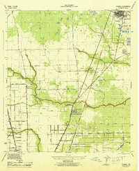
 1954 Humble1956 Print · USGSNortheast of Houston during the mid-fifties, this area shows the transition from oil fields to burgeoning suburbs. Genealogists and historians can locate family-named landmarks and institutions like Rosewood Park Cemetery, Bordersville, and the Aldine Sch.
 - 1954 Map of Aldine, 1956 Print
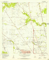 1954 Aldine1956 Print · USGSNorth of Houston in the mid-fifties, this area shows a landscape of bayous and oil wells transitioning toward suburban life. Researchers can locate early landmarks like Gulf Coast Airport, St Peters Ch, and schools such as Inez Carroll Grade Sch.
 - 1956 Map of Houston, 1963 Print
 1956 Houston1963 Print · USGSSoutheast Texas in the mid-fifties is captured here as a powerhouse of oil and maritime trade. Genealogists and historians can trace the foundations of Houston and its ports, alongside landmarks like the Rice Institute and the Spindletop Oil Field.2 unique versions available
 - 1967 Map of Humble
 1967 Humble1967 Print · USGSNorthern Harris County is caught in a moment of rapid suburban and industrial expansion in the late sixties. Researchers can trace family sites at Rosewood Park Cem or locate the early footprints of Houston Intercontinental Airport and Douglas MacArthur High Sch.2 unique versions available
 - 1967 Map of Aldine
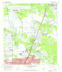
 1967 Aldine1967 Print · USGSNorth Harris County was entering a period of rapid development in the 1960s, balancing its petroleum roots with new residential neighborhoods. Genealogists and local historians can trace family sites like Paradise Cem, the Veterans Administration Cemetery, and old schools including Caroll Sch.3 unique versions available
 - 1975 Map of Houston, 1977 Print
 1975 Houston1977 Print · USGSThe Texas Gulf Coast in the mid-seventies shows a sprawling Houston metropolis linked to the sea by the massive Houston Ship Channel. Researchers can trace the mid-century industrial landscape from the Astrodome to the Lyndon B. Johnson Space Center.2 unique versions available
 - 1982 Map of Humble
 1982 Humble1982 Print · USGSNorth of Houston in the early eighties, the landscape is defined by the growth of modern aviation and expanding suburbs. Researchers can trace family roots through numerous sites like Brookside Memorial Park (Cem), Bordersville, and Mac Arthur High Sch.
 - 1982 Map of Aldine, 1983 Print
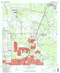
 1982 Aldine1983 Print · USGSNorthern Harris County during the early eighties showcases a landscape transitioning from the Bammel Oil and Gas Field to dense suburban growth. Genealogists can locate the Houston National Cemetery and Paradise Cemetery near the expanding Aldine community.2 unique versions available
 - 1992 Map of Houston
 1992 Houston1992 Print · USGSThe Houston metropolitan area reached its modern sprawl in the early nineties, centered on the Buffalo Bayou and a massive regional rail network. Genealogists and historians can trace the development of satellite cities like Sugar Land and Pasadena, or locate legacy sites like the Humble Oil Field and the NASA Lyndon B Johnson Space Center.
 - 1995 Map of Humble, 1999 Print
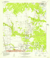
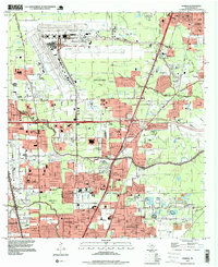 1995 Humble1999 Print · USGSNorthern Houston and the city of Humble are shown during a period of rapid suburban and industrial expansion in the mid-nineties. Researchers can locate numerous local landmarks including Thorne Stadium, Aldine Cem, and the sprawling George Bush Intercontinental Airport.
 - 1995 Map of Aldine, 1999 Print
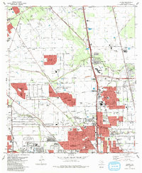
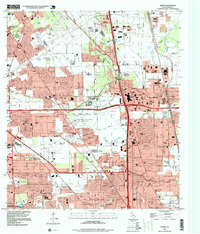 1995 Aldine1999 Print · USGSAldine and the surrounding Harris County suburbs are shown in the mid-1990s, where energy production and residential growth converge. Researchers can trace family history at Houston National Cemetery or locate local landmarks like the Greenspoint Mall and Aldine High Sch.
 - 2010 Map of Humble, 2010 Print
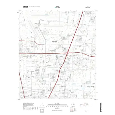
 2010 Humble2010 Print · USGSCovers Airline, including Houston, Humble, and other nearby areas
 - 2010 Map of Aldine, 2010 Print
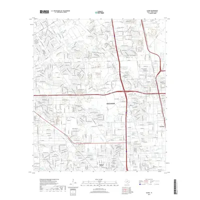
 2010 Aldine2010 Print · USGSCovers Airline, including Houston, Aldine, and other nearby areas
 - 2013 Map of Aldine, 2013 Print
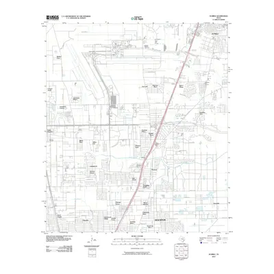
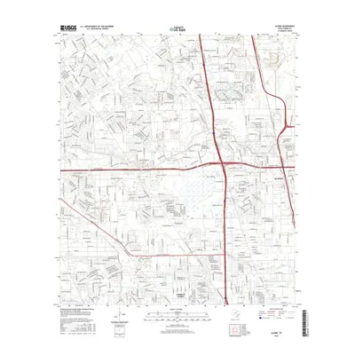
 2013 Aldine2013 Print · USGSCovers Airline, including Houston, Aldine, and other nearby areas
 - 2013 Map of Humble, 2013 Print
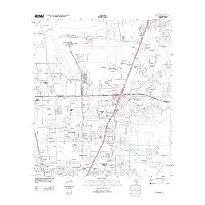 2013 Humble2013 Print · USGSCovers Airline, including Houston, Humble, and other nearby areas
 - 2016 Map of Humble, 2016 Print
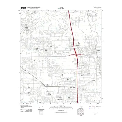
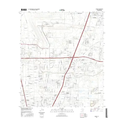 2016 Humble2016 Print · USGSCovers Airline, including Houston, Humble, and other nearby areas
 - 2016 Map of Aldine, 2016 Print
 2016 Aldine2016 Print · USGSCovers Airline, including Houston, Aldine, and other nearby areas
 - 2019 Map of Humble, 2019 Print
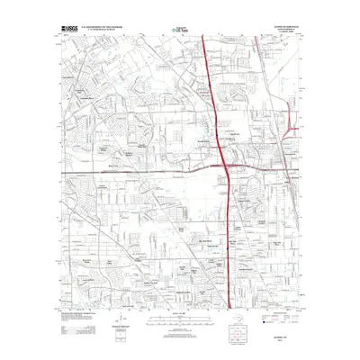
 2019 Humble2019 Print · USGSCovers Airline, including Houston, Humble, and other nearby areas
 - 2019 Map of Aldine, 2019 Print
 2019 Aldine2019 Print · USGSCovers Airline, including Houston, Aldine, and other nearby areas
Showing maps 1-25 of 27
Frequently asked questions
- What are the different types of historical maps available for Airline?
- What is the oldest map of Airline?
- Where can I purchase historical maps of Airline for my home or office?
- Where can I download high-res historical maps of Airline?
- Are there historical topographic maps available for Airline?
- Is there historical aerial imagery available for Airline?
- Where are historical maps of Airline sourced from?