1900s (20th Century) Maps of Haskell County, Texas
Explore 32 historic maps of Haskell County from the 1900s (20th Century). These maps offer a rare glimpse into what life looked like during the 1900s — showing old roads, neighborhoods, homes, and landmarks that have changed or disappeared over time.
Whether you're researching your family's past, planning a metal detecting trip, or studying how Haskell County's landscape evolved across the 1900s, these high-resolution maps are a powerful tool for exploring the history of this region.
- Focus on a specific era: All maps on this page are from the 1900s, giving you a focused view of this time period.
- See what’s changed: Compare century-old streets, trails, and buildings to today's modern landscape using overlays and satellite layers.
- Research with precision: Use these maps for genealogy, historical research, land use analysis, or educational projects.
- View, download, or print: Maps are fully viewable online in high resolution, and can be downloaded or printed for your own records.
Start exploring Haskell County's history through authentic maps from the 1900s. This is your window into the past.
Haskell County, TX maps
(32)- 1925 Map of Haskell 3-b
 1925 Haskell 3-b1925 Print · USGSSettlement in West Texas during the mid-twenties is centered on the railroad town of Rule and the winding Brazos River. Researchers can trace rural school locations like Rhody School and Cook Springs School or the old path of the Kansas City Mexico and Orient rail line.
 - 1954 Map of Abilene, 1966 Print
 1954 Abilene1966 Print · USGSThe Texas Big Country comes into focus in the mid-1950s as petroleum and new water projects reshape the landscape. Local historians can trace the Butterfield Trail, find the Fort Phantom Hill Ruins, and locate numerous small communities along the Texas & Pacific line.2 unique versions available
 - 1954 Map of Wichita Falls, 1966 Print
 1954 Wichita Falls1966 Print · USGSNorth Texas in the mid-fifties is captured here as a landscape of expanding oil fields and vital rail corridors. Genealogists and historians can trace family roots through rural landmarks like Bacon Chapel and the rail-side growth of Seymour and Archer City.3 unique versions available
 - 1958 Map of Wichita Falls
 1958 Wichita Falls1958 Print · USGSNorth Texas during the late fifties reveals a landscape defined by the booming petroleum industry and established rail hubs. Researchers can trace the development of Wichita Falls and discover rural landmarks like Barton's Chapel or the Hull-Silk Oil Field.
 - 1958 Map of Abilene
 1958 Abilene1958 Print · USGSMid-century West Texas comes alive in this survey of the Abilene and Stephenville region during a period of steady oil expansion and military growth. Genealogists and local historians can trace the paths of the Texas & Pacific RR through historic towns, locate the Fort Griffin Ruins, and find smaller settlements like Desdemona and Lueders.
 - 1962 Map of Antelope Creek SW, 1965 Print
 1962 Antelope Creek SW1965 Print · USGSThe Haskell and Throckmorton County line in the early sixties reveals a landscape shaped by petroleum and water. Trace the Swenson Oil Field and scattered Oil Wells along the winding banks of Millers Creek and Squaw Creek.
 - 1962 Map of Antelope Creek NW, 1965 Print
 1962 Antelope Creek NW1965 Print · USGSThe Baylor and Knox County line in the early sixties shows a landscape where ranching met the growing oil industry. Researchers can trace family ties at the Bomarton Cem or follow the path of the Fort Worth and Denver railroad and Millers Creek.2 unique versions available
 - 1964 Map of Sagerton, 1966 Print
 1964 Sagerton1966 Print · USGSHaskell and Stonewall Counties are captured in the mid-sixties as the rural landscape centered on the rail junction at Sagerton. Researchers can trace the dual rail lines of the Atchison Topeka and Santa Fe and landmarks like Flat Top Mountain.
 - 1965 Map of Jud, 1966 Print
 1965 Jud1966 Print · USGSHaskell County ranch lands and river breaks met the growing petroleum industry in the mid-1960s. Genealogists and historians can trace family roots at Idella Cem or study the extensive energy infrastructure surrounding Jud and the Jud Oil Field.
 - 1965 Map of Tuxedo, 1967 Print
 1965 Tuxedo1967 Print · USGSThe rural landscape of Jones and Haskell Counties is captured here in the mid-1960s, a time when rail lines and oil fields dominated the local economy. Genealogists and historians can trace family locations near Tuxedo, Capron Cem, and the Flat Top Ranch.2 unique versions available
 - 1965 Map of Lueders NW, 1967 Print
 1965 Lueders NW1967 Print · USGSAgricultural and industrial life in the Texas Big Country comes into focus in the mid-sixties at the Jones and Haskell county line. Researchers can trace rural community landmarks like Bethel Cem, the local Cotton Gin, and the Missouri Kansas Texas rail line.
 - 1965 Map of Lueders NE, 1967 Print
 1965 Lueders NE1967 Print · USGSShackelford County was a blend of ranching tradition and oil production in the mid-1960s. Genealogists and local historians can locate the Rockdale Cem, Berryhill Sch, and the Hendrick Ranch along the Clear Fork Brazos River.
 - 1965 Map of Stamford, 1967 Print
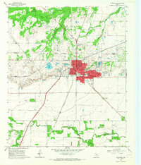 1965 Stamford1967 Print · USGSStamford in the mid-sixties served as a vital West Texas rail junction where the Fort Worth and Denver met the Missouri Kansas Texas line. Researchers can locate specific family sites near the Texas Cowboy Reunion Grounds, Stamford Cem, and local landmarks like Washington Sch.
 - 1965 Map of Antelope Hills, 1967 Print
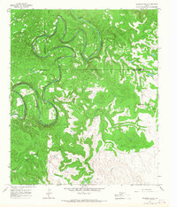 1965 Antelope Hills1967 Print · USGSShackelford County in the mid-1960s is defined by the winding course of the river and a landscape transformed by the oil industry. Researchers can trace the era's petroleum development through numerous Oil Wells and Drill Hole sites near the Antelope Hills.
 - 1965 Map of Reynolds Bend NW, 1970 Print
 1965 Reynolds Bend NW1970 Print · USGSThrockmorton and Haskell Counties are captured in the mid-sixties, showcasing a landscape defined by ranching and resource extraction. Researchers can map early petroleum activity through numerous Oil Wells and trace the winding course of North Paint Creek.
 - 1966 Map of Hoover Mountain, 1968 Print
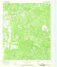 1966 Hoover Mountain1968 Print · USGSThe Clear Fork Brazos River valley along the Haskell and Throckmorton county line is shown here in the mid-1960s. Researchers can locate early river crossings like Goody Crossing, family landmarks like Sloan Ranch, and numerous petroleum sites.
 - 1966 Map of Haskell, 1968 Print
 1966 Haskell1968 Print · USGSHaskell thrived as a West Texas rail and oil center in the mid-sixties, anchored by its historic central grid and local industry. Researchers can pinpoint Willow Cemetery, outlying settlements like Spain, and the Fort Worth and Denver railroad line.
 - 1966 Map of Lake Stamford East, 1969 Print
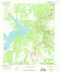 1966 Lake Stamford East1969 Print · USGSHaskell County's hydraulic and energy landscape comes into focus during the mid-sixties, centered on the newly managed waters of Lake Stamford. Researchers can trace early oil exploration via Drill Holes or locate community landmarks like Scott Memorial Park and Scott Crossing.2 unique versions available
 - 1966 Map of Dudleys Creek, 1969 Print
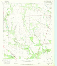 1966 Dudleys Creek1969 Print · USGSHaskell County at the height of the 1960s oil boom reveals a landscape of ranching and energy production. Trace the intersection of the Fort Worth and Denver rail line with rural landmarks like Plainview and Roadside Park.
 - 1966 Map of Pinkerton, 1969 Print
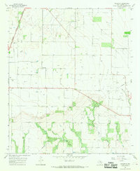 1966 Pinkerton1969 Print · USGSHaskell County in the mid-sixties reveals a landscape of industrial growth and rural heritage as the Texas oil economy expanded. Researchers can trace the path of the Atchison Topeka and Santa Fe railroad or find family sites at Pinkerton Cem and Rule Cem.2 unique versions available
 - 1966 Map of Lake Stamford West, 1969 Print
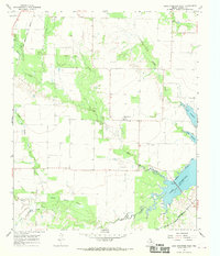 1966 Lake Stamford West1969 Print · USGSHaskell County's landscape in the mid-1960s reveals a rural Texas territory defined by the expanding waters of Lake Stamford and the Haskell Oil Field. Genealogists and historians can trace the Howard Cem and the settlement at Paint Creek during an era of petroleum exploration.
 - 1966 Map of Irby, 1970 Print
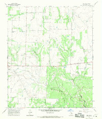 1966 Irby1970 Print · USGSHaskell County ranchlands and oil fields are captured here during the mid-1960s. Genealogists and historians can trace the rural communities of Mattson and Irby, or locate family sites like Roberts Cem and a solitary Grave near the creek.2 unique versions available
 - 1967 Map of Rochester, 1969 Print
 1967 Rochester1969 Print · USGSHaskell County's oil and rail landscape is captured here in the late sixties, centered on the junction at Rochester. Genealogists and historians can trace the Atchison Topeka and Santa Fe railroad past O'Brien and locate the Rochester Cem or Russell Lake.
 - 1967 Map of Weinert, 1970 Print
 1967 Weinert1970 Print · USGSWeinert and the surrounding Haskell County ranch lands are captured here in the late sixties, centered on the Fort Worth and Denver rail line. Researchers can trace local burials at Weinert Cem or find family landmarks like Zahn Lake and Pleasant Valley Cem.
 - 1967 Map of Knox City NW, 1970 Print
 1967 Knox City NW1970 Print · USGSThe Brazos River valley in the late sixties reveals a landscape of petroleum exploration and winding creek beds along the Knox and King county lines. Genealogists and researchers can locate the settlement of Hamilton, trace the route of Mc Faddin Lane, and identify numerous early Oil Wells.
Showing maps 1-25 of 32
Top cities of Haskell County
- Haskell historical maps
- Rule historical maps
- Rochester historical maps
- Weinert historical maps
- O'Brien historical maps
Frequently asked questions
- What are the different types of historical maps available for Haskell County?
- What is the oldest map of Haskell County?
- Where can I purchase historical maps of Haskell County for my home or office?
- Where can I download high-res historical maps of Haskell County?
- Are there historical topographic maps available for Haskell County?
- Is there historical aerial imagery available for Haskell County?
- Where are historical maps of Haskell County sourced from?