Old Maps of Canadian, Texas for Academic Research
Study the evolution of Canadian with 15 high-resolution historic maps. Whether you're teaching, researching, or modeling changes in land use, these maps provide essential visual documentation of urban, environmental, and geographic change.
- Analyze long-term change: Track patterns in development, transportation, and natural features.
- Ideal for environmental or urban studies: Support academic projects with primary historical map data.
- Use in the classroom or lab: Educators and researchers rely on these maps to bring historical context to life.
These maps are a powerful tool for teaching, research, and visualizing how Canadian has changed over the decades.
Canadian, TX maps
(15)- 1954 Map of Amarillo, 1966 Print
 1954 Amarillo1966 Print · USGSThe Texas Panhandle in the mid-1960s shows a landscape of rising industrial power and deep-rooted ranching tradition. Local historians can trace the paths of the Panhandle and Santa Fe railroad or locate sites like the Pantex Ordnance Plant and Mobeetie.2 unique versions available
 - 1958 Map of Amarillo
 1958 Amarillo1958 Print · USGSThe Texas Panhandle in the mid-1950s reveals a landscape of expanding military installations and oil-rich rail towns. Local historians can trace the development of Amarillo Air Force Base or locate smaller settlements like Magic City and New Mobeetie.
 - 1972 Map of Canadian West, 1974 Print
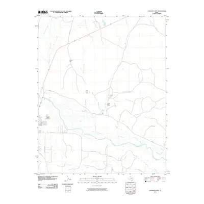
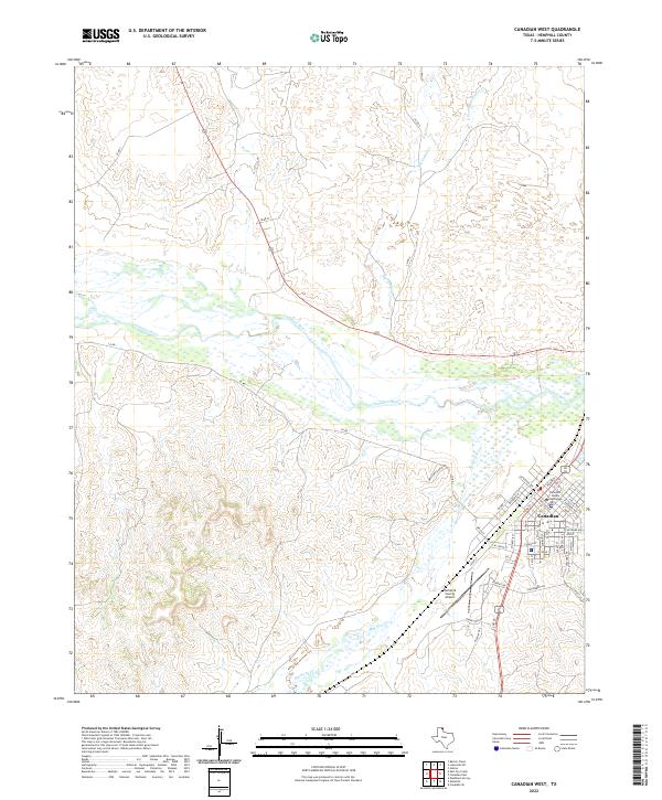
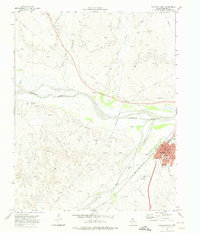 1972 Canadian West1974 Print · USGSThe Hemphill County seat of Canadian is shown in the early 1970s at the height of its energy and rail influence. Trace the town's development through the Courthouse and High Sch, or follow the Atchison Topeka and Santa Fe line across the Canadian River.
 - 1972 Map of Canadian East, 1974 Print
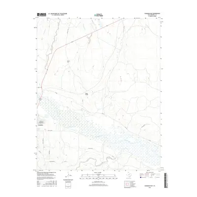
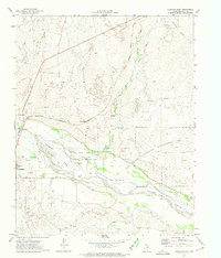 1972 Canadian East1974 Print · USGSThe Texas Panhandle comes alive in the early 1970s as the Canadian River flows past the rail lines and ranches of Hemphill County. Genealogists and historians can trace the Atchison Topeka and Santa Fe Railroad route, locate the local Cemetery, and find the Urschell Ranch and Anvil Park.
 - 1982 Map of Pampa, 1983 Print
 1982 Pampa1983 Print · USGSThe Texas Panhandle in the early eighties shows a landscape shaped by petroleum and ranching along the Canadian River. Genealogists and local historians can trace the paths of the Atchison Topeka and Santa Fe railroad through Pampa, Mobeetie, and Heaton.
 - 2010 Map of Canadian West, 2010 Print
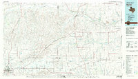
 2010 Canadian West2010 Print · USGSCovers Canadian, including Hemphill County, United States, and other nearby areas
 - 2010 Map of Canadian East, 2010 Print
 2010 Canadian East2010 Print · USGSCovers Canadian, including Hemphill County, United States, and other nearby areas
 - 2012 Map of Canadian East, 2012 Print
 2012 Canadian East2012 Print · USGSCovers Canadian, including Hemphill County, United States, and other nearby areas
 - 2012 Map of Canadian West, 2012 Print
 2012 Canadian West2012 Print · USGSCovers Canadian, including Hemphill County, United States, and other nearby areas
 - 2016 Map of Canadian East, 2016 Print
 2016 Canadian East2016 Print · USGSCovers Canadian, including Hemphill County, United States, and other nearby areas
 - 2016 Map of Canadian West, 2016 Print
 2016 Canadian West2016 Print · USGSCovers Canadian, including Hemphill County, United States, and other nearby areas
 - 2019 Map of Canadian West, 2019 Print
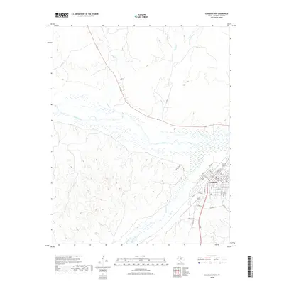 2019 Canadian West2019 Print · USGSCovers Canadian, including Hemphill County, United States, and other nearby areas
 - 2019 Map of Canadian East, 2019 Print
 2019 Canadian East2019 Print · USGSCovers Canadian, including Hemphill County, United States, and other nearby areas
 - 2022 Map of Canadian West, 2022 Print
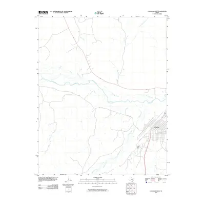
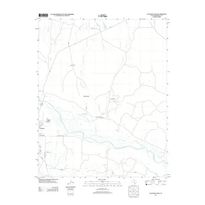
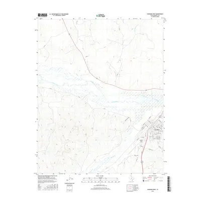
 2022 Canadian West2022 Print · USGSThe Texas Panhandle town of Canadian is documented here in the early twenty-first century, centered on its seat of local government. Researchers can trace the town grid around the Hemphill County Courthouse or follow the winding Canadian River and Red Deer Cr.
 - 2022 Map of Canadian East, 2022 Print
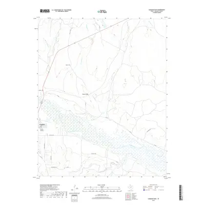
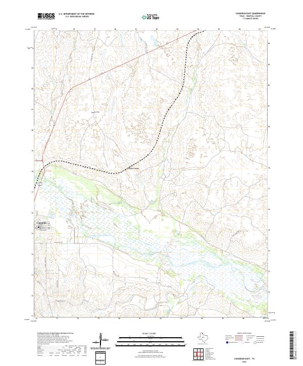 2022 Canadian East2022 Print · USGSThe eastern edge of Canadian and the wide river valley are documented here in the early 2020s. Genealogists and historians can trace family locations near the Edith Ford Memorial Cemeteries and land along Clear Creek or Tanner Flat.
End of results
Showing maps 1-15 of 15
Frequently asked questions
- What are the different types of historical maps available for Canadian?
- What is the oldest map of Canadian?
- Where can I purchase historical maps of Canadian for my home or office?
- Where can I download high-res historical maps of Canadian?
- Are there historical topographic maps available for Canadian?
- Is there historical aerial imagery available for Canadian?
- Where are historical maps of Canadian sourced from?