1960s Maps of Alberta Estates Number 2 Colonia, Texas
Explore 2 historic maps of Alberta Estates Number 2 Colonia from the 1960s. These maps offer a rare glimpse into what life looked like during the 1960s — showing old roads, neighborhoods, homes, and landmarks that have changed or disappeared over time.
Whether you're researching your family's past, planning a metal detecting trip, or studying how Alberta Estates Number 2 Colonia's landscape evolved across the 1960s, these high-resolution maps are a powerful tool for exploring the history of this region.
- Focus on a specific era: All maps on this page are from the 1960s, giving you a focused view of this time period.
- See what’s changed: Compare century-old streets, trails, and buildings to today's modern landscape using overlays and satellite layers.
- Research with precision: Use these maps for genealogy, historical research, land use analysis, or educational projects.
- View, download, or print: Maps are fully viewable online in high resolution, and can be downloaded or printed for your own records.
Start exploring Alberta Estates Number 2 Colonia's history through authentic maps from the 1960s. This is your window into the past.
Alberta Estates Number 2 Colonia, TX maps
(2)- 1962 Map of McAllen
 1962 McAllen1962 Print · USGSThe Lower Rio Grande Valley in the mid-twentieth century shows a complex landscape of irrigation, oil production, and border commerce. Genealogists and historians can trace family roots through riverside towns like Zapata, Roma-Los Saenz, and Hidalgo, or locate landmarks like Santa Elena Ch and Moore Air Force Base.
 - 1963 Map of Pharr, 1965 Print
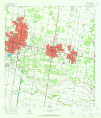 1963 Pharr1965 Print · USGSHidalgo County's urban and industrial corridor is captured in the early sixties as it centers on the growth of McAllen and Pharr. Researchers can trace the mid-century development of landmarks like Miller International Airport, Guadalupe Cem, and the massive Main Floodway.2 unique versions available
End of results
Showing maps 1-2 of 2
Top cities near Alberta Estates Number 2 Colonia
- McAllen historical maps
- Edinburg historical maps
- Mission historical maps
- Pharr historical maps
- Weslaco historical maps
- San Juan historical maps
See more
Frequently asked questions
- What are the different types of historical maps available for Alberta Estates Number 2 Colonia?
- What is the oldest map of Alberta Estates Number 2 Colonia?
- Where can I purchase historical maps of Alberta Estates Number 2 Colonia for my home or office?
- Where can I download high-res historical maps of Alberta Estates Number 2 Colonia?
- Are there historical topographic maps available for Alberta Estates Number 2 Colonia?
- Is there historical aerial imagery available for Alberta Estates Number 2 Colonia?
- Where are historical maps of Alberta Estates Number 2 Colonia sourced from?