2000s (21st Century) Maps of Doffing, Texas
Explore 6 historic maps of Doffing from the 2000s (21st Century). These maps offer a rare glimpse into what life looked like during the 2000s — showing old roads, neighborhoods, homes, and landmarks that have changed or disappeared over time.
Whether you're researching your family's past, planning a metal detecting trip, or studying how Doffing's landscape evolved across the 2000s, these high-resolution maps are a powerful tool for exploring the history of this region.
- Focus on a specific era: All maps on this page are from the 2000s, giving you a focused view of this time period.
- See what’s changed: Compare century-old streets, trails, and buildings to today's modern landscape using overlays and satellite layers.
- Research with precision: Use these maps for genealogy, historical research, land use analysis, or educational projects.
- View, download, or print: Maps are fully viewable online in high resolution, and can be downloaded or printed for your own records.
Start exploring Doffing's history through authentic maps from the 2000s. This is your window into the past.
Doffing, TX maps
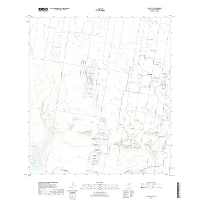
(6)- 2002 Map of Citrus City, 2003 Print
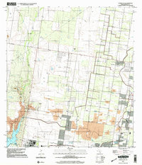 2002 Citrus City2003 Print · USGSNear the turn of the millennium, this portion of Hidalgo County reveals a landscape where historic ranching and modern industry meet. Genealogists and historians can trace legacy sites like La Morita Ranch and Santa Rita Ranch alongside the vast Tabasco Oil and Gas Field.
 - 2010 Map of Citrus City, 2010 Print
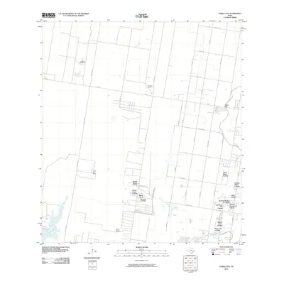 2010 Citrus City2010 Print · USGSCovers Doffing, including La Joya, Peñitas, and other nearby areas
 - 2012 Map of Citrus City, 2012 Print
 2012 Citrus City2012 Print · USGSCovers Doffing, including La Joya, Peñitas, and other nearby areas
 - 2016 Map of Citrus City, 2016 Print
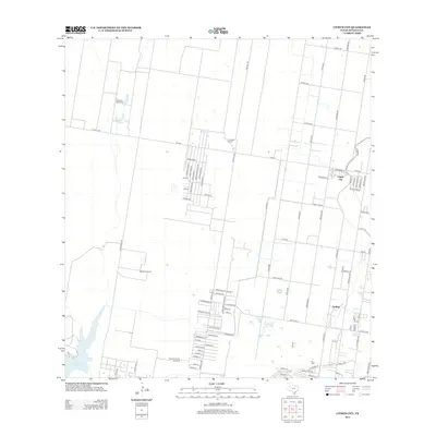
 2016 Citrus City2016 Print · USGSCovers Doffing, including La Joya, Peñitas, and other nearby areas
 - 2019 Map of Citrus City, 2019 Print
 2019 Citrus City2019 Print · USGSCovers Doffing, including La Joya, Peñitas, and other nearby areas
 - 2022 Map of Citrus City, 2022 Print
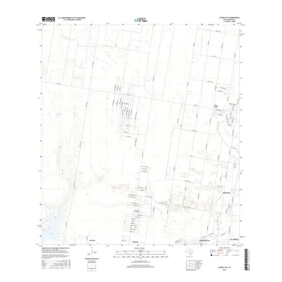
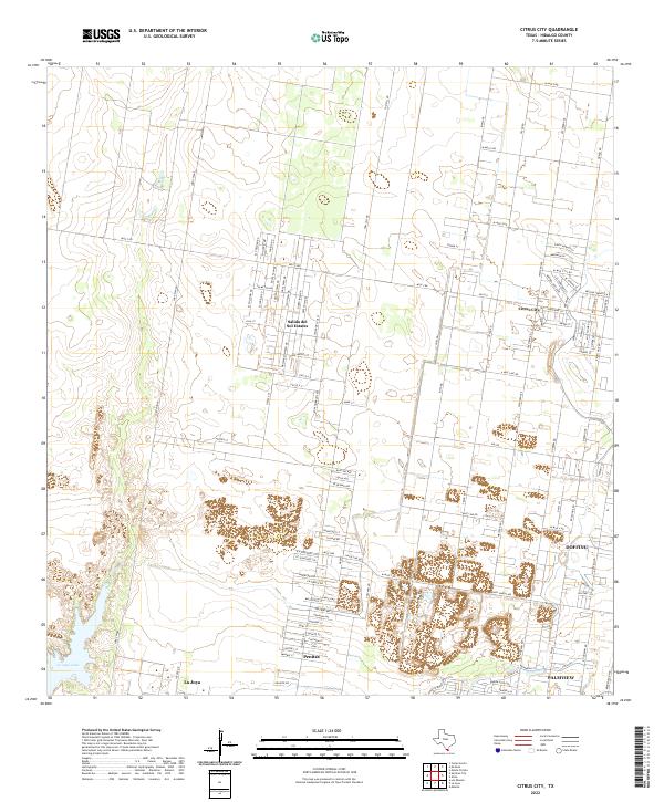 2022 Citrus City2022 Print · USGSHidalgo County settlements near the southern border reflect rapid modern growth within a traditional agricultural grid. Trace the layout of growing communities like Citrus City, Salida del Sol Estates, and the waters of La Joya Lake.
End of results
Showing maps 1-6 of 6
Top cities near Doffing
- McAllen historical maps
- Edinburg historical maps
- Mission historical maps
- Pharr historical maps
- San Juan historical maps
- Palmview historical maps
See more
Frequently asked questions
- What are the different types of historical maps available for Doffing?
- What is the oldest map of Doffing?
- Where can I purchase historical maps of Doffing for my home or office?
- Where can I download high-res historical maps of Doffing?
- Are there historical topographic maps available for Doffing?
- Is there historical aerial imagery available for Doffing?
- Where are historical maps of Doffing sourced from?