Old Maps of Belott, Texas for Metal Detecting
Plan your next treasure hunt with 12 historic maps of Belott. Find old homesites, ghost towns, trails, and gathering spots that may be lost to time — perfect for identifying promising metal detecting locations.
- Locate forgotten sites: Uncover places like long-lost settlements, abandoned rail lines, or gathering spots.
- Plan better hunts: Use map overlays combined with LiDAR or satellite views to narrow in on historically rich areas.
- Made for detectorists: Thousands of hobbyists use these maps to discover relics, coins, and hidden history.
Use these historic maps to boost your research and find new opportunities beneath the surface of Belott.
Belott, TX maps
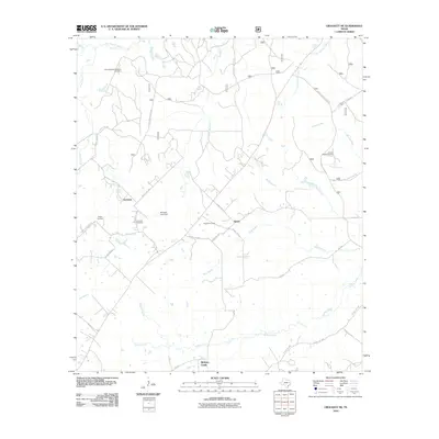
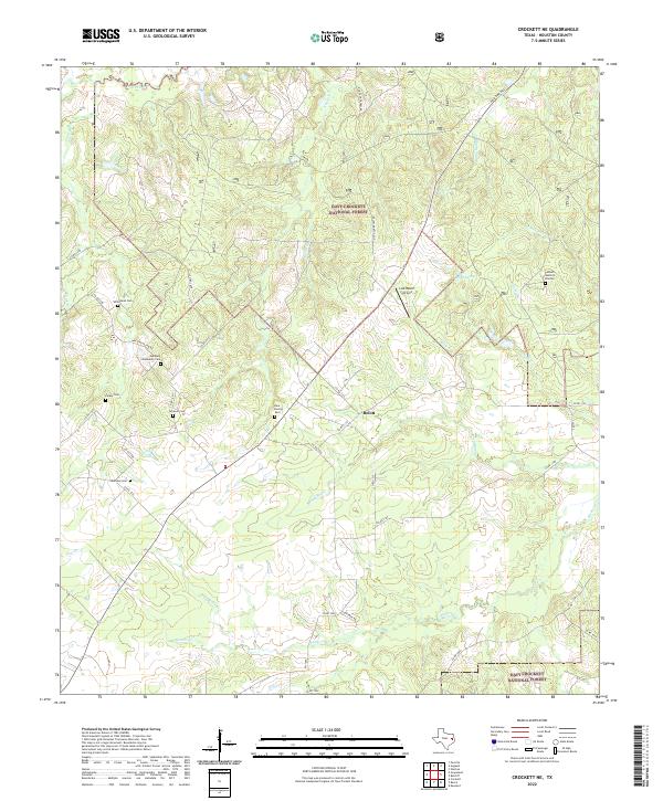
(12)- 1950 Map of Crockett NE, 1967 Print
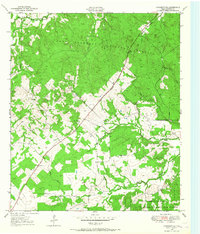 1950 Crockett NE1967 Print · USGSEast Texas timberland and small community life are captured in the mid-century as the Old Antonio Road cuts through the forest. Researchers can locate rural landmarks like Glover Sch, Grounds Cem, and the settlement of Belott.2 unique versions available
 - 1951 Map of Crockett NE
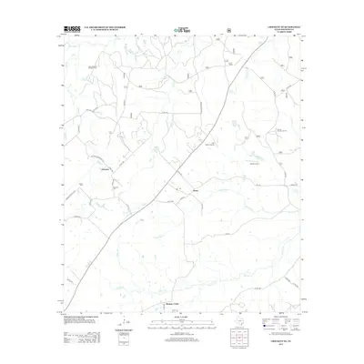
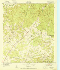 1951 Crockett NE1951 Print · USGSNortheast Houston County in the early fifties is shown as a landscape of timber and rural homesteads. Genealogists can locate family landmarks such as Parker Cem and Grounds Cem or trace the path of the historic Old San Antonio Trail.
 - 1953 Map of Palestine, 1964 Print
 1953 Palestine1964 Print · USGSEast Texas was defined by its deep pine forests and burgeoning energy sector in the mid-1950s. Genealogists and historians can trace the rail-and-river economy through settlements like Tennessee Colony and Pollok or explore the early footprints of the Cayuga Oil Field and Davy Crockett National Forest.2 unique versions available
 - 1957 Map of Palestine
 1957 Palestine1957 Print · USGSEast Texas in the mid-fifties reveals a landscape of deep pine forests and winding river valleys before the era of massive reservoir construction. Researchers can trace the legacy of the timber and rail industries through labels for the Missouri Pacific RR, Davy Crockett National Forest, and Nacogdoches.
 - 1984 Map of Palestine
 1984 Palestine1984 Print · USGSEast Texas in the mid-eighties reveals a landscape of massive reservoirs and protected timberlands between Palestine and Nacogdoches. Researchers can trace old routes like the Missouri Pacific RR and locate rural communities such as Tennessee Colony, Latexo, and Etoile.3 unique versions available
 - 1985 Map of Crockett
 1985 Crockett1985 Print · USGSEast Texas timber and river country are captured here during the mid-eighties, showing the region's transition into the modern era. Genealogists and historians can trace the Old San Antonio Road and locate rural landmarks like Hazel Chapel or Weldon Cem.2 unique versions available
 - 2004 Map of Crockett NE, 2006 Print
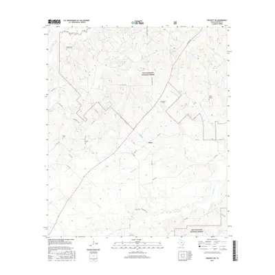
 2004 Crockett NE2006 Print · USGSHouston County at the turn of the millennium shows a landscape defined by the deep woods of the Davy Crockett National Forest and the path of the Old San Antonio Road. Genealogists and local historians can trace family ties at Belott, Parker Cem, and Pleasant Hill Ch.
 - 2010 Map of Crockett NE, 2010 Print
 2010 Crockett NE2010 Print · USGSCovers Belott, including Hickory Creek, Germany, and other nearby areas
 - 2013 Map of Crockett NE, 2013 Print
 2013 Crockett NE2013 Print · USGSCovers Belott, including Hickory Creek, Germany, and other nearby areas
 - 2016 Map of Crockett NE, 2016 Print
 2016 Crockett NE2016 Print · USGSCovers Belott, including Hickory Creek, Germany, and other nearby areas
 - 2019 Map of Crockett NE, 2019 Print
 2019 Crockett NE2019 Print · USGSCovers Belott, including Hickory Creek, Germany, and other nearby areas
 - 2022 Map of Crockett NE, 2022 Print
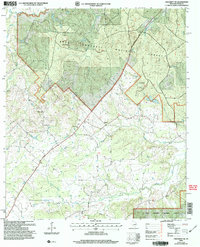
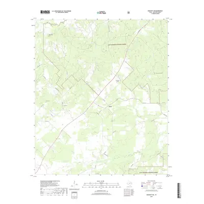
 2022 Crockett NE2022 Print · USGSHouston County is home to the Davy Crockett National Forest in this recent survey. Local researchers can trace family landmarks like Germany Community Cem, Whitehead Cem, and the settlement at Belott.
End of results
Showing maps 1-12 of 12
Top cities near Belott
- Crockett historical maps
- Grapeland historical maps
- Alto historical maps
- Kennard historical maps
- Latexo historical maps
- Hickory Creek historical maps
Frequently asked questions
- What are the different types of historical maps available for Belott?
- What is the oldest map of Belott?
- Where can I purchase historical maps of Belott for my home or office?
- Where can I download high-res historical maps of Belott?
- Are there historical topographic maps available for Belott?
- Is there historical aerial imagery available for Belott?
- Where are historical maps of Belott sourced from?