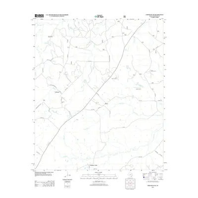
2013 Map of Crockett NE
USGS Topo · Published 2013About this map
The Edens-Madden Massacre Cem stands as a significant historical marker in this rural Houston County landscape, preserving the memory of early Texas frontier conflict. The settlement patterns around Germany and Belott reflect the agricultural roots of the region, where small communities established themselves near reliable water sources like Rosy Bayou and Hickory Cr. The map shows a transition toward modern utility with the presence of Last Resort Airport and Dibrell Airport, yet the area remains deeply connected to its past through family landmarks such as the Grounds Cem and Parker Cem. The southern edge is defined by the community of Hickory Creek, situated at the convergence of numerous local drainage systems including Black Br and Austin Br, illustrating the enduring importance of the creek network to local geography.
Find a feature on this map
41 named features on this map. Tap any name to fly to it.
Don’t see what you’re looking for? This feature index may not catch every label — zoom into the map to look around manually.
Map Details
Editions of this 2013 Crockett NE Map
This is the sole edition of this map. No revisions or reprints were ever made.
Other maps of this area

1946 · Alto
USGS Topo · 1:62,500

1950 · Crockett
USGS Topo · 1:24,000

1950 · Crockett NE
USGS Topo · 1:24,000

1950 · Ratcliff
USGS Topo · 1:24,000

1951 · Crockett
USGS Topo · 1:24,000

1951 · Kennard
USGS Topo · 1:24,000

1951 · Grapeland
USGS Topo · 1:24,000

1951 · Berea
USGS Topo · 1:24,000

1951 · Crockett NE
USGS Topo · 1:24,000

1951 · Ratcliff
USGS Topo · 1:24,000