Old Maps of Creath, Texas for Genealogy
Trace your family roots with 12 historic maps of Creath. These high-res maps reveal old neighborhoods, homesites, landmarks, and streets — helping you uncover where your ancestors lived and how the area evolved over time.
- Explore historic neighborhoods: Identify where your relatives may have lived in the 1800s or 1900s.
- Compare maps over time: Trace the changes in streets, buildings, and landmarks for multi-generational research.
- Perfect for genealogy & ancestry research: Used by family historians and researchers to map out lineage and migration.
These maps are an incredible resource for exploring your personal connection to Creath's past.
Creath, TX maps
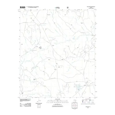
(12)- 1950 Map of Ratcliff, 1975 Print
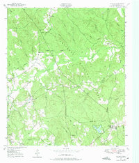 1950 Ratcliff1975 Print · USGSHouston County at the mid-century was a landscape of dense piney woods and quiet rural outposts. Researchers can trace family sites at Bethel Cem or Conner Cem, and locate long-standing communities like Tadmor and Creath.
 - 1951 Map of Ratcliff
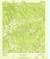 1951 Ratcliff1951 Print · USGSHouston County at the start of the 1950s was a landscape of deep timber and small forest communities within the Davy Crockett National Forest. Researchers can locate family landmarks such as Tadmor Ch, Old Zion Cem, and the old settlement at Ratcliff.
 - 1953 Map of Palestine, 1964 Print
 1953 Palestine1964 Print · USGSEast Texas was defined by its deep pine forests and burgeoning energy sector in the mid-1950s. Genealogists and historians can trace the rail-and-river economy through settlements like Tennessee Colony and Pollok or explore the early footprints of the Cayuga Oil Field and Davy Crockett National Forest.2 unique versions available
 - 1957 Map of Palestine
 1957 Palestine1957 Print · USGSEast Texas in the mid-fifties reveals a landscape of deep pine forests and winding river valleys before the era of massive reservoir construction. Researchers can trace the legacy of the timber and rail industries through labels for the Missouri Pacific RR, Davy Crockett National Forest, and Nacogdoches.
 - 1984 Map of Palestine
 1984 Palestine1984 Print · USGSEast Texas in the mid-eighties reveals a landscape of massive reservoirs and protected timberlands between Palestine and Nacogdoches. Researchers can trace old routes like the Missouri Pacific RR and locate rural communities such as Tennessee Colony, Latexo, and Etoile.3 unique versions available
 - 1985 Map of Crockett
 1985 Crockett1985 Print · USGSEast Texas timber and river country are captured here during the mid-eighties, showing the region's transition into the modern era. Genealogists and historians can trace the Old San Antonio Road and locate rural landmarks like Hazel Chapel or Weldon Cem.2 unique versions available
 - 2004 Map of Ratcliff, 2006 Print
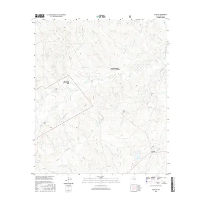
 2004 Ratcliff2006 Print · USGSDeep within the East Texas Piney Woods during the early 2000s, this area shows a landscape shaped by forestry and small timber-belt settlements. Genealogists and historians can locate family landmarks such as Old Zion Cem, Bethel Ch, and the logging-era heritage near Ratcliff.
 - 2011 Map of Ratcliff, 2011 Print
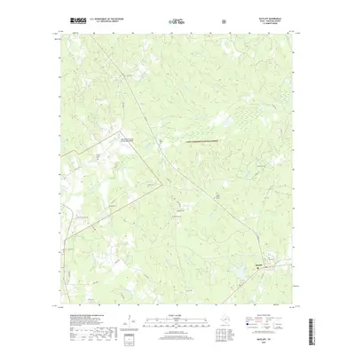
 2011 Ratcliff2011 Print · USGSCovers Creath, including Harrison Town, Ratcliff, and other nearby areas
 - 2013 Map of Ratcliff, 2013 Print
 2013 Ratcliff2013 Print · USGSCovers Creath, including Harrison Town, Ratcliff, and other nearby areas
 - 2016 Map of Ratcliff, 2016 Print
 2016 Ratcliff2016 Print · USGSCovers Creath, including Harrison Town, Ratcliff, and other nearby areas
 - 2019 Map of Ratcliff, 2019 Print
 2019 Ratcliff2019 Print · USGSCovers Creath, including Harrison Town, Ratcliff, and other nearby areas
 - 2022 Map of Ratcliff, 2022 Print
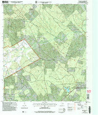
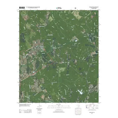
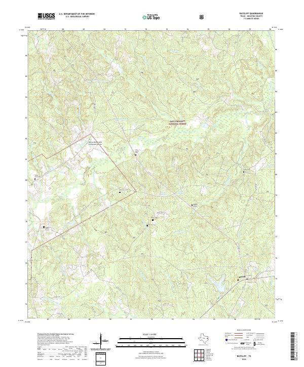 2022 Ratcliff2022 Print · USGSHouston County's piney woods appear in great detail during the early twenty-first century, centering on the community of Ratcliff. Genealogists can locate numerous secluded burial sites including Old Patton Cem, McKelvey Cem, and the Vaughn Family Graves.
End of results
Showing maps 1-12 of 12
Top cities near Creath
Frequently asked questions
- What are the different types of historical maps available for Creath?
- What is the oldest map of Creath?
- Where can I purchase historical maps of Creath for my home or office?
- Where can I download high-res historical maps of Creath?
- Are there historical topographic maps available for Creath?
- Is there historical aerial imagery available for Creath?
- Where are historical maps of Creath sourced from?