Old Maps of Big Spring, Texas
Explore 14 old maps of Big Spring, spanning from 1941 to today. These high-resolution historic maps reveal how streets, neighborhoods, landmarks, and natural features evolved over time — perfect for genealogy, metal detecting, research, and local history exploration.
What you can do with these maps:
- See how Big Spring changed over time: Compare historical maps to modern-day views to trace roads, homesites, rail lines & more.
- View detailed metadata: Each map includes creators, publishers, year, scale, and archive source.
- Overlay maps with satellite & LiDAR: Visualize the past alongside modern tools to explore terrain & human change.
- Trusted historical sources: Maps sourced from the USGS, Library of Congress, and other archives.
- Access maps your way: View online, download high-res files, or order prints for personal or research use.
Start exploring old maps of Big Spring to uncover forgotten places, hidden landmarks, and the deep history beneath your feet.
Big Spring, TX maps
(14)- 1941 Map of Morita
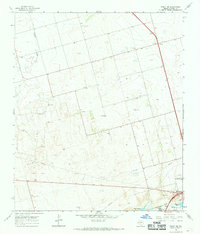
 1941 Morita1941 Print · USGSCovers Big Spring, including Elbow, Morita, and other nearby areas
 - 1941 Map of Big Spring South, 1949 Print
 1941 Big Spring South1949 Print · USGSCovers Big Spring, including Forsan, Otis Chalk, and other nearby areas2 unique versions available
 - 1942 Map of Big Spring South
 1942 Big Spring South1942 Print · USGSCovers Big Spring, including Forsan, Otis Chalk, and other nearby areas
 - 1942 Map of Big Spring North
 1942 Big Spring North1942 Print · USGSCovers Big Spring, including Coahoma, Midway, and other nearby areas
 - 1949 Map of Morita
 1949 Morita1949 Print · USGSCovers Big Spring, including Elbow, Morita, and other nearby areas
 - 1954 Map of Big Spring, 1965 Print
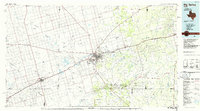
 1954 Big Spring1965 Print · USGSCovers Big Spring, including Snyder, Sweetwater, and other nearby areas4 unique versions available
 - 1954 Map of Big Spring North, 1976 Print
 1954 Big Spring North1976 Print · USGSCovers Big Spring, including Ziler, Howard County, and other nearby areas
 - 1958 Map of Big Spring
 1958 Big Spring1958 Print · USGSCovers Big Spring, including Snyder, Sweetwater, and other nearby areas
 - 1965 Map of Big Spring North
 1965 Big Spring North1965 Print · USGSCovers Big Spring, including Ziler, Howard County, and other nearby areas
 - 1966 Map of Knott SE, 1968 Print
 1966 Knott SE1968 Print · USGSCovers Big Spring, including Fairview, Howard County, and other nearby areas2 unique versions available
 - 1966 Map of Elbow, 1968 Print
 1966 Elbow1968 Print · USGSCovers Big Spring, including Elbow, Howard County, and other nearby areas
 - 1971 Map of Big Spring South, 1974 Print
 1971 Big Spring South1974 Print · USGSCovers Big Spring, including Howard County, United States, and other nearby areas2 unique versions available
 - 1971 Map of Big Spring North, 1974 Print
 1971 Big Spring North1974 Print · USGSCovers Big Spring, including Coahoma, Midway, and other nearby areas
 - 1986 Map of Big Spring
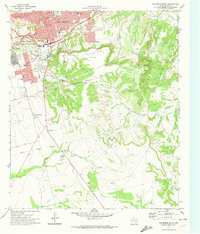
 1986 Big Spring1986 Print · USGSCovers Big Spring, including Stanton, Coahoma, and other nearby areas2 unique versions available
End of results
Showing maps 1-14 of 14
Top cities near Big Spring
Top neighborhoods of Big Spring
- Webb Village historical maps
- Indianola historical maps
- Mountain View historical maps
- North Park Hill historical maps
- Stardust historical maps
- Wasson Place historical maps
See more
Frequently asked questions
- What are the different types of historical maps available for Big Spring?
- What is the oldest map of Big Spring?
- Where can I purchase historical maps of Big Spring for my home or office?
- Where can I download high-res historical maps of Big Spring?
- Are there historical topographic maps available for Big Spring?
- Is there historical aerial imagery available for Big Spring?
- Where are historical maps of Big Spring sourced from?