
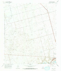
1966 Map of Knott SE
USGS Topo · Published 1968About this map
The northwest corner of Howard County is defined by the industrial and institutional developments of the mid-1960s, notably featuring the Big Spring State Hospital and the sprawling grounds of Webb Air Force Base. The landscape is a study in resource extraction and water management, with an extensive Oil Field crisscrossed by a Pipeline network and a large-scale Aqueduct cutting across the plains.
Find a feature on this map
16 named features on this map. Tap any name to fly to it.
Don’t see what you’re looking for? This feature index may not catch every label — zoom into the map to look around manually.
Map Details
Editions of this 1966 Knott SE Map
2 editions found
Other maps of this area

1941 · Morita
USGS Topo · 1:62,500

1941 · Big Spring South
USGS Topo · 1:62,500

1942 · Big Spring South
USGS Topo · 1:62,500

1942 · Big Spring North
USGS Topo · 1:62,500

1949 · Morita
USGS Topo · 1:62,500

1954 · Big Spring
USGS Topo · 1:250,000

1954 · Big Spring North
USGS Topo · 1:24,000

1958 · Big Spring
USGS Topo · 1:250,000

1965 · Big Spring North
USGS Topo · 1:24,000

1966 · Knott
USGS Topo · 1:24,000