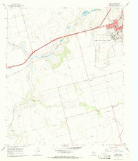
1966 Map of Elbow
USGS Topo · Published 1968About this map
Webb Air Force Base dominates the landscape of Howard County in the mid-1960s, featuring an expansive layout of runways, a Control Tower, and the adjacent residential enclave of Webb Village. This military installation is flanked by the growing edge of Big Spring, where mid-century amenities like a Drive-in Theater and a Golf Course sit near the Texas and Pacific rail line.
Find a feature on this map
23 named features on this map. Tap any name to fly to it.
Don’t see what you’re looking for? This feature index may not catch every label — zoom into the map to look around manually.
Map Details
Editions of this 1966 Elbow Map
This is the sole edition of this map. No revisions or reprints were ever made.
Other maps of this area

1941 · Morita
USGS Topo · 1:62,500

1941 · Big Spring South
USGS Topo · 1:62,500

1942 · Big Spring South
USGS Topo · 1:62,500

1942 · Big Spring North
USGS Topo · 1:62,500

1949 · Morita
USGS Topo · 1:62,500

1954 · Big Spring
USGS Topo · 1:250,000

1954 · Big Spring North
USGS Topo · 1:24,000

1958 · Big Spring
USGS Topo · 1:250,000

1965 · Big Spring North
USGS Topo · 1:24,000
1966 · Lucian Wells Ranch
USGS Topo · 1:24,000