Old Maps of Jasper County, Texas for Hiking & Exploration
Hike through history with 204 historic maps of Jasper County. Explore old trails, ghost towns, and forgotten backroads — perfect for outdoor adventurers and local explorers.
- Rediscover forgotten places: Map out old mining camps, roads, and footpaths that no longer exist on modern maps.
- Layer with modern tools: Combine with LiDAR or satellite views to plan hikes through historical terrain.
- Made for exploration: Popular among hikers, overlanders, and local history lovers.
Use these maps to find adventure and explore the hidden past of Jasper County.
Jasper County, TX maps
(204)- 1926 Map of Lakeview
 1926 Lakeview1926 Print · USGSThe Neches River lowlands are captured here in the mid-1920s, showing a landscape defined by marshy sloughs and emerging industry. Genealogists and historians can locate family landmarks like the Williamson Church or trace old routes to Colliers Ferry.
 - 1926 Map of Texla
 1926 Texla1926 Print · USGSCoastal Texas in the mid-1920s is defined by its winding waterways and expanding rail lines. Genealogists and industrial historians can trace the Kansas City Southern route past the Linscomb Cem and the settlement at Texla.
 - 1928 Map of Zavalla 3-c
 1928 Zavalla 3-c1928 Print · USGSThe timber-driven landscape of East Texas is captured here in the late twenties along the winding Neches River. Researchers can trace the paths of old logging lines like the Lumber RR Switch and find rural community hubs like Rockland, Nancy, and the Saron Sch.
 - 1931 Map of Zavalla
 1931 Zavalla1931 Print · USGSEast Texas river life and rail expansion meet in the late 1920s at the junction of the Neches River and the Beaumont Southern Pacific. Researchers can trace old river crossings like Rockland Ferry and Rock Ford or locate vanished school sites like Saron Sch.2 unique versions available
 - 1932 Map of Beaumont
 1932 Beaumont1932 Print · USGSThe Neches River lowlands and the growing settlement of Vidor are captured here during the early thirties. Genealogists can locate family landmarks like Magnolia Grove Sch, Williamson Ch, and the river crossing at Colliers Ferry.2 unique versions available
 - 1943 Map of Texla, 1953 Print
 1943 Texla1953 Print · USGSSoutheast Texas at the height of the Second World War shows a landscape defined by the intersection of new rail lines and older timber mill roads. Genealogists can locate family sites like Singleton Cem and Linscomb Cem near the banks of Cow Bayou.
 - 1952 Map of Lake Charles
 1952 Lake Charles1952 Print · USGSSouthwest Louisiana is captured here in the mid-fifties, showing a landscape defined by the rise of the petrochemical industry and deep-water navigation. Researchers can trace family roots through numerous small-town settlements and oil developments like Nibletts Bluff, the Lockport Oil Field, and Starks.
 - 1953 Map of Alexandria, 1963 Print
 1953 Alexandria1963 Print · USGSCentral Louisiana during the early fifties is mapped here at the intersection of the piney woods and the Red River valley. Genealogists and historians can trace the rail-and-river network connecting towns like Alexandria, Natchitoches, and the grounds of Camp Beauregard.3 unique versions available
 - 1953 Map of Palestine, 1964 Print
 1953 Palestine1964 Print · USGSEast Texas was defined by its deep pine forests and burgeoning energy sector in the mid-1950s. Genealogists and historians can trace the rail-and-river economy through settlements like Tennessee Colony and Pollok or explore the early footprints of the Cayuga Oil Field and Davy Crockett National Forest.2 unique versions available
 - 1954 Map of Lake Charles, 1964 Print
 1954 Lake Charles1964 Print · USGSSouthwest Louisiana in the mid-fifties is defined by its massive petroleum industry and its complex network of bayous and rail lines. Researchers can trace the development of the Sulphur Mines Oil Field or locate historic settlements like Longville and De Quincy.3 unique versions available
 - 1954 Map of Beaumont, 1964 Print
 1954 Beaumont1964 Print · USGSSoutheast Texas in the mid-fifties reveals a landscape of massive national forests, emerging reservoirs, and a booming oil economy. Genealogists and researchers can trace rural settlements like Dallardsville and Village Mills or locate early drilling sites at Sour Lake Oil Field.3 unique versions available
 - 1955 Map of Alexandria
 1955 Alexandria1955 Print · USGSCentral Louisiana in the mid-fifties is a landscape of river-port cities, sprawling timberlands, and massive military reservations. Genealogists and historians can trace the rail networks of the Texas & Pacific RR and locate sites like Camp Polk Military Reservation and Natchitoches.
 - 1955 Map of Roganville, 1956 Print
 1955 Roganville1956 Print · USGSDeep in the East Texas piney woods during the mid-fifties, this area shows a landscape of timber-focused rail lines and small country congregations. Researchers can locate family landmarks like Cole Springs Cemetery, Holly Springs, and the Zion Lookout tower.2 unique versions available
 - 1955 Map of Silsbee, 1956 Print
 1955 Silsbee1956 Print · USGSSoutheast Texas in the mid-fifties is captured here as a landscape of timber and oil, where the Neches River meanders through the piney woods. Genealogists and historians can trace community roots through Peaceful Rest Cem, Good Shepherd Ch, and the rail stops at Lumberton and Fletcher.3 unique versions available
 - 1955 Map of Bessmay, 1956 Print
 1955 Bessmay1956 Print · USGSIn the mid-1950s, the borderlands between Texas and Louisiana were a landscape of rail-connected timber towns and emerging oil fields. Researchers can trace family history through sites like Morse Cemetery and Nichols Creek Church, or locate rail junctions at Bessmay and Buna.2 unique versions available
 - 1955 Map of Curtis, 1956 Print
 1955 Curtis1956 Print · USGSJasper County is captured here in the mid-fifties just as the landscape was transforming around the Dam B Reservoir. Genealogists can trace family names across a dozen rural burial grounds, from Lanier Cem to Trotti Cem, and locate historical markers like the Bevelport Townsite.3 unique versions available
 - 1957 Map of Beaumont
 1957 Beaumont1957 Print · USGSSoutheast Texas in the mid-fifties is defined by the timber-rich lands between the Trinity River and Beaumont. Trace the history of the Alabama and Coushatti Indian Reservation or locate early campus sites like Prairie View College.
 - 1957 Map of Palestine
 1957 Palestine1957 Print · USGSEast Texas in the mid-fifties reveals a landscape of deep pine forests and winding river valleys before the era of massive reservoir construction. Researchers can trace the legacy of the timber and rail industries through labels for the Missouri Pacific RR, Davy Crockett National Forest, and Nacogdoches.
 - 1957 Map of Texla, 1958 Print
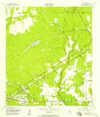 1957 Texla1958 Print · USGSOrange County's transition from timber and rail to mid-century residential growth is captured here in the late fifties. Genealogists and local historians can trace family sites like Singleton Cem and the Log Cabin Tabernacle near the old Texla townsite.3 unique versions available
 - 1957 Map of Orangefield, 1958 Print
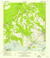 1957 Orangefield1958 Print · USGSSoutheast Texas at the peak of the mid-century oil boom is detailed here, showing the intricate intersection of rail lines and bayous. Genealogists can locate family landmarks such as Linscomb Cem, Winfree Ch, and the settlement of Mauriceville.2 unique versions available
 - 1957 Map of Brookeland, 1959 Print
 1957 Brookeland1959 Print · USGSDeep in the Piney Woods during the late fifties, this area shows a landscape defined by timber, rail, and family settlements. Genealogists can trace rural roots at Weeks Settlement, Browndell, and the Low Cem (Historical Mon).2 unique versions available
 - 1958 Map of Zavalla, 1959 Print
 1958 Zavalla1959 Print · USGSEast Texas piney woods and the Neches River valley are captured here just before the landscape-altering creation of the Sam Rayburn Reservoir. Genealogists can trace family-named sites like Dunkin Cem, the Barium Mill, and the site of Fort Teran.3 unique versions available
 - 1958 Map of Mc Gee Bend, 1959 Print
 1958 Mc Gee Bend1959 Print · USGSEast Texas at the end of the 1950s shows a landscape on the brink of change as the Angelina River is harnessed. Trace lost locations like Veach and Zavala or locate family roots at Oak Grove Ch and Sinclair Cem.3 unique versions available
 - 1958 Map of Spurger, 1960 Print
 1958 Spurger1960 Print · USGSSoutheast Texas in the late fifties was a landscape of river bottomlands and emerging oil fields. Researchers can trace the legacy of timber and oil through the Old Railroad Grade and Joes Lake Oil Field, or find family roots at Withers Cem and Spring Hill Ch.2 unique versions available
 - 1958 Map of Kirbyville, 1960 Print
 1958 Kirbyville1960 Print · USGSJasper and Newton counties in the late fifties show a landscape of timber-driven growth and rural community centers. Genealogists can trace family landmarks like Wilson Cem, Lewis Chapel, and several local schools from Bon Ami to Salem.2 unique versions available
Showing maps 1-25 of 204
Top cities of Jasper County
Frequently asked questions
- What are the different types of historical maps available for Jasper County?
- What is the oldest map of Jasper County?
- Where can I purchase historical maps of Jasper County for my home or office?
- Where can I download high-res historical maps of Jasper County?
- Are there historical topographic maps available for Jasper County?
- Is there historical aerial imagery available for Jasper County?
- Where are historical maps of Jasper County sourced from?