1930s Maps of Jim Hogg County, Texas
Explore 5 historic maps of Jim Hogg County from the 1930s. These maps offer a rare glimpse into what life looked like during the 1930s — showing old roads, neighborhoods, homes, and landmarks that have changed or disappeared over time.
Whether you're researching your family's past, planning a metal detecting trip, or studying how Jim Hogg County's landscape evolved across the 1930s, these high-resolution maps are a powerful tool for exploring the history of this region.
- Focus on a specific era: All maps on this page are from the 1930s, giving you a focused view of this time period.
- See what’s changed: Compare century-old streets, trails, and buildings to today's modern landscape using overlays and satellite layers.
- Research with precision: Use these maps for genealogy, historical research, land use analysis, or educational projects.
- View, download, or print: Maps are fully viewable online in high resolution, and can be downloaded or printed for your own records.
Start exploring Jim Hogg County's history through authentic maps from the 1930s. This is your window into the past.
Jim Hogg County, TX maps
(5)- 1938 Map of Agua Nueva, 1959 Print
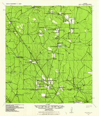 1938 Agua Nueva1959 Print · USGSThe ranching country of South Texas is captured here in the late 1930s before modern development altered these family lands. Researchers can locate specific ancestral sites and livestock holdings like Agua Nueva, Palangana Ranch, and Rancho Viejo.
 - 1938 Map of Cuevitas, 1959 Print
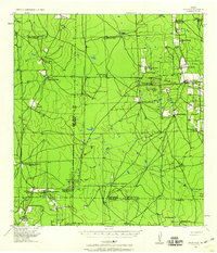
 1938 Cuevitas1959 Print · USGSSouth Texas ranching and the nascent oil industry define this borderlands region in the late nineteen-thirties. Researchers can trace ancestral family lands through dozens of named sites like San Antonio Viejo Ranch, Cuevitas, and the Sun Oil Co Camp.
 - 1939 Map of Bruni, 1958 Print
 1939 Bruni1958 Print · USGSSouth Texas brush country was a hub of energy and ranching in the late thirties as the oil boom transformed the landscape. Genealogists and historians can trace family landholdings like Santa Cruz Ranch and the early industrial footprint of Mirando City or the Valdez Oil Field.2 unique versions available
 - 1939 Map of Encantada, 1959 Print
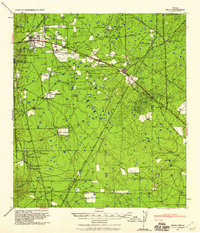
 1939 Encantada1959 Print · USGSBrooks and Starr counties are shown in the late 1930s as a landscape of established cattle ranches and emerging oil fields. Genealogists and researchers can locate family landmarks such as Guerra, Encantada Ranch, and La Particion Ranch.
 - 1939 Map of Randado, 1959 Print
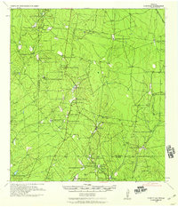
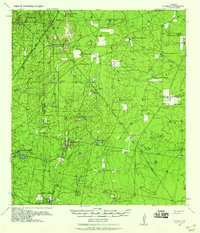 1939 Randado1959 Print · USGSSouth Texas ranching and the rise of the oil industry intersect in the late 1930s across Jim Hogg County. Genealogists and local historians can trace legacy family holdings like Lopez Ranch and De la Garza Ranch alongside infrastructure for the Randado Oil Field.
End of results
Showing maps 1-5 of 5
Top cities of Jim Hogg County
Frequently asked questions
- What are the different types of historical maps available for Jim Hogg County?
- What is the oldest map of Jim Hogg County?
- Where can I purchase historical maps of Jim Hogg County for my home or office?
- Where can I download high-res historical maps of Jim Hogg County?
- Are there historical topographic maps available for Jim Hogg County?
- Is there historical aerial imagery available for Jim Hogg County?
- Where are historical maps of Jim Hogg County sourced from?