1960s Maps of Jim Hogg County, Texas
Explore 5 historic maps of Jim Hogg County from the 1960s. These maps offer a rare glimpse into what life looked like during the 1960s — showing old roads, neighborhoods, homes, and landmarks that have changed or disappeared over time.
Whether you're researching your family's past, planning a metal detecting trip, or studying how Jim Hogg County's landscape evolved across the 1960s, these high-resolution maps are a powerful tool for exploring the history of this region.
- Focus on a specific era: All maps on this page are from the 1960s, giving you a focused view of this time period.
- See what’s changed: Compare century-old streets, trails, and buildings to today's modern landscape using overlays and satellite layers.
- Research with precision: Use these maps for genealogy, historical research, land use analysis, or educational projects.
- View, download, or print: Maps are fully viewable online in high resolution, and can be downloaded or printed for your own records.
Start exploring Jim Hogg County's history through authentic maps from the 1960s. This is your window into the past.
Jim Hogg County, TX maps
(5)- 1962 Map of McAllen
 1962 McAllen1962 Print · USGSThe Lower Rio Grande Valley in the mid-twentieth century shows a complex landscape of irrigation, oil production, and border commerce. Genealogists and historians can trace family roots through riverside towns like Zapata, Roma-Los Saenz, and Hidalgo, or locate landmarks like Santa Elena Ch and Moore Air Force Base.
 - 1967 Map of Hebbronville SE, 1971 Print
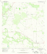 1967 Hebbronville SE1971 Print · USGSThe ranch lands of Jim Hogg County are captured here in the late sixties as the oil and gravel industries expanded across the brush country. Researchers can trace the Texas Mexican line and locate numerous family-named landmarks like Papalote Nuevo Windmill and San Tomas Windmill.2 unique versions available
 - 1967 Map of Hebbronville, 1971 Print
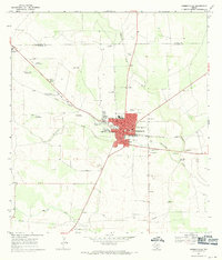 1967 Hebbronville1971 Print · USGSHebbronville sits at a vital South Texas rail junction in the late sixties, where the livestock and oil economies met the brush country. Researchers can trace family history at Old Hebbronville Cem or locate local landmarks like Dusty Downs Racetrack and the Courthouse.
 - 1968 Map of Palomas Ranch NW, 1971 Print
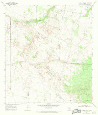 1968 Palomas Ranch NW1971 Print · USGSBrooks County ranchlands in the late sixties show a landscape where water and oil dictate the pace of life. Genealogists and historians can trace family-named landmarks like the Trevino Windmill and Vaquero Windmill or locate a quiet Cem near the county line.
 - 1968 Map of Palomas Ranch SW, 1971 Print
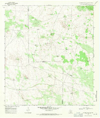 1968 Palomas Ranch SW1971 Print · USGSThe ranch lands of South Texas are captured in the late sixties, showcasing the vital water networks of the Brooks and Jim Hogg county line. Researchers can trace remote family landmarks like Garcia or flowing artesian sources such as the Rayado Well.2 unique versions available
End of results
Showing maps 1-5 of 5
Top cities of Jim Hogg County
Frequently asked questions
- What are the different types of historical maps available for Jim Hogg County?
- What is the oldest map of Jim Hogg County?
- Where can I purchase historical maps of Jim Hogg County for my home or office?
- Where can I download high-res historical maps of Jim Hogg County?
- Are there historical topographic maps available for Jim Hogg County?
- Is there historical aerial imagery available for Jim Hogg County?
- Where are historical maps of Jim Hogg County sourced from?