Old Maps of Lamar County, Texas for Genealogy
Trace your family roots with 163 historic maps of Lamar County. These high-res maps reveal old neighborhoods, homesites, landmarks, and streets — helping you uncover where your ancestors lived and how the area evolved over time.
- Explore historic neighborhoods: Identify where your relatives may have lived in the 1800s or 1900s.
- Compare maps over time: Trace the changes in streets, buildings, and landmarks for multi-generational research.
- Perfect for genealogy & ancestry research: Used by family historians and researchers to map out lineage and migration.
These maps are an incredible resource for exploring your personal connection to Lamar County's past.
Lamar County, TX maps
(163)- 1903 Map of Paris
 1903 Paris1903 Print · USGSThe Red River borderlands of the Indian Territory and Texas are shown here at the start of the century. Genealogists and researchers can trace early settlements and social hubs like Grant, Oberlin, and the Camp Ground along the winding banks of the Red River.
 - 1947 Map of Honey Grove, 1966 Print
 1947 Honey Grove1966 Print · USGSNortheast Texas at the close of the 1940s reveals a landscape of thriving rural school districts and rail-side commerce. Genealogists can trace family roots through numerous sites like McCraw Chapel, Oakwood Cem, and Michigan Prairie School.2 unique versions available
 - 1948 Map of Grant, 1963 Print
 1948 Grant1963 Print · USGSThe Red River borderlands of Oklahoma and Texas are shown here in the late 1940s, featuring the extensive Camp Maxey Military Reservation. Researchers can trace the St Louis San Francisco Railway through Grant and locate dozens of local landmarks like Hills Chapel School and Goodland Cem.2 unique versions available
 - 1948 Map of Paris, 1966 Print
 1948 Paris1966 Print · USGSLamar County in the late 1940s shows the growth of Paris alongside its vital rail lines and military infrastructure. Researchers can trace family sites at Evergreen Cem, explore the Camp Maxey Military Reservation, or locate rural landmarks like Roxton and Ambia Sch.
 - 1948 Map of Direct, 1968 Print
 1948 Direct1968 Print · USGSThe Red River valley at the close of the 1940s reveals a landscape of isolated farming communities and local schools spanning the Oklahoma-Texas border. Genealogists and historians can trace the foundations of New Oberlin or locate remote landmarks like Iron Stob School and Arch Chapel Cem.
 - 1949 Map of Direct
 1949 Direct1949 Print · USGSThe Oklahoma and Texas borderlands along the Red River are captured here in the late 1940s. Local historians can trace the vanished Oberlin Ferry and old country schools like Crowder Springs School or visit family sites at Forest Grove Cem and Monkstown.2 unique versions available
 - 1949 Map of Honey Grove
 1949 Honey Grove1949 Print · USGSIn the late 1940s, the rural corridor between Honey Grove and Petty thrived as a network of rail-side towns and country schoolhouses. Genealogists can trace family landmarks like Spoonamore Hill, the Michigan Prairie School, and Oakwood Cem.
 - 1949 Map of Grant
 1949 Grant1949 Print · USGSThe Red River borderlands of Oklahoma and Texas are captured here just after the war, showing a rural landscape dominated by large river bends and military expansion. You can trace early community hubs like Grant and Arthur City or locate local landmarks like Hills Chapel School and Forest Chapel.2 unique versions available
 - 1949 Map of Paris
 1949 Paris1949 Print · USGSPost-war Paris and Lamar County are shown here at a peak of rail and agricultural connectivity before the highway era transformed the rural landscape. Genealogists and local historians can locate dozens of country schools and churches, such as Cedar Hill Sch, Ambia Sch, and Mount Vernon Church.
 - 1951 Map of Slate Shoals, 1952 Print
 1951 Slate Shoals1952 Print · USGSLamar County, Texas, and Choctaw County, Oklahoma, are separated by the winding Red River in this early 1950s study. Genealogists can locate several remote landmarks, including the Pee Dee Sch and rural burials at Newbether Cem.3 unique versions available
 - 1951 Map of Frogville, 1952 Print
 1951 Frogville1952 Print · USGSThe Oklahoma-Texas borderlands along the Red River are captured here in the early fifties, showing a landscape defined by meandering river bends. Genealogists can locate numerous local burial sites and schools like Frogville Cem, Everidge Cem, and Lake View Sch.3 unique versions available
 - 1951 Map of Shoals, 1952 Print
 1951 Shoals1952 Print · USGSThe northern banks of the Red River are captured here in the early fifties, showing a rural community defined by its schools and rail lines. Genealogists can trace family landmarks like Shoat Springs Cem, Ervin Sch, and the settlement of Shoals.2 unique versions available
 - 1951 Map of Woodland, 1952 Print
 1951 Woodland1952 Print · USGSThe Red River Valley's borderlands in the early fifties are captured here as a landscape of small agricultural hamlets and riverfront boundaries. Researchers can trace rural community life through landmarks like Lone Star Sch, Woodland Cem, and the crossing at Pin Hook.2 unique versions available
 - 1953 Map of Texarkana, 1964 Print
 1953 Texarkana1964 Print · USGSThe Texas-Arkansas borderlands are captured here in the mid-fifties, during a decade of massive military and hydraulic engineering projects. Genealogists and researchers can locate family landmarks like Old Boston Cem, Siloam Ch, and the vast Red River Arsenal.4 unique versions available
 - 1956 Map of Texarkana
 1956 Texarkana1956 Print · USGSThe Ark-La-Tex borderlands come alive in the mid-fifties, showing the transition from a rail-dependent rural economy to a post-war industrial landscape. Researchers can trace the massive Red River Ordnance Depot and find towns like Talco, Bogata, and Naples.
 - 1963 Map of Minter, 1964 Print
 1963 Minter1964 Print · USGSLamar and Delta Counties in the early sixties reveal a landscape of river-bottom farms and small rural settlements. Genealogists and historians can locate family landmarks like Minter Cem, Rockford Ch, and the community of Taylor Town.
 - 1963 Map of Cunningham, 1964 Print
 1963 Cunningham1964 Print · USGSNortheast Texas river country in the early sixties reveals a landscape shaped by the meeting of the North and South Sulphur Rivers. Researchers can locate family landmarks like Restland Cem and Morris Chapel Cem near the historic settlements of Cunningham and Halesboro.
 - 1964 Map of Detroit, 1967 Print
 1964 Detroit1967 Print · USGSThe railroad corridor and fertile creek bottoms of Red River and Lamar counties are captured here in the mid-1960s. Genealogists can trace family footprints at Egypt Cemetery, New Hope Church, and the community of Post Oak.
 - 1964 Map of Deport, 1967 Print
 1964 Deport1967 Print · USGSDeport and the surrounding Lamar County countryside are captured here in the mid-sixties, showing a landscape of small farming communities and winding creeks. Genealogists can locate several family landmarks and burial sites, including Wrights Chapel Cem, the Birthplace of John N. Garner, and Milton.
 - 1964 Map of Pattonville, 1967 Print
 1964 Pattonville1967 Print · USGSLamar County's rural communities and creek-side settlements are captured here in the mid-1960s. Genealogists and local historians can trace family roots through landmarks like Biardstown Cem, the Plainview Community Hall, and the Old Railroad Grade that once spanned the county.
 - 1964 Map of Blossom, 1967 Print
 1964 Blossom1967 Print · USGSLamar County life centered on the rail-and-road corridor between Paris and Blossom during the mid-sixties. Researchers can trace family history at Corn Cem, Sikes Cem, or Providence Ch and locate era-specific landmarks like the Drive-in Theater and Cox Field.
 - 1964 Map of Charleston, 1968 Print
 1964 Charleston1968 Print · USGSThe North Sulphur River valley comes into focus during the mid-1960s, showing the rural homesteads and river crossings along the Lamar-Delta county line. Genealogists can trace family names at Hazel Dell Cem or locate the community hubs of Charleston and Lake Creek.
 - 1964 Map of Cooper North, 1968 Print
 1964 Cooper North1968 Print · USGSDelta County agricultural life in the mid-1960s centers on the Southern Pacific rail line and the North Sulphur River bottomlands. Genealogists and historians can trace family locations near Simmons Cem, Enloe, and the rural community at Crossroads.
 - 1964 Map of Pecan Gap, 1968 Print
 1964 Pecan Gap1968 Print · USGSPecan Gap and its surrounding farm country appear here in the mid-sixties, dominated by the winding Sulphur River. Genealogists can trace family sites via the many local burial grounds like Bledsoe Cem or the oddly named Jot Em Down community.2 unique versions available
 - 1980 Map of Pat Mayse Lake West, 1981 Print
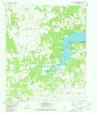 1980 Pat Mayse Lake West1981 Print · USGSLamar County in the early eighties shows a balance between established rural settlements and significant conservation efforts near Pat Mayse Lake. Genealogists and local historians can trace small communities like Garretts Bluff and Ragtown, or locate family sites at Sumner Cem and Caviness.
Showing maps 1-25 of 163
Top cities of Lamar County
- Paris historical maps
- Reno historical maps
- Blossom historical maps
- Roxton historical maps
- Toco historical maps
- Sun Valley historical maps
Frequently asked questions
- What are the different types of historical maps available for Lamar County?
- What is the oldest map of Lamar County?
- Where can I purchase historical maps of Lamar County for my home or office?
- Where can I download high-res historical maps of Lamar County?
- Are there historical topographic maps available for Lamar County?
- Is there historical aerial imagery available for Lamar County?
- Where are historical maps of Lamar County sourced from?