1940s Maps of Lamar County, Texas
Explore 8 historic maps of Lamar County from the 1940s. These maps offer a rare glimpse into what life looked like during the 1940s — showing old roads, neighborhoods, homes, and landmarks that have changed or disappeared over time.
Whether you're researching your family's past, planning a metal detecting trip, or studying how Lamar County's landscape evolved across the 1940s, these high-resolution maps are a powerful tool for exploring the history of this region.
- Focus on a specific era: All maps on this page are from the 1940s, giving you a focused view of this time period.
- See what’s changed: Compare century-old streets, trails, and buildings to today's modern landscape using overlays and satellite layers.
- Research with precision: Use these maps for genealogy, historical research, land use analysis, or educational projects.
- View, download, or print: Maps are fully viewable online in high resolution, and can be downloaded or printed for your own records.
Start exploring Lamar County's history through authentic maps from the 1940s. This is your window into the past.
Lamar County, TX maps
(8)- 1947 Map of Honey Grove, 1966 Print
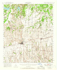 1947 Honey Grove1966 Print · USGSNortheast Texas at the close of the 1940s reveals a landscape of thriving rural school districts and rail-side commerce. Genealogists can trace family roots through numerous sites like McCraw Chapel, Oakwood Cem, and Michigan Prairie School.2 unique versions available
 - 1948 Map of Grant, 1963 Print
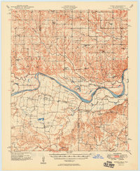
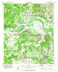 1948 Grant1963 Print · USGSThe Red River borderlands of Oklahoma and Texas are shown here in the late 1940s, featuring the extensive Camp Maxey Military Reservation. Researchers can trace the St Louis San Francisco Railway through Grant and locate dozens of local landmarks like Hills Chapel School and Goodland Cem.2 unique versions available
 - 1948 Map of Paris, 1966 Print
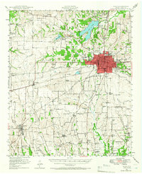 1948 Paris1966 Print · USGSLamar County in the late 1940s shows the growth of Paris alongside its vital rail lines and military infrastructure. Researchers can trace family sites at Evergreen Cem, explore the Camp Maxey Military Reservation, or locate rural landmarks like Roxton and Ambia Sch.
 - 1948 Map of Direct, 1968 Print
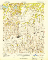
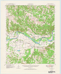 1948 Direct1968 Print · USGSThe Red River valley at the close of the 1940s reveals a landscape of isolated farming communities and local schools spanning the Oklahoma-Texas border. Genealogists and historians can trace the foundations of New Oberlin or locate remote landmarks like Iron Stob School and Arch Chapel Cem.
 - 1949 Map of Direct
 1949 Direct1949 Print · USGSThe Oklahoma and Texas borderlands along the Red River are captured here in the late 1940s. Local historians can trace the vanished Oberlin Ferry and old country schools like Crowder Springs School or visit family sites at Forest Grove Cem and Monkstown.2 unique versions available
 - 1949 Map of Honey Grove
 1949 Honey Grove1949 Print · USGSIn the late 1940s, the rural corridor between Honey Grove and Petty thrived as a network of rail-side towns and country schoolhouses. Genealogists can trace family landmarks like Spoonamore Hill, the Michigan Prairie School, and Oakwood Cem.
 - 1949 Map of Grant
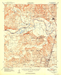 1949 Grant1949 Print · USGSThe Red River borderlands of Oklahoma and Texas are captured here just after the war, showing a rural landscape dominated by large river bends and military expansion. You can trace early community hubs like Grant and Arthur City or locate local landmarks like Hills Chapel School and Forest Chapel.2 unique versions available
 - 1949 Map of Paris
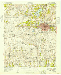 1949 Paris1949 Print · USGSPost-war Paris and Lamar County are shown here at a peak of rail and agricultural connectivity before the highway era transformed the rural landscape. Genealogists and local historians can locate dozens of country schools and churches, such as Cedar Hill Sch, Ambia Sch, and Mount Vernon Church.
End of results
Showing maps 1-8 of 8
Top cities of Lamar County
- Paris historical maps
- Reno historical maps
- Blossom historical maps
- Roxton historical maps
- Toco historical maps
- Sun Valley historical maps
Frequently asked questions
- What are the different types of historical maps available for Lamar County?
- What is the oldest map of Lamar County?
- Where can I purchase historical maps of Lamar County for my home or office?
- Where can I download high-res historical maps of Lamar County?
- Are there historical topographic maps available for Lamar County?
- Is there historical aerial imagery available for Lamar County?
- Where are historical maps of Lamar County sourced from?