1900s (20th Century) Maps of Limestone County, Texas
Explore 33 historic maps of Limestone County from the 1900s (20th Century). These maps offer a rare glimpse into what life looked like during the 1900s — showing old roads, neighborhoods, homes, and landmarks that have changed or disappeared over time.
Whether you're researching your family's past, planning a metal detecting trip, or studying how Limestone County's landscape evolved across the 1900s, these high-resolution maps are a powerful tool for exploring the history of this region.
- Focus on a specific era: All maps on this page are from the 1900s, giving you a focused view of this time period.
- See what’s changed: Compare century-old streets, trails, and buildings to today's modern landscape using overlays and satellite layers.
- Research with precision: Use these maps for genealogy, historical research, land use analysis, or educational projects.
- View, download, or print: Maps are fully viewable online in high resolution, and can be downloaded or printed for your own records.
Start exploring Limestone County's history through authentic maps from the 1900s. This is your window into the past.
Limestone County, TX maps
(33)- 1920 Map of Mexia
 1920 Mexia1920 Print · USGSLimestone and Freestone counties are shown here just after the Great War, during a period of significant railway expansion and rural settlement. Researchers can trace the routes of the Houston and Texas Central and locate sites like Cotton Gin, Pt. Enterprise, and Duck Lake.
 - 1920 Map of Mart
 1920 Mart1920 Print · USGSCentral Texas at the dawn of the 1920s shows a landscape of busy rail junctions and small post office hubs. Researchers can trace rural lineages through William's School, the community at Axtell P.O., and the Navasota River bottomlands.
 - 1954 Map of Waco, 1964 Print
 1954 Waco1964 Print · USGSCentral Texas during the mid-fifties shows a landscape defined by the expansion of Fort Hood Military Reservation and the Brazos river system. Trace the rail lines and early airfields like James Connally Air Force Base and settlements like Temple or McGregor.2 unique versions available
 - 1955 Map of Waco
 1955 Waco1955 Print · USGSCentral Texas at the peak of the Cold War reveals a landscape defined by military expansion and major water projects. Researchers can trace the footprints of Fort Hood, the waters of Lake Waco, and regional hubs like Temple or Mexia.
 - 1956 Map of Jewett
 1956 Jewett1956 Print · USGSLeon and Freestone counties emerge as a vital rail and mining hub in this early twentieth-century survey. Genealogists and historians can trace the growth of settlements like Jewett and Buffalo, or locate defunct stops such as Newly and the Evansville Coal Spur.
 - 1956 Map of Hubbard
 1956 Hubbard1956 Print · USGSHubbard and the surrounding Blackland Prairie country are captured here in the mid-1950s as a vital railroad and farming hub. Genealogists can locate several rural burial grounds, including Fairview Cemetery and Valley View Cem, alongside the Phyllis Wheatly Sch.3 unique versions available
 - 1956 Map of Axtell, 1957 Print
 1956 Axtell1957 Print · USGSMid-century McLennan and Hill counties appear here at a busy rail-and-creek intersection just before significant modernization. Genealogists can trace rural family roots at TK Cem or Shead Cem, and follow the St Louis Southwestern rail line through Axtell.2 unique versions available
 - 1956 Map of Mart, 1958 Print
 1956 Mart1958 Print · USGSAgricultural life in McLennan County thrived in the mid-1950s as the town of Mart sat at the busy intersection of the Missouri Pacific rail line. Researchers can trace rural school locations like Anderson Sch and family burial sites at Evergreen Cem and Mart Cem.2 unique versions available
 - 1957 Map of Prairie Hill
 1957 Prairie Hill1957 Print · USGSLimestone County in the late fifties remains a landscape of quiet creek-side communities and aviation history. Researchers can trace rural lineages through Mt Antioch Cem or locate the site of the Prairie Hill Air Force Auxiliary Airfield.2 unique versions available
 - 1957 Map of Groesbeck
 1957 Groesbeck1957 Print · USGSLimestone County at the turn of the century shows a dense web of railroad stops and rural post offices centered on the Navasota River. Genealogists and historians can locate family sites near Honest Ridge School, Springfield, and the Reunion Grounds.
 - 1957 Map of Otto, 1958 Print
 1957 Otto1958 Print · USGSThe rural settlement of Otto and the surrounding Falls County countryside are captured here in the late fifties as family farms relied on the MISSOURI PACIFIC rail line. Researchers can locate many local landmarks including Metina Cem and the Corner Sch (Aband).
 - 1960 Map of Echols, 1961 Print
 1960 Echols1961 Print · USGSLimestone County was a landscape of quiet rural communities and creek-side farms at the dawn of the sixties. You can trace early settlement roots through local markers like Coolidge Cem, the Old Railroad Grade, and the Echols Sch.2 unique versions available
 - 1960 Map of Groesbeck, 1961 Print
 1960 Groesbeck1961 Print · USGSLimestone County at the start of the sixties revolves around the rail hub of Groesbeck and the waters of the Navasota River. Genealogists can trace family roots at Faulkenberry Cem and the site of Fort Parker (Historical).2 unique versions available
 - 1960 Map of Tehuacana, 1961 Print
 1960 Tehuacana1961 Print · USGSThe Limestone County hills around the turn of the 1960s reveal a landscape of rural colleges and water management. Genealogists can trace family roots at Honest Ridge Cem and Forest Glade Cem or locate the historic Westminster College.3 unique versions available
 - 1962 Map of Petteway, 1964 Print
 1962 Petteway1964 Print · USGSThe rural borderlands of Robertson and Limestone counties come into focus in the early sixties. Genealogists and local historians can trace family-named watercourses and community landmarks like Post Oak Sch, Petteway Ch, and the waters of Hurricane Creek.2 unique versions available
 - 1963 Map of Wortham, 1966 Print
 1963 Wortham1966 Print · USGSThe community of Wortham sits at the heart of the Texas oil patch in the early sixties. Genealogists and researchers can trace the Southern Pacific rail line between Currie and Gude, and locate family sites like Miller Cem or Red Cem.2 unique versions available
 - 1963 Map of Mexia, 1966 Print
 1963 Mexia1966 Print · USGSThe city of Mexia is captured here in the early 1960s, a time of established oil production and rail-driven growth. Genealogists can trace family names across New Home Cem and Spillers Cem, or locate local landmarks like Dunbar High Sch.2 unique versions available
 - 1965 Map of Coolidge, 1967 Print
 1965 Coolidge1967 Print · USGSCoolidge and the surrounding Limestone County prairie are captured here during a period of significant water management in the mid-sixties. Genealogists and local historians can trace the rural landscape through the Dover Cem and settlements like Munger or Calina.2 unique versions available
 - 1965 Map of Union High, 1967 Print
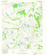 1965 Union High1967 Print · USGSThe rural borderlands of Navarro and Limestone counties are shown in the mid-1960s, featuring a landscape undergoing major hydrological changes. Researchers can locate vanished landmarks like Union High and Shady Grove Ch, or trace the numerous soil conservation reservoirs from Dam No 31 to Dam No 19.
 - 1965 Map of Donie, 1968 Print
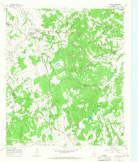 1965 Donie1968 Print · USGSDonie and the surrounding Leon County countryside are captured here in the mid-1960s, showing a landscape defined by timber, water, and the rail line. Genealogists and local historians can locate long-standing landmarks such as Wilson Chapel, Post Oak Cem, and the waters of Thundering Springs.2 unique versions available
 - 1965 Map of Kosse West, 1969 Print
 1965 Kosse West1969 Print · USGSThe rural border of Falls and Limestone counties comes to life in the mid-1960s, showing a landscape of small farming communities and country roads. Genealogists can trace old family sites near Antioch Cem, Alto Springs, and the Southern Pacific rail line.
 - 1966 Map of Round Prairie, 1968 Print
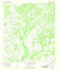 1966 Round Prairie1968 Print · USGSThe tri-county borderlands of Leon, Limestone, and Robertson counties are captured here in the mid-1960s. Genealogists can trace family heritage through numerous burial sites like Seale-Round Prairie Cem and Grayson Cem near the Navasota River.3 unique versions available
 - 1966 Map of Thornton, 1968 Print
 1966 Thornton1968 Print · USGSThornton and the surrounding Limestone County ranch lands are captured in the mid-sixties, centered on the Southern Pacific railroad. Genealogists can trace numerous family burial sites, including Pippin, Phifer, and Pleasant Grove cemeteries.
 - 1966 Map of Teague South, 1968 Print
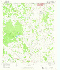 1966 Teague South1968 Print · USGSFreestone and Limestone counties are captured in the mid-1960s as the rail-centered economy of Teague meets the rural crossroads of Personville. Researchers can trace family history at Greenwood Cem or locate the old Salem Ch and Union Ch amid the Bear Branch and Holman Creek bottoms.2 unique versions available
 - 1966 Map of Box Church, 1969 Print
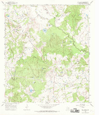 1966 Box Church1969 Print · USGSLimestone County life in the mid-1960s centered on small creek-side settlements and a network of family burial grounds. Genealogists can trace local roots at Box Church or search for remote sites like Hughes and Hyden Cem and Masters Cem near the Navasota River.2 unique versions available
Showing maps 1-25 of 33
Top cities of Limestone County
- Mexia historical maps
- Groesbeck historical maps
- Coolidge historical maps
- Thornton historical maps
- Kosse historical maps
- Tehuacana historical maps
Frequently asked questions
- What are the different types of historical maps available for Limestone County?
- What is the oldest map of Limestone County?
- Where can I purchase historical maps of Limestone County for my home or office?
- Where can I download high-res historical maps of Limestone County?
- Are there historical topographic maps available for Limestone County?
- Is there historical aerial imagery available for Limestone County?
- Where are historical maps of Limestone County sourced from?