Old Maps of Mackenzie Park, Lubbock for Metal Detecting
Plan your next treasure hunt with 9 historic maps of Mackenzie Park. Find old homesites, ghost towns, trails, and gathering spots that may be lost to time — perfect for identifying promising metal detecting locations.
- Locate forgotten sites: Uncover places like long-lost settlements, abandoned rail lines, or gathering spots.
- Plan better hunts: Use map overlays combined with LiDAR or satellite views to narrow in on historically rich areas.
- Made for detectorists: Thousands of hobbyists use these maps to discover relics, coins, and hidden history.
Use these historic maps to boost your research and find new opportunities beneath the surface of Mackenzie Park.
Mackenzie Park, Lubbock maps
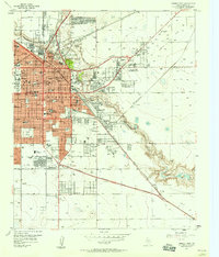
(9)- 1954 Map of Lubbock, 1958 Print
 1954 Lubbock1958 Print · USGSThe High Plains and Caprock region of West Texas come alive in the mid-1950s, showing a landscape defined by oil discovery and the Brazos River headwaters. Genealogists and historians can trace rail-connected towns like Roaring Springs, find the Pleasant Valley church, or locate family-named landmarks such as Soldier Mound.4 unique versions available
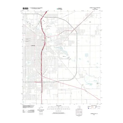
 - 1957 Map of Lubbock East, 1958 Print
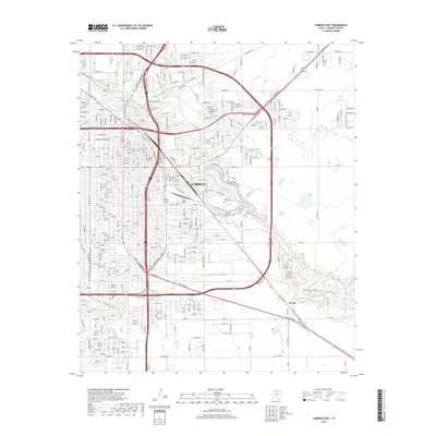
 1957 Lubbock East1958 Print · USGSLubbock emerges as a major West Texas center in the late fifties, showcasing the city's expansion alongside the Double Mountain Fork. Researchers can locate mid-century institutions like Texas Technological College, the City Cemetery, and Mac Kenzie State Park.4 unique versions available
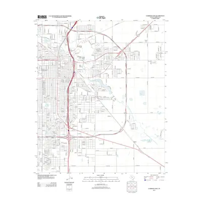
 - 1957 Map of Lubbock, 1958 Print
 1957 Lubbock1958 Print · USGSLubbock and its surrounding High Plains communities are captured here in the late fifties during a period of steady growth. Researchers can trace local genealogy and land use through landmarks like City Cemetery, Antioch Sch, and the Lubbock Municipal Airport.
 - 1986 Map of Lubbock
 1986 Lubbock1986 Print · USGSLubbock and the surrounding High Plains are documented in the mid-eighties as a structured grid of agricultural tracts and growing urban centers. Genealogists and local historians can trace family-named areas like Heckville, old rail stops on the Atchison Topeka and Santa Fe, and the winding path of Yellow House Canyon.2 unique versions available
 - 2010 Map of Lubbock East, 2010 Print
 2010 Lubbock East2010 Print · USGSCovers Mackenzie Park, including Lubbock, Burris, and other nearby areas
 - 2012 Map of Lubbock East, 2012 Print
 2012 Lubbock East2012 Print · USGSCovers Mackenzie Park, including Lubbock, Burris, and other nearby areas
 - 2016 Map of Lubbock East, 2016 Print
 2016 Lubbock East2016 Print · USGSCovers Mackenzie Park, including Lubbock, Burris, and other nearby areas
 - 2019 Map of Lubbock East, 2019 Print
 2019 Lubbock East2019 Print · USGSCovers Mackenzie Park, including Lubbock, Burris, and other nearby areas
 - 2022 Map of Lubbock East, 2022 Print
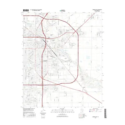
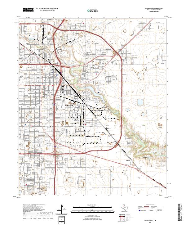 2022 Lubbock East2022 Print · USGSLubbock and its eastern environs are captured here in the early twenty-first century, showing the intersection of urban growth and the Brazos River headwaters. Trace local history through landmarks like the City of Lubbock Cem, the BNSF Railway, and the winding Yellow House Canyon.
End of results
Showing maps 1-9 of 9
Frequently asked questions
- What are the different types of historical maps available for Mackenzie Park?
- What is the oldest map of Mackenzie Park?
- Where can I purchase historical maps of Mackenzie Park for my home or office?
- Where can I download high-res historical maps of Mackenzie Park?
- Are there historical topographic maps available for Mackenzie Park?
- Is there historical aerial imagery available for Mackenzie Park?
- Where are historical maps of Mackenzie Park sourced from?