Old Maps of Mansfield, Texas for Metal Detecting
Plan your next treasure hunt with 18 historic maps of Mansfield. Find old homesites, ghost towns, trails, and gathering spots that may be lost to time — perfect for identifying promising metal detecting locations.
- Locate forgotten sites: Uncover places like long-lost settlements, abandoned rail lines, or gathering spots.
- Plan better hunts: Use map overlays combined with LiDAR or satellite views to narrow in on historically rich areas.
- Made for detectorists: Thousands of hobbyists use these maps to discover relics, coins, and hidden history.
Use these historic maps to boost your research and find new opportunities beneath the surface of Mansfield.
Mansfield, TX maps
(18)- 1894 Map of Fort Worth, 1918 Print
 1894 Fort Worth1918 Print · USGSNorth Texas at the end of the nineteenth century centers on a burgeoning Fort Worth and its strategic rail junctions. Researchers can locate early township sites like Johnson Station and Birdville or trace the military footprint of Camp Bowie.3 unique versions available
 - 1954 Map of Dallas, 1963 Print
 1954 Dallas1963 Print · USGSNorth Texas in the mid-fifties and early sixties reveals a landscape of rapid urban growth and water management. Genealogists and historians can trace the evolution of the metroplex through landmarks like Hensley Field, Boles Orphan Home, and the Texas & Pacific RR.4 unique versions available
 - 1958 Map of Dallas
 1958 Dallas1958 Print · USGSNorth Texas in the late fifties shows the dramatic expansion of the Metroplex as it absorbs surrounding farm towns. Genealogists and historians can trace old rail lines like the Missouri-Kansas-Texas and locate early lakefront developments at Eagle Mountain Lake and Lake Worth Village.
 - 1959 Map of Britton, 1960 Print
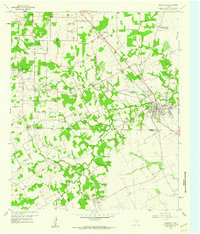
 1959 Britton1960 Print · USGSNorth Texas farm and rail country comes into focus in the late fifties at the junction of Tarrant, Dallas, and Ellis counties. Genealogists can trace family landmarks like Pleasant Valley Cem, St Paul Ch, and the rail junction at Britton.6 unique versions available
 - 1959 Map of Mansfield, 1960 Print
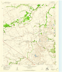
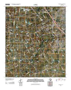
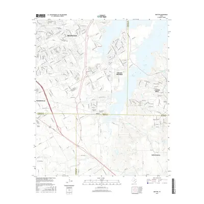
 1959 Mansfield1960 Print · USGSNear the close of the 1950s, this area south of Fort Worth shows a rural landscape of small towns and family farms. Researchers can trace the rail corridors of the Missouri Pacific or locate local landmarks like Poverty Knob, Retta, and Mansfield High Sch.5 unique versions available
 - 1959 Map of Arlington, 1961 Print
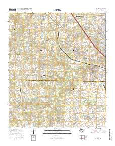
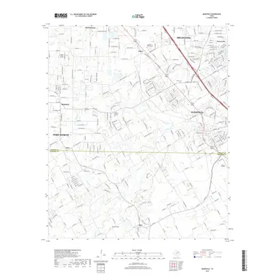
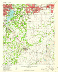 1959 Arlington1961 Print · USGSArlington and Mansfield are caught in a moment of post-war transformation as the suburbs of North Texas begin to bloom. Genealogists and local historians can trace family locations near Rehoboth Cem, study the footprint of Arlington State College, or locate vanished landmarks like Lucas Airport.
 - 1985 Map of Fort Worth
 1985 Fort Worth1985 Print · USGSMid-1980s Tarrant County and Parker County emerge from a transition between urban sprawl and rural cattle country. Researchers can trace the expansion of Fort Worth and Arlington alongside older landmarks like Nebo Mtn and Kikapoo Falls.2 unique versions available
 - 1995 Map of Britton, 2002 Print
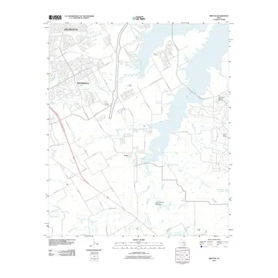
 1995 Britton2002 Print · USGSThe Tarrant and Dallas county borderlands were being rapidly transformed by the waters of Joe Pool Lake in the mid-1990s. Local researchers can still find historic landmarks like the Britton settlement, Estes Cem, and Friendship Ch amid the expanding suburbs.
 - 2010 Map of Mansfield, 2010 Print
 2010 Mansfield2010 Print · USGSCovers Mansfield, including Fort Worth, Arlington, and other nearby areas
 - 2010 Map of Britton, 2010 Print
 2010 Britton2010 Print · USGSCovers Mansfield, including Dallas, Arlington, and other nearby areas
 - 2012 Map of Mansfield, 2012 Print
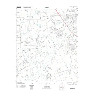 2012 Mansfield2012 Print · USGSCovers Mansfield, including Fort Worth, Arlington, and other nearby areas
 - 2013 Map of Britton, 2013 Print
 2013 Britton2013 Print · USGSCovers Mansfield, including Dallas, Arlington, and other nearby areas
 - 2016 Map of Britton, 2016 Print
 2016 Britton2016 Print · USGSCovers Mansfield, including Dallas, Arlington, and other nearby areas
 - 2016 Map of Mansfield, 2016 Print
 2016 Mansfield2016 Print · USGSCovers Mansfield, including Fort Worth, Arlington, and other nearby areas
 - 2019 Map of Britton, 2019 Print
 2019 Britton2019 Print · USGSCovers Mansfield, including Dallas, Arlington, and other nearby areas
 - 2019 Map of Mansfield, 2019 Print
 2019 Mansfield2019 Print · USGSCovers Mansfield, including Fort Worth, Arlington, and other nearby areas
 - 2022 Map of Mansfield, 2022 Print
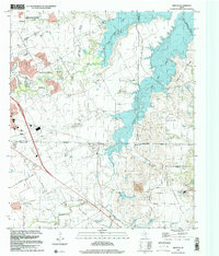
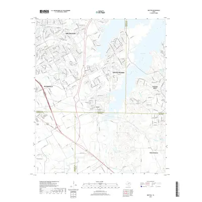
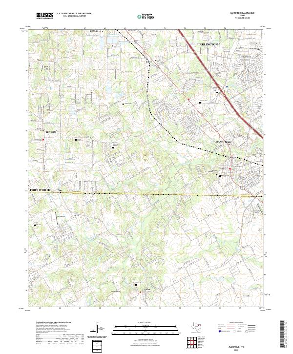 2022 Mansfield2022 Print · USGSMansfield and the surrounding suburban reaches of Tarrant and Johnson counties are captured here at a moment of rapid modern growth. Researchers can locate numerous historic burial sites such as Wyatts Chapel Cemetery, the high point of Poverty Knob, and local landmarks like Birk Airport.
 - 2022 Map of Britton, 2022 Print
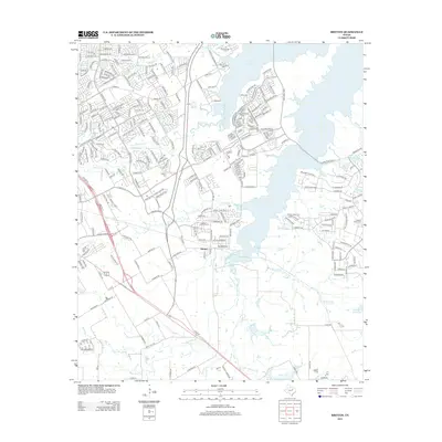
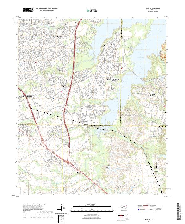 2022 Britton2022 Print · USGSFour North Texas counties meet at the crossroads of Britton in this recent survey of the suburbanizing landscape south of Arlington. Researchers can trace the sprawling shores of Joe Pool Lake and locate several community landmarks like Britton Cem and Saint Paul Cem.
End of results
Showing maps 1-18 of 18
Top cities near Mansfield
- Dallas historical maps
- Fort Worth historical maps
- Arlington historical maps
- Irving historical maps
- Grand Prairie historical maps
- DeSoto historical maps
See more
Top neighborhoods of Mansfield
- Fairways of Walnut Creek historical maps
- Kings Mill historical maps
- Polo Crossing historical maps
- Rustic Meadow historical maps
- Bisbee historical maps
- Arbors Crossing historical maps
See more
Frequently asked questions
- What are the different types of historical maps available for Mansfield?
- What is the oldest map of Mansfield?
- Where can I purchase historical maps of Mansfield for my home or office?
- Where can I download high-res historical maps of Mansfield?
- Are there historical topographic maps available for Mansfield?
- Is there historical aerial imagery available for Mansfield?
- Where are historical maps of Mansfield sourced from?