1960s Maps of Marion County, Texas
Explore 17 historic maps of Marion County from the 1960s. These maps offer a rare glimpse into what life looked like during the 1960s — showing old roads, neighborhoods, homes, and landmarks that have changed or disappeared over time.
Whether you're researching your family's past, planning a metal detecting trip, or studying how Marion County's landscape evolved across the 1960s, these high-resolution maps are a powerful tool for exploring the history of this region.
- Focus on a specific era: All maps on this page are from the 1960s, giving you a focused view of this time period.
- See what’s changed: Compare century-old streets, trails, and buildings to today's modern landscape using overlays and satellite layers.
- Research with precision: Use these maps for genealogy, historical research, land use analysis, or educational projects.
- View, download, or print: Maps are fully viewable online in high resolution, and can be downloaded or printed for your own records.
Start exploring Marion County's history through authentic maps from the 1960s. This is your window into the past.
Marion County, TX maps
(17)- 1961 Map of Cunningham Creek, 1963 Print
 1961 Cunningham Creek1963 Print · USGSCass County, Texas, is documented here in the early 1960s, showing a landscape of bayous and small rural settlements. Genealogists can locate family landmarks like the Bear Creek Cem and Caves Spring Ch or trace the winding course of Black Cypress Creek.
 - 1961 Map of Lassater, 1964 Print
 1961 Lassater1964 Print · USGSEast Texas oil and water interests converge in the early sixties as the Lake O' the Pines fills the valley. Genealogists and locals can trace the Louisiana and Arkansas rail line through Lassater or locate Pyland Cem and Mims Chapel.
 - 1961 Map of Harleton, 1964 Print
 1961 Harleton1964 Print · USGSHarrison County settlement patterns in the early sixties reveal a landscape of rural churches and family cemeteries just as Lake O' the Pines began reshaping the terrain. Genealogists and local historians can trace legacy landmarks like Harleton, Liberty Cem, and the community life centered around Piney Ch.3 unique versions available
 - 1962 Map of Kellyville, 1963 Print
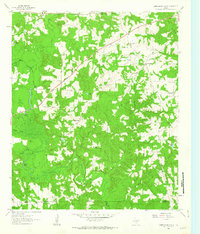
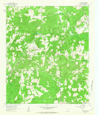
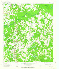
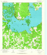
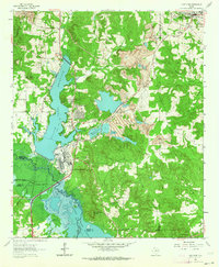
 1962 Kellyville1963 Print · USGSMarion County in the early sixties was a landscape of bayous and rail lines at the edge of the newly formed reservoir. Genealogists can trace family roots through the Beamer-Davis Cem and Valley Plains Cem, or locate the Jefferson Rural Academy.3 unique versions available
 - 1962 Map of McLeod, 1963 Print
 1962 McLeod1963 Print · USGSThe Texas-Louisiana borderlands come into focus in the early sixties, showing a landscape defined by petroleum production and rural rail lines. Researchers can trace family sites and industry via the Kansas City Southern, Josey Cem, and the Refinery near North Rodessa.2 unique versions available
 - 1962 Map of Lanier, 1963 Print
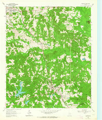
 1962 Lanier1963 Print · USGSEast Texas at the start of the sixties reveals a landscape shaped by oil, iron ore, and rural settlement. Genealogists can trace family landmarks like Salem Cem and Zion Hill Cem alongside industrial features like the Strip Mines and the Texas and Pacific railroad.
 - 1962 Map of Marshall NW, 1963 Print
 1962 Marshall NW1963 Print · USGSEast Texas oil and timber lands come alive in the early sixties near the Marion and Harrison county line. Researchers can trace rural community life through landmarks like Woodlawn, Brantly Cem, and the Vickie Oil Field.2 unique versions available
 - 1962 Map of Trees, 1963 Print
 1962 Trees1963 Print · USGSThe Texas-Louisiana borderlands come alive in this early 1960s survey of the James Bayou and Caddo Lake region. Genealogists and historians can trace numerous family burial sites like Burks-Hart Cem and the landings at Stacy Landing or Bonham Landing.2 unique versions available
 - 1962 Map of Woodlawn, 1963 Print
 1962 Woodlawn1963 Print · USGSHarrison County was a landscape of bayous and rail lines in the early sixties, centered on the community of Woodlawn. Local historians can trace the foundations of the area through Woodlawn Cem, Pope City, and the rural Cypress River Airfield.3 unique versions available
 - 1962 Map of Smithland, 1963 Print
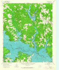
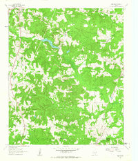
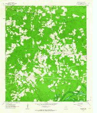 1962 Smithland1963 Print · USGSMarion County in the early sixties reveals a landscape of deep piney woods and the intricate wetlands of Caddo Lake. Genealogists and local historians can trace family ties through sites like Whalley Cem, Moseley Cem, and the rural Logan Chapel.3 unique versions available
 - 1962 Map of Kildare, 1963 Print
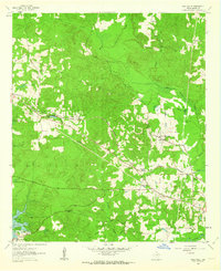
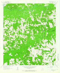
 1962 Kildare1963 Print · USGSEastern Texas oil and rail culture meet in the early sixties near the Marion County line. Genealogists and industrial historians can trace the Texas and Pacific rail line through Kildare and locate the Kildare Oil Field and Terrell Cem.2 unique versions available
 - 1962 Map of Jefferson, 1963 Print
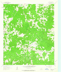
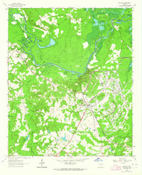
 1962 Jefferson1963 Print · USGSJefferson and the surrounding bayous are shown at a peak of mid-century industrial and rail activity. Researchers can trace the legacy of East Texas through sites like Old Foundry Cem, the Refinery, and the crossing of the Texas and Pacific railroad.2 unique versions available
 - 1962 Map of Potters Point, 1964 Print
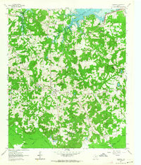
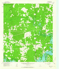
 1962 Potters Point1964 Print · USGSCaddo Lake and the borderlands of Texas and Louisiana appear here in the early sixties, showing a landscape defined by its bayous and early industry. Trace the historic landings and settlements of Uncertain, Swansons Landing, and the riverside Elizabeth Ch.3 unique versions available
 - 1962 Map of Karnack, 1964 Print
 1962 Karnack1964 Print · USGSHarrison County in the early sixties reveals a landscape shaped by military industry and the winding waters of the Cypress Bayou. Researchers can trace the sprawling Longhorn Ordnance Works and the homes of Karnack and Baldwin.2 unique versions available
 - 1962 Map of Avinger, 1964 Print
 1962 Avinger1964 Print · USGSEast Texas rail and timber lands are frozen in time during the early sixties, centered on the junction of Avinger and Hughes Springs. Genealogists and local historians can trace rural roots at Mt Moriah Ch, Traylor Sch, and family landmarks like Donaldson Mountain.2 unique versions available
 - 1962 Map of Ore City, 1964 Print
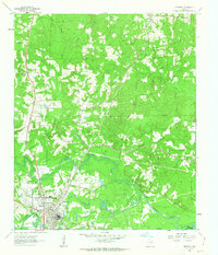
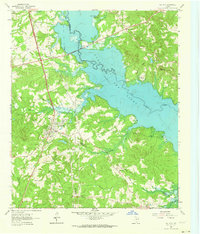 1962 Ore City1964 Print · USGSThe development of East Texas lakefront culture is in full swing during the early sixties as Lake O' the Pines reshapes the landscape near Ore City. Genealogists and historians can trace community roots at Cedar Grove Cem or locate old landmarks like the Mims Chapel Lookout Tower.3 unique versions available
 - 1962 Map of Lone Star, 1964 Print
 1962 Lone Star1964 Print · USGSMorris County in the early sixties was a hub of East Texas industry and rural life, from the growing town of Lone Star to the heavy iron works. Researchers can trace the massive Steel Plant, local landmarks like Hospital in the Pines, and old family burial grounds including South Union Cem.2 unique versions available
End of results
Showing maps 1-17 of 17
Top cities of Marion County
Frequently asked questions
- What are the different types of historical maps available for Marion County?
- What is the oldest map of Marion County?
- Where can I purchase historical maps of Marion County for my home or office?
- Where can I download high-res historical maps of Marion County?
- Are there historical topographic maps available for Marion County?
- Is there historical aerial imagery available for Marion County?
- Where are historical maps of Marion County sourced from?