2020s Maps of Martin County, Texas
Explore 25 historic maps of Martin County from the 2020s. These maps offer a rare glimpse into what life looked like during the 2020s — showing old roads, neighborhoods, homes, and landmarks that have changed or disappeared over time.
Whether you're researching your family's past, planning a metal detecting trip, or studying how Martin County's landscape evolved across the 2020s, these high-resolution maps are a powerful tool for exploring the history of this region.
- Focus on a specific era: All maps on this page are from the 2020s, giving you a focused view of this time period.
- See what’s changed: Compare century-old streets, trails, and buildings to today's modern landscape using overlays and satellite layers.
- Research with precision: Use these maps for genealogy, historical research, land use analysis, or educational projects.
- View, download, or print: Maps are fully viewable online in high resolution, and can be downloaded or printed for your own records.
Start exploring Martin County's history through authentic maps from the 2020s. This is your window into the past.
Martin County, TX maps
(25)- 2022 Map of Patricia SW, 2022 Print
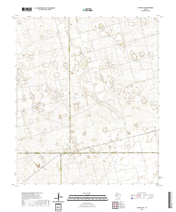 2022 Patricia SW2022 Print · USGSThe West Texas plains at the convergence of four counties are captured here in the early twenty-first century. Researchers can trace the rural road network and water features like Brushy Lake and McKenzie Draw.
 - 2022 Map of Wolcott Ranch, 2022 Print
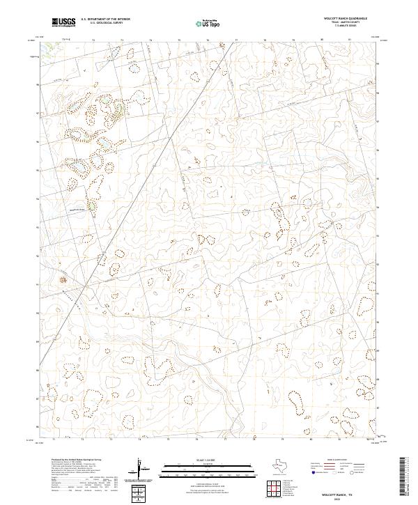 2022 Wolcott Ranch2022 Print · USGSMartin County ranch lands are documented here in the early 2020s, showing the intersection of wide-open West Texas plains and modern road networks. Researchers can trace the paths of Mustang Draw and McKenzie Draw or locate landmarks like North Lake.
 - 2022 Map of Mabee Ranch, 2022 Print
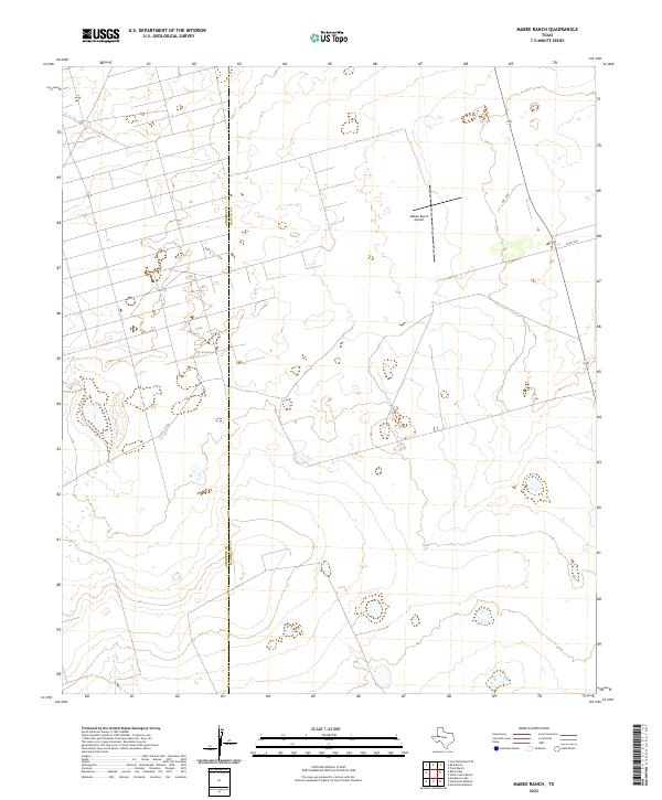 2022 Mabee Ranch2022 Print · USGSThe West Texas plains at the Martin and Andrews county line appear in this recent survey of ranching and aviation infrastructure. Researchers can trace the layout of the Mabee Ranch Airport and transport routes like 349 and PRC 1100.
 - 2022 Map of Flynt Ranch, 2022 Print
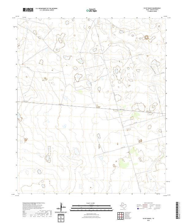 2022 Flynt Ranch2022 Print · USGSModern ranching lands and open plains define this Martin County landscape in 2022. Trace the path of Mustang Draw and the rural road network including Ranch Rd 87 and Hwy 176.
 - 2022 Map of Patricia, 2022 Print
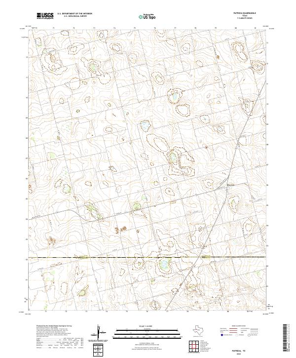 2022 Patricia2022 Print · USGSThe rural borderlands of Dawson and Martin Counties come into focus in this contemporary survey of the High Plains. Researchers can trace the road networks radiating from Patricia, including Ranch Rd 829 and Ranch Rd 2051, to locate specific family land tracts.
 - 2022 Map of Scharbauer Ranch, 2022 Print
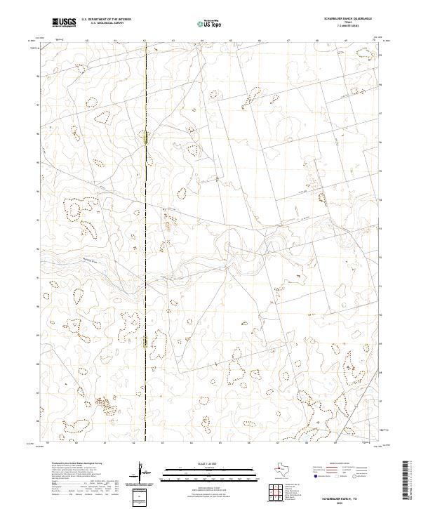 2022 Scharbauer Ranch2022 Print · USGSThe West Texas ranchlands at the border of Martin and Andrews counties are captured here in the early twenty-first century. Researchers can trace the hydrology of Mustang Draw and follow the rural connectivity of Co Rd 4750 and Co Rd 2151.
 - 2022 Map of Bird Ranch, 2022 Print
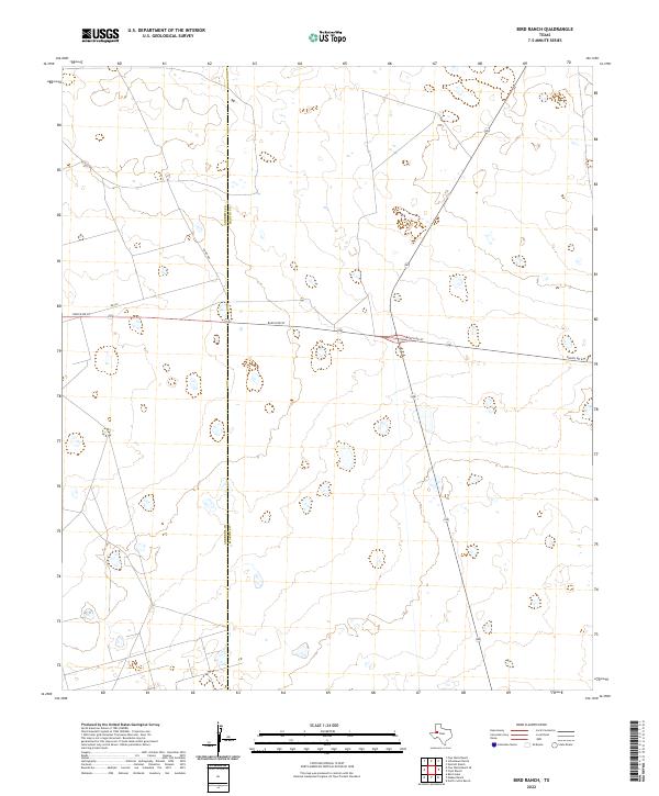 2022 Bird Ranch2022 Print · USGSThe West Texas high plains of Andrews and Martin counties are captured here in the early twenty-first century. Researchers can trace the straight-line border of Andrews Co and Martin Co along the corridor of Ranch Rd 87.
 - 2022 Map of North Curtis Ranch, 2022 Print
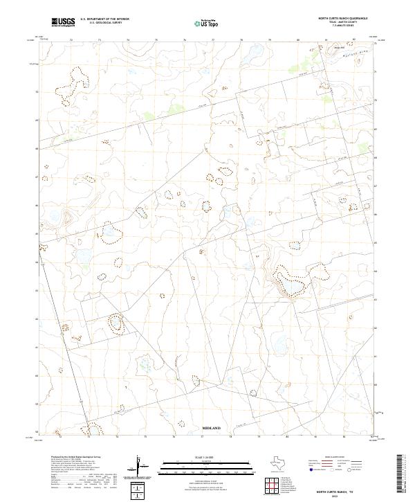 2022 North Curtis Ranch2022 Print · USGSMartin County ranch lands are shown in recent years as the landscape balances traditional cattle operations with energy infrastructure. Researchers can trace rural property access and topography along Mustang Draw, Range Hill, and Lazy Ranch Rd.
 - 2022 Map of Northwest Midland, 2022 Print
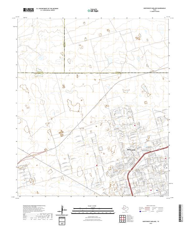 2022 Northwest Midland2022 Print · USGSMidland’s suburban growth and regional road network are clear in this contemporary look at the West Texas landscape. Researchers can trace local development through Tattenham Corner or find the Saint Nicholas Episcopal Church Columbarium.
 - 2022 Map of Northeast Midland, 2022 Print
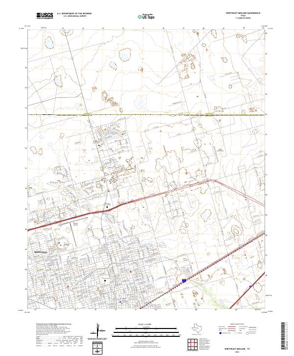 2022 Northeast Midland2022 Print · USGSMidland expands toward the Martin County line in this recent survey of the West Texas Permian Basin. Local historians can trace the urban development around Midland College, Fairview Cem, and the specialized runways at Midland Airpark.
 - 2022 Map of Knott, 2022 Print
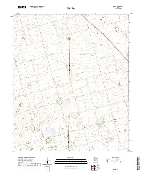 2022 Knott2022 Print · USGSHoward County ranching and farming lands are captured here in the early twenty-first century. Researchers can locate the West Knott Cem and trace the rural road network connecting Knott to the surrounding Martin County line.
 - 2022 Map of Flower Grove, 2022 Print
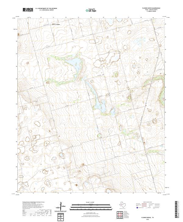 2022 Flower Grove2022 Print · USGSMartin County's ranching and mineral landscape is captured here in the early twenty-first century, showing the rural road networks and intermittent water basins. Researchers can locate the settlement at Three Leagues and trace the drainage patterns around Alkali Lake and Soda Springs.
 - 2022 Map of Houston Ranch, 2022 Print
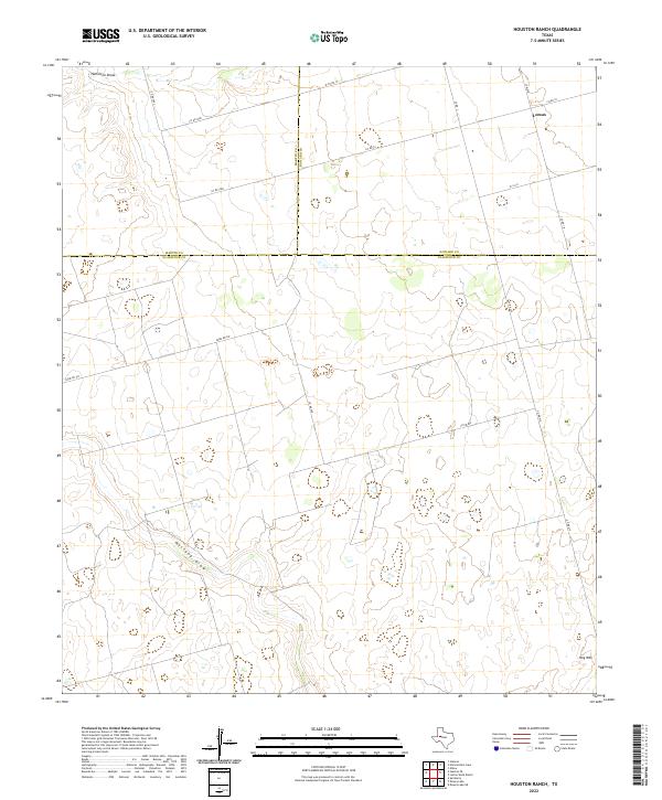 2022 Houston Ranch2022 Print · USGSWest Texas ranch lands are documented here in the early 2020s where three counties converge. Genealogists and researchers can trace the rural network around Lomax and locate landmarks like Hog Mtn and the seasonal path of Mustang Draw.
 - 2022 Map of Lenorah East, 2022 Print
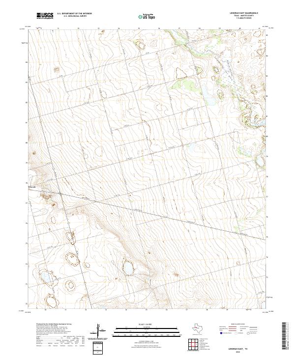 2022 Lenorah East2022 Print · USGSMartin County ranching and rural life are preserved here in the 2020s, showing the intersection of local industry and the high plains. Researchers can trace the layout of Lenorah and the paths of Sulphur Springs Draw and Death Valley.
 - 2022 Map of Stanton SE, 2022 Print
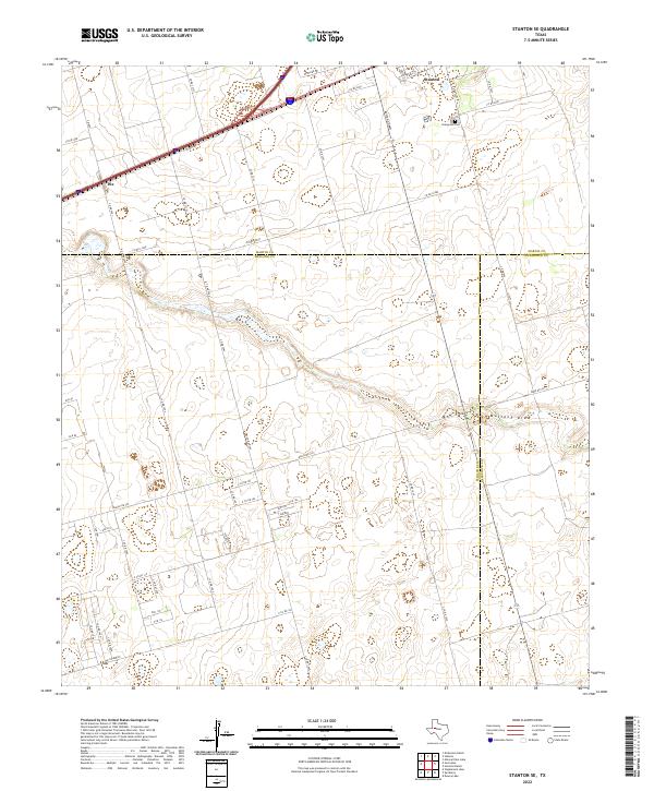 2022 Stanton SE2022 Print · USGSThe West Texas plains at the meeting point of Martin, Midland, and Glasscock counties are shown in this 2022 survey. Genealogists and historians can trace family locations near Stanton, Dix, and the Evergreen Cem while following the path of Mustang Draw.
 - 2022 Map of Knott SW, 2022 Print
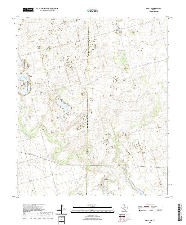 2022 Knott SW2022 Print · USGSHoward and Martin Counties are captured here in the early twenty-first century, showing the vast ranching and energy landscape. Researchers can locate Knott Cem and trace the paths of Sulphur Springs Draw and Red Lake.
 - 2022 Map of Sparenberg, 2022 Print
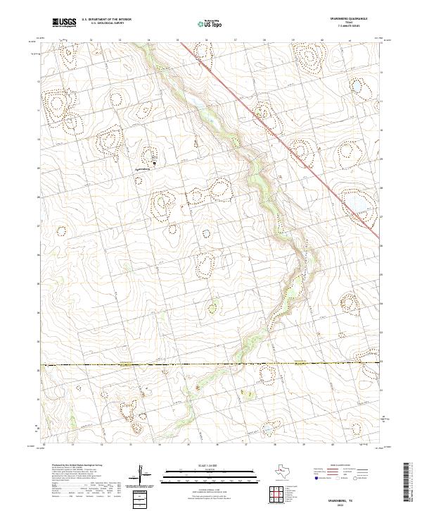 2022 Sparenberg2022 Print · USGSThe rural community of Sparenberg and the high plains of West Texas are documented here in the early twenty-first century. Genealogists and local researchers can locate family sites near the Grace Lutheran Cem and trace property boundaries along Sulphur Springs Draw.
 - 2022 Map of Merrick, 2022 Print
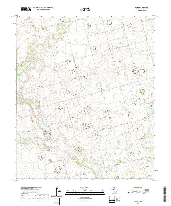 2022 Merrick2022 Print · USGSMartin County's rural landscape is captured here in the early 2020s, showcasing the intricate grid of ranch roads and local drainage patterns. Genealogists and local historians can trace the paths of Sulphur Springs Draw and the junction of N Fm 26 and E Fm 26.
 - 2022 Map of Tenmile, 2022 Print
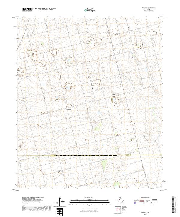 2022 Tenmile2022 Print · USGSThe West Texas high plains of the Llano Estacado are surveyed here in 2022, capturing the rural community of Klondike and the Dawson Co line. Researchers can trace land divisions and local landmarks like Thorp Airport and Farm Rd 2002-E.
 - 2022 Map of Germania, 2022 Print
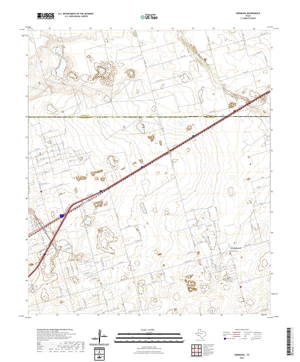 2022 Germania2022 Print · USGSMidland and Martin counties appear here in the early twenty-first century as the high plains landscape continues to develop. Genealogists and local researchers can locate Greenwood and the Greenwood Cem, or trace the path of Mustang Draw.
 - 2022 Map of Natural Dam Lake, 2022 Print
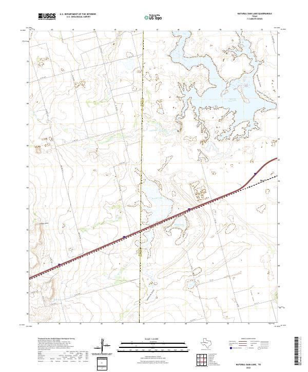 2022 Natural Dam Lake2022 Print · USGSHoward County ranch lands and the community of Morita are documented here in the early twenty-first century. Researchers can trace the unique hydrology of Natural Dam Lake and Red Salt Lake or locate named landmarks like Indian Point and Calf Tank.
 - 2022 Map of Dickenson Ranch, 2022 Print
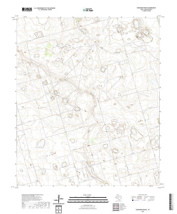 2022 Dickenson Ranch2022 Print · USGSThe West Texas ranchlands of Martin County are captured here in the early 2020s. Researchers can trace the drainage of Mustang Draw and locate the historic Mustang Spring among a network of rural routes like Farm Rd 1208.
 - 2022 Map of Stanton, 2022 Print
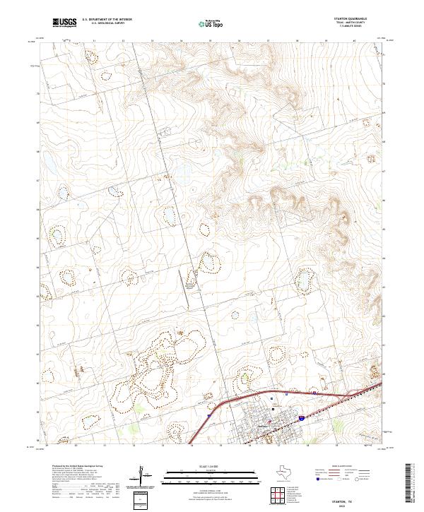 2022 Stanton2022 Print · USGSMartin County, Texas, is captured in this contemporary survey of the high plains ranching and farming country surrounding Stanton. Local researchers can locate family sites along CO RD 3201, trace the town grid near the Martin County Courthouse, or find Saint Joseph Cem.
 - 2022 Map of Ackerly, 2022 Print
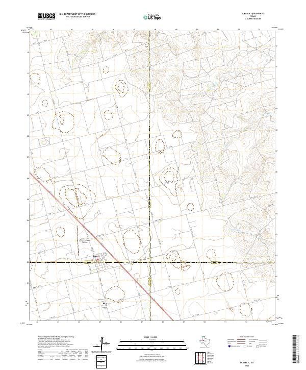 2022 Ackerly2022 Print · USGSThe West Texas town of Ackerly is captured at the unique four-county junction of Dawson, Borden, Martin, and Howard. Researchers can trace local lineage at Fairhaven Cem or locate the Coleman Cattle Company Number 1 Airport amidst a network of ranch-to-market roads.
 - 2022 Map of Lenorah West, 2022 Print
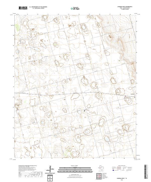 2022 Lenorah West2022 Print · USGSMartin County, Texas, is captured here in its modern rural character, defined by vast ranching tracts and a rigid grid of country roads. Researchers can locate the Hopper Cem and trace the path of Mustang Draw as it winds through the landscape near Lenorah.
End of results
Showing maps 1-25 of 25
Top cities of Martin County
Frequently asked questions
- What are the different types of historical maps available for Martin County?
- What is the oldest map of Martin County?
- Where can I purchase historical maps of Martin County for my home or office?
- Where can I download high-res historical maps of Martin County?
- Are there historical topographic maps available for Martin County?
- Is there historical aerial imagery available for Martin County?
- Where are historical maps of Martin County sourced from?