2020s Maps of Mason, Texas
Explore 4 historic maps of Mason from the 2020s. These maps offer a rare glimpse into what life looked like during the 2020s — showing old roads, neighborhoods, homes, and landmarks that have changed or disappeared over time.
Whether you're researching your family's past, planning a metal detecting trip, or studying how Mason's landscape evolved across the 2020s, these high-resolution maps are a powerful tool for exploring the history of this region.
- Focus on a specific era: All maps on this page are from the 2020s, giving you a focused view of this time period.
- See what’s changed: Compare century-old streets, trails, and buildings to today's modern landscape using overlays and satellite layers.
- Research with precision: Use these maps for genealogy, historical research, land use analysis, or educational projects.
- View, download, or print: Maps are fully viewable online in high resolution, and can be downloaded or printed for your own records.
Start exploring Mason's history through authentic maps from the 2020s. This is your window into the past.
Mason, TX maps
(4)- 2022 Map of Turtle Creek, 2022 Print
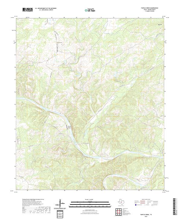 2022 Turtle Creek2022 Print · USGSThe Texas Hill Country south of Mason is captured here during the early twenty-first century as ranching and river geography define the land. Trace rural landmarks like Snowden Field, Kothmann Springs, and the junction of the Llano River and James River.
 - 2022 Map of Mason, 2022 Print
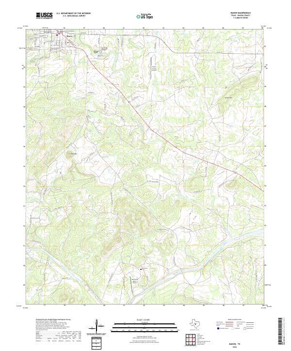 2022 Mason2022 Print · USGSMason and the surrounding Texas Hill Country are captured here in the early twenty-first century, showing a mix of historic settlement and ranching land. Genealogists and researchers can locate the Mason County Courthouse, find the Reichenau Cem, and trace the path of the Llano River.
 - 2022 Map of Purdy Hill, 2022 Print
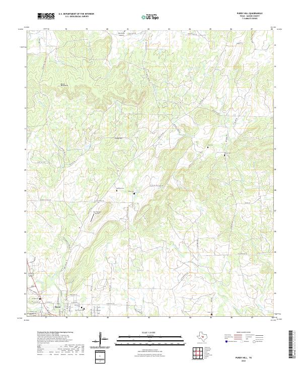 2022 Purdy Hill2022 Print · USGSMason County ranching country is captured here during the early twenty-first century, showing a landscape shaped by rugged hills and family estates. Genealogists can locate several historic burial sites, including the Old Gooch Cem, Jones Cem, and Polk Cem.
 - 2022 Map of Grit, 2022 Print
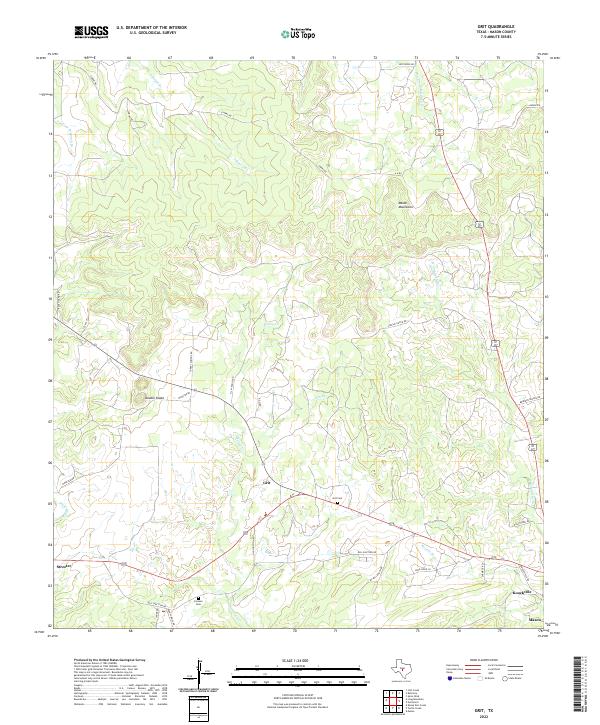 2022 Grit2022 Print · USGSThe rural landscapes west of Mason come into focus in the early 21st century, showing a network of ranch roads and limestone hills. Genealogists and local historians can trace family ties at Grit Cem or Cavness Cem and locate the small communities of Streeter and Grit.
End of results
Showing maps 1-4 of 4
Frequently asked questions
- What are the different types of historical maps available for Mason?
- What is the oldest map of Mason?
- Where can I purchase historical maps of Mason for my home or office?
- Where can I download high-res historical maps of Mason?
- Are there historical topographic maps available for Mason?
- Is there historical aerial imagery available for Mason?
- Where are historical maps of Mason sourced from?