Old Maps of Matagorda County, Texas
Explore 97 old maps of Matagorda County, spanning from 1943 to today. These high-resolution historic maps reveal how streets, neighborhoods, landmarks, and natural features evolved over time — perfect for genealogy, metal detecting, research, and local history exploration.
What you can do with these maps:
- See how Matagorda County changed over time: Compare historical maps to modern-day views to trace roads, homesites, rail lines & more.
- View detailed metadata: Each map includes creators, publishers, year, scale, and archive source.
- Overlay maps with satellite & LiDAR: Visualize the past alongside modern tools to explore terrain & human change.
- Trusted historical sources: Maps sourced from the USGS, Library of Congress, and other archives.
- Access maps your way: View online, download high-res files, or order prints for personal or research use.
Start exploring old maps of Matagorda County to uncover forgotten places, hidden landmarks, and the deep history beneath your feet.
Matagorda County, TX maps
(97)- 1943 Map of Cedar Lakes East, 1958 Print
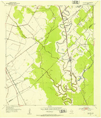
 1943 Cedar Lakes East1958 Print · USGSThe Texas coast near the mouth of the San Bernard River was a landscape of deep-water channels and marshes in the early 1940s. Genealogists and local historians can locate the Ducroz Cem and early settlements like Owen and the Hotel.
 - 1950 Map of Houston, 1953 Print
 1950 Houston1953 Print · USGSCoastal Texas in the early fifties reveals a landscape of massive civil engineering and industrial transit. Genealogists and researchers can trace the growth of the Houston suburbs and the maritime infrastructure of Galveston Bay, including the Gulf Freeway and the Texas City Dike.
 - 1951 Map of Bay City
 1951 Bay City1951 Print · USGSThe mid-century Texas Gulf Coast comes to life in this survey of the delta region where the Brazos and Colorado Rivers meet the sea. Researchers can trace the industrial footprint of Freeport or locate family-named spots like Mangun and Hawkinsville.
 - 1951 Map of Danevang, 1953 Print
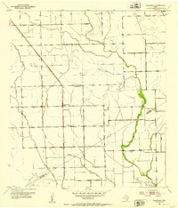 1951 Danevang1953 Print · USGSThe coastal prairie of Wharton and Matagorda Counties comes to life in the early 1950s, showing a landscape defined by ranching and oil. Trace local community roots at Danevang, the Danevang Sch, and the oil wells surrounding Liberty Sch.2 unique versions available
 - 1952 Map of Palacios SE, 1953 Print
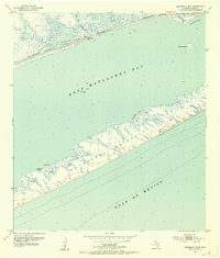
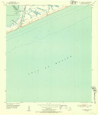
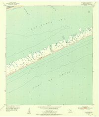 1952 Palacios SE1953 Print · USGSThe Matagorda coast in the early fifties shows a remote stretch of the Matagorda Peninsula between the bay and the open gulf. Researchers can trace the complex wetlands of Maverick Bayou or locate the Submerged Iron Rails lying offshore.4 unique versions available
 - 1952 Map of Danciger, 1953 Print
 1952 Danciger1953 Print · USGSCoastal Texas industry and rural life meet in the early fifties as the Pledger Gas Field expands across the Brazoria County bayous. Genealogists and historians can trace family-named sites like Brown Cem and St Mary Ch near the banks of Dance Bayou.3 unique versions available
 - 1952 Map of Ashwood, 1953 Print
 1952 Ashwood1953 Print · USGSThe mid-century Texas Gulf Coast comes to life in this survey of the petroleum-rich coastal plains at the Matagorda and Brazoria county line. Researchers can trace the industrial landscape of the Old Ocean Oil Field and locate rural landmarks like Free System Cem and the Southern Pacific rail line.4 unique versions available
 - 1952 Map of Lake Austin, 1953 Print
 1952 Lake Austin1953 Print · USGSThe Matagorda County coast in the early fifties shows a landscape defined by hydraulic engineering and oil exploration. Trace the mid-century shoreline and wetland management through the Levee systems and numerous Flowing Wells near Lake Austin.2 unique versions available
 - 1952 Map of Palacios Point, 1953 Print
 1952 Palacios Point1953 Print · USGSThe Matagorda County shoreline in the early fifties shows a landscape of strategic waterways and barrier peninsulas. Researchers can trace the engineering of the Intracoastal Waterway past Palacios Point and the remote Matagorda Peninsula.2 unique versions available
 - 1952 Map of Lane City SE, 1953 Print
 1952 Lane City SE1953 Print · USGSThe Texas Gulf Coast comes to life in the early fifties as the oil industry expands near the winding Colorado River. Researchers can trace the legacy of the North Markham Oil Field and local landmarks like the East KO Sch and Jennings Lake.3 unique versions available
 - 1952 Map of Cedar Lane NE, 1953 Print
 1952 Cedar Lane NE1953 Print · USGSBrazoria County at mid-century reveals a landscape defined by state land use and river-based industry along the Gulf Coast. Genealogists and historians can trace local landmarks like Jerusalem Sch, the rural Galilee Ch, and the industrial Sulphur Plant.3 unique versions available
 - 1952 Map of Pledger, 1953 Print
 1952 Pledger1953 Print · USGSThe coastal prairie of the Texas Gulf Coast comes to life in this early 1950s survey of the Wharton and Matagorda county lines. Genealogists and researchers can trace local landmarks like Union Cem and Bethlehem Ch or follow the rail junctions at Newgulf Junction and Cane Junction.3 unique versions available
 - 1952 Map of Matagorda, 1953 Print
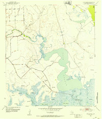
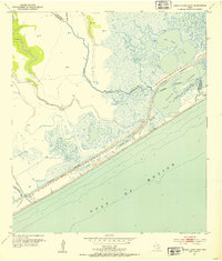
 1952 Matagorda1953 Print · USGSThe Matagorda coast at mid-century reveals a landscape of river islands and bayous where the rail line met the sea. Trace the old village grid near the Matagorda Cem and the Pontoon Bridge crossing the Intracoastal Waterway.4 unique versions available
 - 1952 Map of Blessing SE, 1953 Print
 1952 Blessing SE1953 Print · USGSCoastal Matagorda County in the early fifties shows a landscape of river islands and drainage projects shaped by the Gulf plains. Researchers can trace the Old Railroad Grade and locate local landmarks like Tin Top, St Mary Ch, and Lake Le Tulle.2 unique versions available
 - 1952 Map of Palacios, 1953 Print
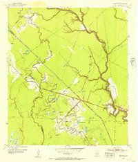
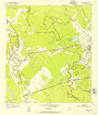
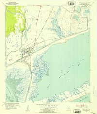
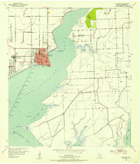 1952 Palacios1953 Print · USGSThe Matagorda County coastline comes alive in the early fifties, showing the strategic position of Palacios at the head of the bay. Researchers can trace the layout of Camp Hulen, locate the Collegeport Cem, and see the early network of Gas Wells.3 unique versions available
 - 1952 Map of Dressing Point, 1953 Print
 1952 Dressing Point1953 Print · USGSThe Texas coast in the early fifties shows a landscape of barrier peninsulas and engineered waterways before extensive modern development. Trace the maritime geography of Matagorda Peninsula, the access at Chinquapin Landing, and the remote Dressing Point.
 - 1952 Map of Turtle Bay, 1953 Print
 1952 Turtle Bay1953 Print · USGSThe Matagorda County coastline during the early fifties reveals a landscape of coastal defenses and aviation infrastructure. Researchers can locate Camp Hulen, the Palacios Municipal Airport, and rural landmarks like Carancahua Ch.3 unique versions available
 - 1952 Map of Cedar Lakes West, 1953 Print
 1952 Cedar Lakes West1953 Print · USGSThe Matagorda and Brazoria county line met the Texas coast in the early fifties amidst a labyrinth of marshes and industrial canals. Trace the engineering of the Intracoastal Waterway and locate remote landmarks like the Pontoon Bridge and early coastal Oil Wells.4 unique versions available
 - 1952 Map of Francitas, 1953 Print
 1952 Francitas1953 Print · USGSThe coastal prairies of Jackson and Matagorda counties come to life in the early 1950s, showing a landscape defined by ranching and the oil industry. Researchers can trace the Missouri Pacific rail line, the Deutschburg Sch, and industrial sites like Francitas Field.2 unique versions available
 - 1952 Map of Matagorda SW, 1953 Print
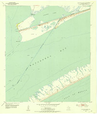
 1952 Matagorda SW1953 Print · USGSThe Texas Gulf Coast during the early fifties reveals a dynamic landscape of barrier islands and river outlets. Coastal researchers can trace the shifting sands of the Matagorda Peninsula and the original course of the Colorado River past Tiger Island.2 unique versions available
 - 1952 Map of South of Palacios Point, 1953 Print
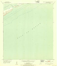 1952 South of Palacios Point1953 Print · USGSThe Texas coast in the early fifties is defined here by the slender reach of the Matagorda Peninsula. Researchers can trace the mid-century shoreline and identify small markers like the Windmill and the entrance to Greens Bayou.2 unique versions available
 - 1952 Map of Blessing, 1953 Print
 1952 Blessing1953 Print · USGSCoastal Texas in the early fifties shows a landscape of rail junctions and emerging energy fields north of the bay. Genealogists can locate Blessing Cem and Ashby Cem, or trace the rail lines through the settlement at Pheasant.2 unique versions available
 - 1952 Map of Brown Cedar Cut, 1953 Print
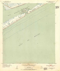 1952 Brown Cedar Cut1953 Print · USGSThe Matagorda coast in the early fifties shows a dynamic landscape of barrier islands and vital shipping lanes. Maritime researchers can trace the original path of the Intracoastal Waterway and the tidal opening of Brown Cedar Cut.2 unique versions available
 - 1952 Map of Bay City, 1953 Print
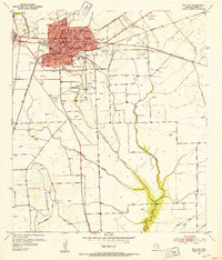 1952 Bay City1953 Print · USGSBay City at the start of the fifties serves as a bustling rail and oil hub for Matagorda County. Researchers can trace the mid-century footprint of the Oil Refinery, the Mo Pac Sta, and local landmarks like the Hilliard Sch.2 unique versions available
 - 1952 Map of Markham, 1953 Print
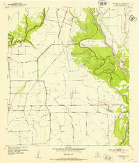
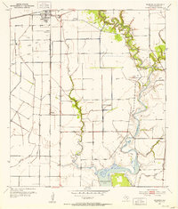
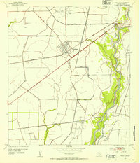 1952 Markham1953 Print · USGSMid-century Matagorda County is defined here by the intersection of the oil industry and the rail lines of the coastal plains. Researchers can trace the development of Markham and Buckeye alongside the North Markham Oil Field and the Colorado River.2 unique versions available
Showing maps 1-25 of 97
Top cities of Matagorda County
Frequently asked questions
- What are the different types of historical maps available for Matagorda County?
- What is the oldest map of Matagorda County?
- Where can I purchase historical maps of Matagorda County for my home or office?
- Where can I download high-res historical maps of Matagorda County?
- Are there historical topographic maps available for Matagorda County?
- Is there historical aerial imagery available for Matagorda County?
- Where are historical maps of Matagorda County sourced from?