1960s Maps of McCulloch County, Texas
Explore 12 historic maps of McCulloch County from the 1960s. These maps offer a rare glimpse into what life looked like during the 1960s — showing old roads, neighborhoods, homes, and landmarks that have changed or disappeared over time.
Whether you're researching your family's past, planning a metal detecting trip, or studying how McCulloch County's landscape evolved across the 1960s, these high-resolution maps are a powerful tool for exploring the history of this region.
- Focus on a specific era: All maps on this page are from the 1960s, giving you a focused view of this time period.
- See what’s changed: Compare century-old streets, trails, and buildings to today's modern landscape using overlays and satellite layers.
- Research with precision: Use these maps for genealogy, historical research, land use analysis, or educational projects.
- View, download, or print: Maps are fully viewable online in high resolution, and can be downloaded or printed for your own records.
Start exploring McCulloch County's history through authentic maps from the 1960s. This is your window into the past.
McCulloch County, TX maps
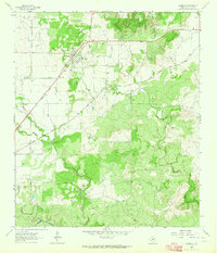
(12)- 1960 Map of West Sweden, 1961 Print
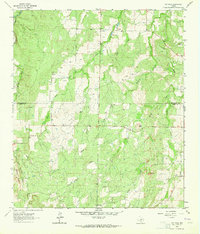
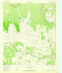 1960 West Sweden1961 Print · USGSMcCulloch County in the early sixties shows a landscape of cattle ranching and rail commerce at the base of the Brady Mountains. Researchers can trace the Gulf Colorado and Santa Fe line through Niblock or locate the Carroll Colony Cem near the banks of Bowie Creek.2 unique versions available
 - 1960 Map of Melvin, 1961 Print
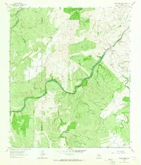
 1960 Melvin1961 Print · USGSMcCulloch County in the early sixties centers on the rail-side community of Melvin as it navigates the landscape of the BRADY MOUNTAINS. Researchers can trace the path of the GULF COLORADO AND SANTA FE railroad through Whiteland and Homer Junction or locate family plots at Melvin Cem.2 unique versions available
 - 1960 Map of Brady North, 1961 Print
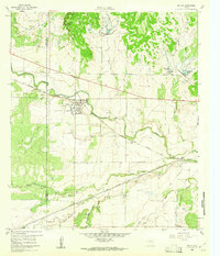
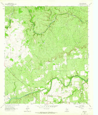
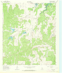
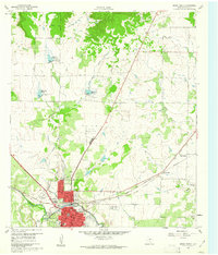 1960 Brady North1961 Print · USGSBrady and the surrounding McCulloch County hills are captured here in the early sixties as a center of Texas ranching and rail. Genealogists can locate family landmarks like Rest Haven Cem, Live Oak Cem, and the community of East Sweden.3 unique versions available
 - 1962 Map of Fredonia, 1965 Print
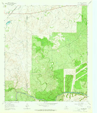
 1962 Fredonia1965 Print · USGSThe ranchlands of the Texas Hill Country meet at the three-county junction of Mason, McCulloch, and San Saba in the early 1960s. Genealogists and local historians can trace the rural landscape of Fredonia, finding the Union Band Ch and family sites near Deer Creek Cem.2 unique versions available
 - 1963 Map of Spy Rock, 1964 Print
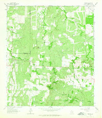
 1963 Spy Rock1964 Print · USGSThe hill country of McCulloch and Mason counties is captured here in the early sixties, as the ranching landscape remained defined by family-run tracts. Genealogists and local historians can locate remote burial sites like Blackjack Cem and prominent landmarks including Spy Rock and Tabor Mountain.2 unique versions available
 - 1963 Map of Pecan Springs, 1964 Print
 1963 Pecan Springs1964 Print · USGSRanching and river life define the McCulloch and San Saba county line during the early sixties. Genealogists and historians can trace family-named landmarks and essential water sources like Pecan Springs, Sperrell Ranch, and the winding Horseshoe Bend of the San Saba River.2 unique versions available
 - 1963 Map of Voca, 1964 Print
 1963 Voca1964 Print · USGSDeep in the Texas Hill Country during the early sixties, this survey of McCulloch County captures a landscape of ranching and river life. Researchers can locate the Spiller Cemetery, Liberty Church, and many family-named landmarks like Brook Ranch.2 unique versions available
 - 1963 Map of Lost Creek, 1964 Print
 1963 Lost Creek1964 Print · USGSSan Saba and McCulloch counties are captured here in the early sixties, showing a landscape of working ranch land and winding creek beds. Researchers can trace the Gulf Colorado and Santa Fe rail line or locate landmarks like Camp Billy Gibbons and Plum Hollow.2 unique versions available
 - 1963 Map of Rochelle, 1964 Print
 1963 Rochelle1964 Print · USGSThe community of Rochelle in the early 1960s is centered among a network of quarries and the Gulf Colorado and Santa Fe railroad. Researchers can trace the path of the Old Railroad Grade or locate family sites at Rochelle Cem and the Price Landing Strip.2 unique versions available
 - 1963 Map of Brady SW, 1964 Print
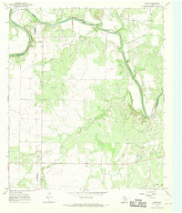
 1963 Brady SW1964 Print · USGSMcCulloch County was undergoing significant water management in the early sixties as new impoundments shaped the ranch land. Trace the early spillways and creek beds of Brady Reservoir, Reservoir No 5, and Post Oak Creek.2 unique versions available
 - 1967 Map of Doole, 1969 Print
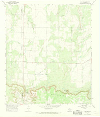
 1967 Doole1969 Print · USGSCentral Texas ranching country comes into focus in the late sixties along the winding Colorado River. Local historians can trace family roots around Stacy and Doole, or locate the rural Cem and isolated landmarks like Wallooppe.
 - 1967 Map of Salt Gap, 1969 Print
 1967 Salt Gap1969 Print · USGSThe border of Concho and McCulloch counties comes alive in the late sixties as the ranching country meets the Brady Mountains. Genealogists and researchers can trace the roads around Salt Gap and locate family landmarks like Rattlesnake Point or Little Saddle Creek.2 unique versions available
End of results
Showing maps 1-12 of 12
Top cities of McCulloch County
Frequently asked questions
- What are the different types of historical maps available for McCulloch County?
- What is the oldest map of McCulloch County?
- Where can I purchase historical maps of McCulloch County for my home or office?
- Where can I download high-res historical maps of McCulloch County?
- Are there historical topographic maps available for McCulloch County?
- Is there historical aerial imagery available for McCulloch County?
- Where are historical maps of McCulloch County sourced from?