1900s (20th Century) Maps of McCulloch County, Texas
Explore 40 historic maps of McCulloch County from the 1900s (20th Century). These maps offer a rare glimpse into what life looked like during the 1900s — showing old roads, neighborhoods, homes, and landmarks that have changed or disappeared over time.
Whether you're researching your family's past, planning a metal detecting trip, or studying how McCulloch County's landscape evolved across the 1900s, these high-resolution maps are a powerful tool for exploring the history of this region.
- Focus on a specific era: All maps on this page are from the 1900s, giving you a focused view of this time period.
- See what’s changed: Compare century-old streets, trails, and buildings to today's modern landscape using overlays and satellite layers.
- Research with precision: Use these maps for genealogy, historical research, land use analysis, or educational projects.
- View, download, or print: Maps are fully viewable online in high resolution, and can be downloaded or printed for your own records.
Start exploring McCulloch County's history through authentic maps from the 1900s. This is your window into the past.
McCulloch County, TX maps
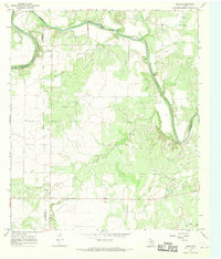
(40)- 1924 Map of Eden 1-a
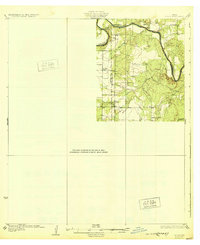
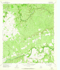
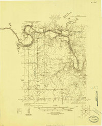 1924 Eden 1-a1924 Print · USGSThe Concho and Colorado River confluence area was a landscape of river crossings and small schoolhouse districts in the mid-1920s. Genealogists can trace early homesteads near Stacy and Doole, or locate landmarks like Bethel Church and the Hardin School.
 - 1924 Map of Brady 2-a
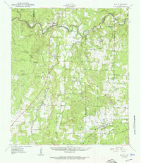
 1924 Brady 2-a1924 Print · USGSThe ranching and farming lands of Central Texas are captured here in the mid-1920s, centering on the deep bends of the river. Researchers can trace early river crossings like Military Crossing and local landmarks such as Whon and the Cow Creek Tabernacle.
 - 1925 Map of Brady 2-b
 1925 Brady 2-b1925 Print · USGSMcCulloch County during the mid-1920s reveals a landscape defined by the serpentine bends of the Colorado River and scattered rural communities. Genealogists and historians can locate specific sites like Marion School, Chaffin Cem, and the river transit point at Chaffin Crossing.
 - 1925 Map of Brady 1-b
 1925 Brady 1-b1925 Print · USGSThe Colorado River corridor near the border of McCulloch and Brown counties is captured here in the mid-1920s. Researchers can trace early infrastructure like the Rio Grande Highway and the railroad station at Mercury, or locate family-named landmarks like Morgen Mtn.
 - 1925 Map of Brady 1-a
 1925 Brady 1-a1925 Print · USGSCentral Texas river country and ranchland are captured in the mid-1920s as early highway networks began to reach remote crossings. Researchers can locate early rural landmarks like Elm Grove Church, Holt School, and the settlement of Milburn.
 - 1928 Map of Mercury
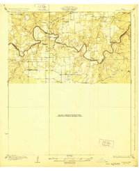
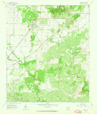
 1928 Mercury1928 Print · USGSCentral Texas river country comes to life in the late 1920s as the railroad connects small cattle towns near the four-county junction. Trace family roots at Mercury and Winchell, or locate old landmarks like Elm Grove Church and Holt School.
 - 1928 Map of Waldrip
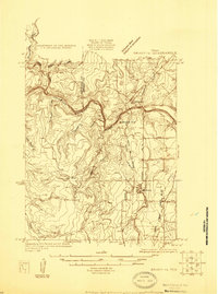
 1928 Waldrip1928 Print · USGSCrossing the Colorado River in the late 1920s, this area of McCulloch and Coleman Counties was a landscape of remote ranches and vital river fords. Genealogists can locate family landmarks like Chaffin Cem and White Ranch or trace old routes through Military Crossing.2 unique versions available
 - 1931 Map of Stacy
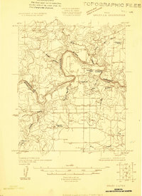
 1931 Stacy1931 Print · USGSCentral Texas ranching country comes into focus during the 1920s as the river defines three county lines. Genealogists can locate rural schoolhouses like Hardin Sch and Williams Sch or trace old river fords at Crane Crossing.2 unique versions available
 - 1950 Map of Mercury
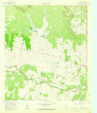
 1950 Mercury1950 Print · USGSMcCulloch County and its neighbors are shown in the mid-twentieth century as the rural landscape transitioned from pioneer roots to modern ranching. Researchers can trace family history through community sites like Cowboy Cemetery, Elm Grove School, and the village of Mercury.2 unique versions available
 - 1954 Map of Brownwood, 1955 Print
 1954 Brownwood1955 Print · USGSCentral Texas in the early fifties shows a landscape of rail-linked cattle towns and winding river valleys before modern highway expansion. Genealogists and historians can trace family-named peaks and vanished rail stops like Trickham, Santa Anna, and the Brady Mountains.3 unique versions available
 - 1954 Map of Llano, 1964 Print
 1954 Llano1964 Print · USGSThe Texas Hill Country and Highland Lakes appear in the mid-fifties, just as new reservoirs began reshaping the landscape. Trace ranching history and river routes from Mason to Llano, or follow the Gulf Colorado and Santa Fe RR past Buchanan Lake.2 unique versions available
 - 1955 Map of Llano
 1955 Llano1955 Print · USGSCentral Texas and the Hill Country are seen here during the mid-1950s growth of the Highland Lakes. Trace old settlements and geologic landmarks from Enchanted Rock and Longhorn Cavern to the small community of Luckenbach.
 - 1956 Map of Llano, 1976 Print
 1956 Llano1976 Print · USGSThe Texas Hill Country comes alive in this mid-seventies survey of the Llano Uplift and Colorado River lakes. Genealogists and historians can trace family roots through settlements like Luckenbach and Castell or locate the famed L B J Ranch and Enchanted Rock.
 - 1960 Map of West Sweden, 1961 Print
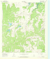
 1960 West Sweden1961 Print · USGSMcCulloch County in the early sixties shows a landscape of cattle ranching and rail commerce at the base of the Brady Mountains. Researchers can trace the Gulf Colorado and Santa Fe line through Niblock or locate the Carroll Colony Cem near the banks of Bowie Creek.2 unique versions available
 - 1960 Map of Melvin, 1961 Print
 1960 Melvin1961 Print · USGSMcCulloch County in the early sixties centers on the rail-side community of Melvin as it navigates the landscape of the BRADY MOUNTAINS. Researchers can trace the path of the GULF COLORADO AND SANTA FE railroad through Whiteland and Homer Junction or locate family plots at Melvin Cem.2 unique versions available
 - 1960 Map of Brady North, 1961 Print
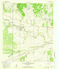
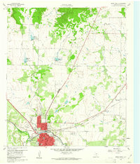 1960 Brady North1961 Print · USGSBrady and the surrounding McCulloch County hills are captured here in the early sixties as a center of Texas ranching and rail. Genealogists can locate family landmarks like Rest Haven Cem, Live Oak Cem, and the community of East Sweden.3 unique versions available
 - 1962 Map of Fredonia, 1965 Print
 1962 Fredonia1965 Print · USGSThe ranchlands of the Texas Hill Country meet at the three-county junction of Mason, McCulloch, and San Saba in the early 1960s. Genealogists and local historians can trace the rural landscape of Fredonia, finding the Union Band Ch and family sites near Deer Creek Cem.2 unique versions available
 - 1963 Map of Spy Rock, 1964 Print
 1963 Spy Rock1964 Print · USGSThe hill country of McCulloch and Mason counties is captured here in the early sixties, as the ranching landscape remained defined by family-run tracts. Genealogists and local historians can locate remote burial sites like Blackjack Cem and prominent landmarks including Spy Rock and Tabor Mountain.2 unique versions available
 - 1963 Map of Pecan Springs, 1964 Print
 1963 Pecan Springs1964 Print · USGSRanching and river life define the McCulloch and San Saba county line during the early sixties. Genealogists and historians can trace family-named landmarks and essential water sources like Pecan Springs, Sperrell Ranch, and the winding Horseshoe Bend of the San Saba River.2 unique versions available
 - 1963 Map of Voca, 1964 Print
 1963 Voca1964 Print · USGSDeep in the Texas Hill Country during the early sixties, this survey of McCulloch County captures a landscape of ranching and river life. Researchers can locate the Spiller Cemetery, Liberty Church, and many family-named landmarks like Brook Ranch.2 unique versions available
 - 1963 Map of Lost Creek, 1964 Print
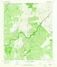
 1963 Lost Creek1964 Print · USGSSan Saba and McCulloch counties are captured here in the early sixties, showing a landscape of working ranch land and winding creek beds. Researchers can trace the Gulf Colorado and Santa Fe rail line or locate landmarks like Camp Billy Gibbons and Plum Hollow.2 unique versions available
 - 1963 Map of Rochelle, 1964 Print
 1963 Rochelle1964 Print · USGSThe community of Rochelle in the early 1960s is centered among a network of quarries and the Gulf Colorado and Santa Fe railroad. Researchers can trace the path of the Old Railroad Grade or locate family sites at Rochelle Cem and the Price Landing Strip.2 unique versions available
 - 1963 Map of Brady SW, 1964 Print
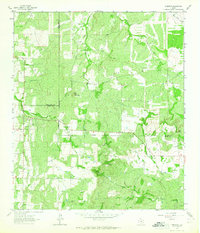
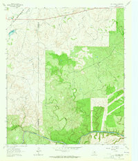
 1963 Brady SW1964 Print · USGSMcCulloch County was undergoing significant water management in the early sixties as new impoundments shaped the ranch land. Trace the early spillways and creek beds of Brady Reservoir, Reservoir No 5, and Post Oak Creek.2 unique versions available
 - 1967 Map of Doole, 1969 Print
 1967 Doole1969 Print · USGSCentral Texas ranching country comes into focus in the late sixties along the winding Colorado River. Local historians can trace family roots around Stacy and Doole, or locate the rural Cem and isolated landmarks like Wallooppe.
 - 1967 Map of Salt Gap, 1969 Print
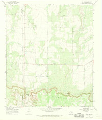 1967 Salt Gap1969 Print · USGSThe border of Concho and McCulloch counties comes alive in the late sixties as the ranching country meets the Brady Mountains. Genealogists and researchers can trace the roads around Salt Gap and locate family landmarks like Rattlesnake Point or Little Saddle Creek.2 unique versions available
Showing maps 1-25 of 40
Top cities of McCulloch County
Frequently asked questions
- What are the different types of historical maps available for McCulloch County?
- What is the oldest map of McCulloch County?
- Where can I purchase historical maps of McCulloch County for my home or office?
- Where can I download high-res historical maps of McCulloch County?
- Are there historical topographic maps available for McCulloch County?
- Is there historical aerial imagery available for McCulloch County?
- Where are historical maps of McCulloch County sourced from?