2020s Maps of Bellmead, Texas
Explore 2 historic maps of Bellmead from the 2020s. These maps offer a rare glimpse into what life looked like during the 2020s — showing old roads, neighborhoods, homes, and landmarks that have changed or disappeared over time.
Whether you're researching your family's past, planning a metal detecting trip, or studying how Bellmead's landscape evolved across the 2020s, these high-resolution maps are a powerful tool for exploring the history of this region.
- Focus on a specific era: All maps on this page are from the 2020s, giving you a focused view of this time period.
- See what’s changed: Compare century-old streets, trails, and buildings to today's modern landscape using overlays and satellite layers.
- Research with precision: Use these maps for genealogy, historical research, land use analysis, or educational projects.
- View, download, or print: Maps are fully viewable online in high resolution, and can be downloaded or printed for your own records.
Start exploring Bellmead's history through authentic maps from the 2020s. This is your window into the past.
Bellmead, TX maps
(2)- 2022 Map of Elm Mott, 2022 Print
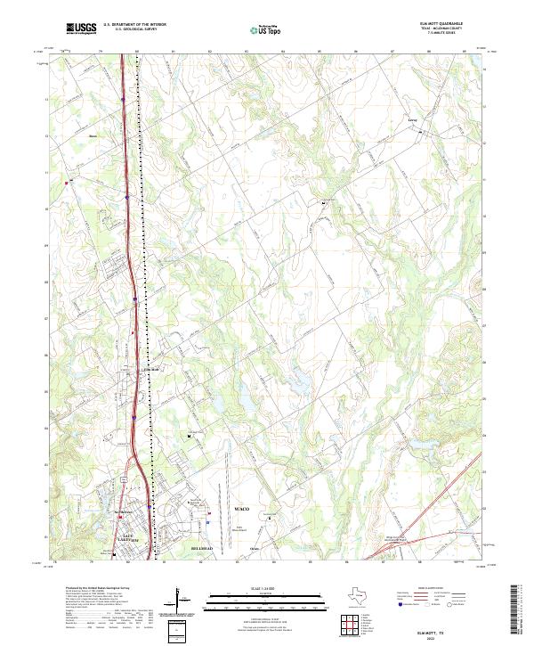 2022 Elm Mott2022 Print · USGSNorth of Waco during the early 2020s, this area shows a mix of rural prairie life and aviation hubs. Genealogists can locate family sites like Stanfield Walker Cemetery and Elm Mott Cemetery while tracing the waters of Tehuacana Creek.
 - 2022 Map of Waco East, 2022 Print
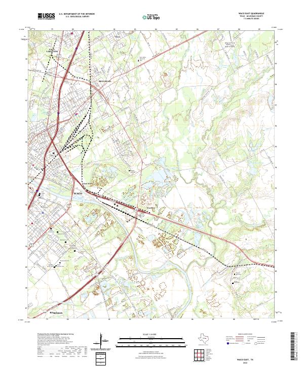 2022 Waco East2022 Print · USGSThe Brazos River serves as the central artery for this contemporary view of the Waco metropolitan area and its eastern suburbs. Genealogists can locate numerous burial grounds across the city, from First Street Cem to Rodef Sholom Cem and Chapel Hill Cem.
End of results
Showing maps 1-2 of 2
Top cities near Bellmead
- Waco historical maps
- Hewitt historical maps
- Robinson historical maps
- Woodway historical maps
- Lacy Lakeview historical maps
- McGregor historical maps
See more
Top neighborhoods of Bellmead
Frequently asked questions
- What are the different types of historical maps available for Bellmead?
- What is the oldest map of Bellmead?
- Where can I purchase historical maps of Bellmead for my home or office?
- Where can I download high-res historical maps of Bellmead?
- Are there historical topographic maps available for Bellmead?
- Is there historical aerial imagery available for Bellmead?
- Where are historical maps of Bellmead sourced from?